Milltown Topo Map Indiana
To zoom in, hover over the map of Milltown
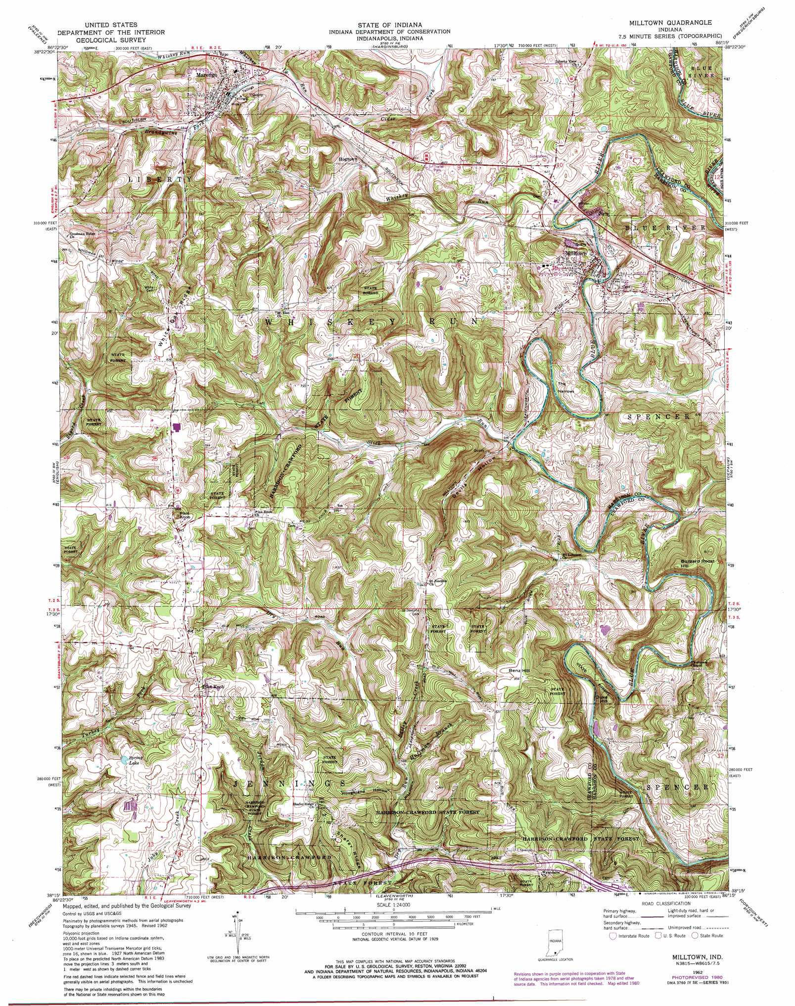
USGS Topo Quad 38086c3 - 1:24,000 scale
| Topo Map Name: | Milltown |
| USGS Topo Quad ID: | 38086c3 |
| Print Size: | ca. 21 1/4" wide x 27" high |
| Southeast Coordinates: | 38.25° N latitude / 86.25° W longitude |
| Map Center Coordinates: | 38.3125° N latitude / 86.3125° W longitude |
| U.S. State: | IN |
| Filename: | o38086c3.jpg |
| Download Map JPG Image: | Milltown topo map 1:24,000 scale |
| Map Type: | Topographic |
| Topo Series: | 7.5´ |
| Map Scale: | 1:24,000 |
| Source of Map Images: | United States Geological Survey (USGS) |
| Alternate Map Versions: |
Milltown IN 1948 Download PDF Buy paper map Milltown IN 1962, updated 1963 Download PDF Buy paper map Milltown IN 1962, updated 1973 Download PDF Buy paper map Milltown IN 1962, updated 1981 Download PDF Buy paper map Milltown IN 2010 Download PDF Buy paper map Milltown IN 2013 Download PDF Buy paper map Milltown IN 2016 Download PDF Buy paper map |
1:24,000 Topo Quads surrounding Milltown
French Lick |
Paoli |
Livonia |
Becks Mill |
Salem |
Greenbrier |
Valeene |
Hardinsburg |
Fredericksburg |
Palmyra |
Taswell |
English |
Milltown |
Depauw |
Crandall |
Branchville |
Beechwood |
Leavenworth |
Corydon West |
Corydon East |
Derby |
Alton |
New Amsterdam |
Mauckport |
Laconia |
> Back to 38086a1 at 1:100,000 scale
> Back to 38086a1 at 1:250,000 scale
> Back to U.S. Topo Maps home
Milltown topo map: Gazetteer
Milltown: Gaps
The Narrows elevation 179m 587′Milltown: Lakes
Spring Lake elevation 233m 764′Milltown: Populated Places
Carefree elevation 233m 764′Hogtown elevation 175m 574′
Marengo elevation 182m 597′
Milltown elevation 189m 620′
Pilot Knob elevation 264m 866′
Wynnsboro (historical) elevation 149m 488′
Milltown: Post Offices
Sharps Mill Post Office (historical) elevation 145m 475′Milltown: Ridges
Shafer Ridge elevation 230m 754′White Oak Ridge elevation 275m 902′
Milltown: Streams
Bailey Creek elevation 175m 574′Brandywine Fork elevation 174m 570′
Cider Fork elevation 172m 564′
Huffman Branch elevation 175m 574′
Slick Run elevation 158m 518′
Whiskey Run elevation 165m 541′
Milltown: Summits
Benz Hill elevation 262m 859′Buzzard Roost Hill elevation 247m 810′
Duke Hill elevation 223m 731′
Pilot Knob elevation 287m 941′
Milltown: Valleys
Devils Hollow elevation 161m 528′Houghland Hollow elevation 173m 567′
Milltown digital topo map on disk
Buy this Milltown topo map showing relief, roads, GPS coordinates and other geographical features, as a high-resolution digital map file on DVD: