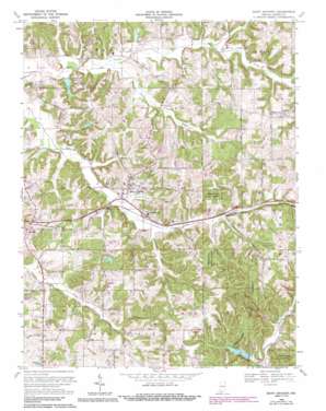
Saint Anthony Topo Map Indiana
To zoom in, hover over the map of Saint Anthony
USGS Topo Quad 38086c7 - 1:24,000 scale
| Topo Map Name: | Saint Anthony |
| USGS Topo Quad ID: | 38086c7 |
| Print Size: | ca. 21 1/4" wide x 27" high |
| Southeast Coordinates: | 38.25° N latitude / 86.75° W longitude |
| Map Center Coordinates: | 38.3125° N latitude / 86.8125° W longitude |
| U.S. State: | IN |
| Filename: | o38086c7.jpg |
| Download Map JPG Image: | Saint Anthony topo map 1:24,000 scale |
| Map Type: | Topographic |
| Topo Series: | 7.5´ |
| Map Scale: | 1:24,000 |
| Source of Map Images: | United States Geological Survey (USGS) |
| Alternate Map Versions: |
Saint Anthony IN 1955, updated 1956 Download PDF Buy paper map Saint Anthony IN 1955, updated 1967 Download PDF Buy paper map Saint Anthony IN 1969, updated 1971 Download PDF Buy paper map Saint Anthony IN 1969, updated 1990 Download PDF Buy paper map Saint Anthony IN 2010 Download PDF Buy paper map Saint Anthony IN 2013 Download PDF Buy paper map Saint Anthony IN 2016 Download PDF Buy paper map |
1:24,000 Topo Quads surrounding Saint Anthony
> Back to 38086a1 at 1:100,000 scale
> Back to 38086a1 at 1:250,000 scale
> Back to U.S. Topo Maps home
Saint Anthony topo map: Gazetteer
Saint Anthony: Dams
Birk Lake Dam elevation 160m 524′Ferdinand Forest Dam elevation 143m 469′
Habig Lake Dam elevation 151m 495′
Larry Hopf Lake Dam elevation 183m 600′
Olinger Lake Dam elevation 141m 462′
Saint Anthony Conservation Club Dam elevation 170m 557′
Saint Anthony School Lake Dam elevation 169m 554′
Saint Anthony: Lakes
Camp Ground Lake elevation 184m 603′Saint Anthony: Populated Places
Bretzville elevation 173m 567′Kyana elevation 154m 505′
Saint Anthony elevation 166m 544′
Saint Marks elevation 160m 524′
Schnellville elevation 199m 652′
Saint Anthony: Reservoirs
Birk Lake elevation 160m 524′Ferdinand State Forest Lake elevation 143m 469′
Habig Lake elevation 151m 495′
Larry Hopf Lake elevation 183m 600′
Olinger Lake elevation 141m 462′
Saint Anthony Conservation Club Lake elevation 170m 557′
Saint Anthony Conservation Lake elevation 170m 557′
Saint Anthony School Lake elevation 169m 554′
Saint Anthony: Streams
Grassy Fork elevation 143m 469′Richland Creek elevation 146m 479′
Saint Anthony digital topo map on disk
Buy this Saint Anthony topo map showing relief, roads, GPS coordinates and other geographical features, as a high-resolution digital map file on DVD:


