French Lick Topo Map Indiana
To zoom in, hover over the map of French Lick
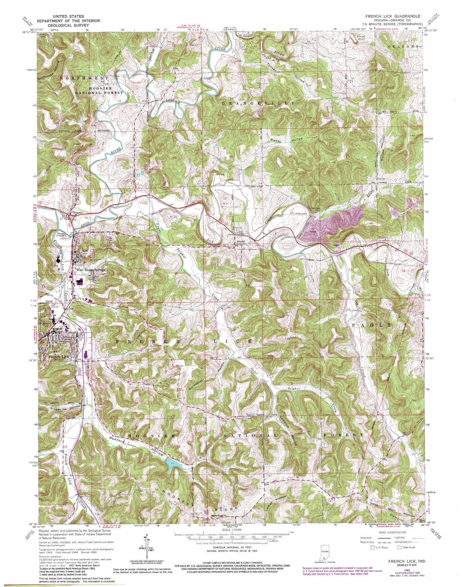
USGS Topo Quad 38086e5 - 1:24,000 scale
| Topo Map Name: | French Lick |
| USGS Topo Quad ID: | 38086e5 |
| Print Size: | ca. 21 1/4" wide x 27" high |
| Southeast Coordinates: | 38.5° N latitude / 86.5° W longitude |
| Map Center Coordinates: | 38.5625° N latitude / 86.5625° W longitude |
| U.S. State: | IN |
| Filename: | o38086e5.jpg |
| Download Map JPG Image: | French Lick topo map 1:24,000 scale |
| Map Type: | Topographic |
| Topo Series: | 7.5´ |
| Map Scale: | 1:24,000 |
| Source of Map Images: | United States Geological Survey (USGS) |
| Alternate Map Versions: |
French Lick IN 1951 Download PDF Buy paper map French Lick IN 1965, updated 1966 Download PDF Buy paper map French Lick IN 1965, updated 1973 Download PDF Buy paper map French Lick IN 1965, updated 1981 Download PDF Buy paper map French Lick IN 1965, updated 1990 Download PDF Buy paper map French Lick IN 1993, updated 1996 Download PDF Buy paper map French Lick IN 2011 Download PDF Buy paper map French Lick IN 2014 Download PDF Buy paper map French Lick IN 2016 Download PDF Buy paper map |
| FStopo: | US Forest Service topo French Lick is available: Download FStopo PDF Download FStopo TIF |
1:24,000 Topo Quads surrounding French Lick
Indian Springs |
Williams |
Bedford West |
Bedford East |
Tunnelton |
Shoals |
Huron |
Georgia |
Mitchell |
Campbellsburg |
Rusk |
Hillham |
French Lick |
Paoli |
Livonia |
Dubois |
Cuzco |
Greenbrier |
Valeene |
Hardinsburg |
Saint Anthony |
Birdseye |
Taswell |
English |
Milltown |
> Back to 38086e1 at 1:100,000 scale
> Back to 38086a1 at 1:250,000 scale
> Back to U.S. Topo Maps home
French Lick topo map: Gazetteer
French Lick: Dams
Springs Valley Structure Number F-3 Dam elevation 167m 547′French Lick: Forests
Paoli Experimental Forest elevation 246m 807′French Lick: Populated Places
Abydel elevation 170m 557′French Lick elevation 152m 498′
Prospect elevation 148m 485′
Turleys elevation 159m 521′
West Baden Springs elevation 146m 479′
French Lick: Ridges
Moores Ridge elevation 232m 761′French Lick: Streams
French Lick Creek elevation 141m 462′Lick Creek elevation 143m 469′
Log Creek elevation 158m 518′
Sand Creek elevation 146m 479′
Shirley Creek elevation 146m 479′
Upper Sulphur Creek elevation 143m 469′
Willow Creek elevation 164m 538′
French Lick: Valleys
Barnheisel Hollow elevation 159m 521′Buzzard Hollow elevation 149m 488′
Compton Hollow elevation 167m 547′
Dry Hollow elevation 149m 488′
Elrod Gulf elevation 174m 570′
Grapevine Hollow elevation 149m 488′
Pipher Hollow elevation 149m 488′
Scott Hollow elevation 153m 501′
Toliver Hollow elevation 149m 488′
French Lick digital topo map on disk
Buy this French Lick topo map showing relief, roads, GPS coordinates and other geographical features, as a high-resolution digital map file on DVD: