Bedford West Topo Map Indiana
To zoom in, hover over the map of Bedford West
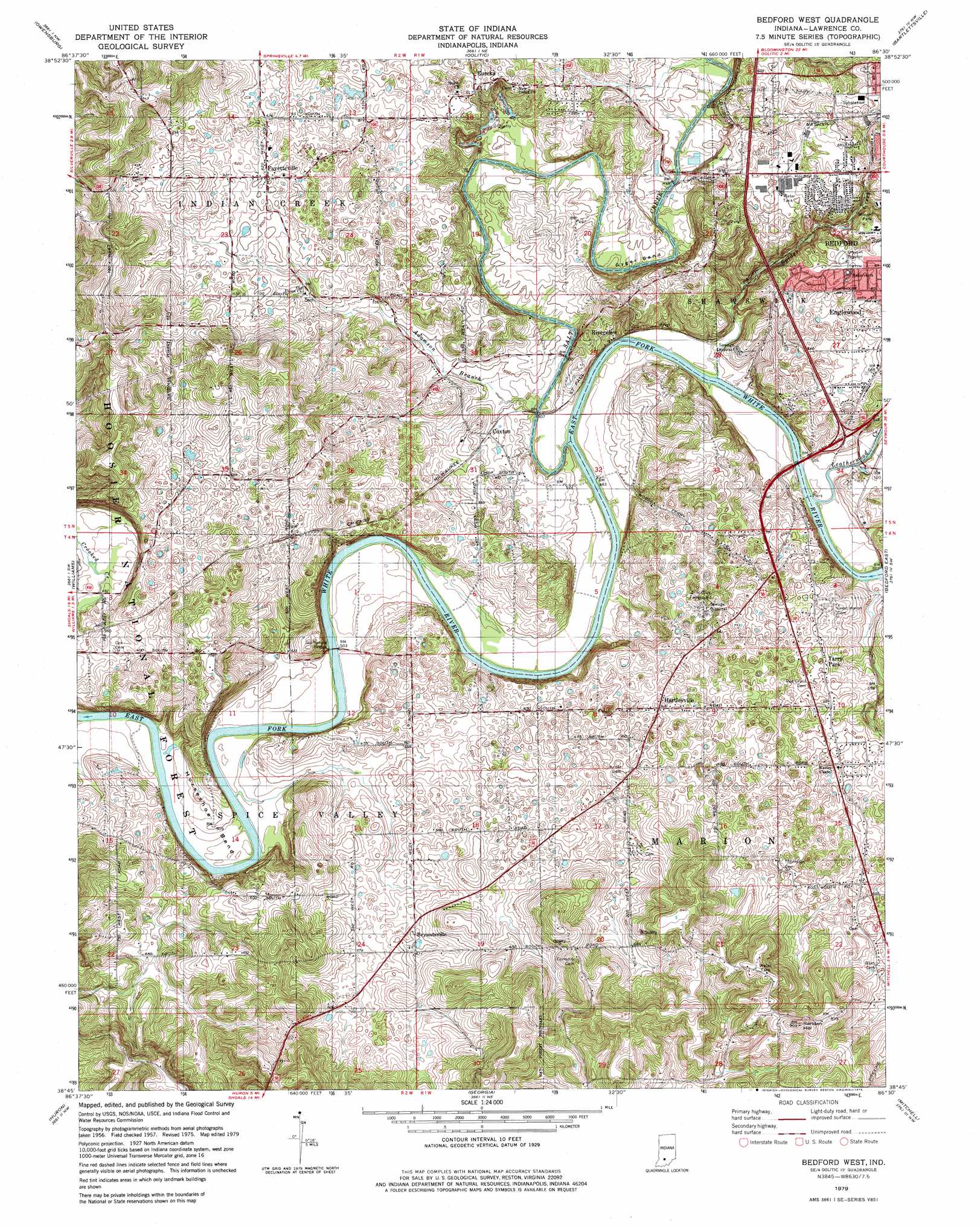
USGS Topo Quad 38086g5 - 1:24,000 scale
| Topo Map Name: | Bedford West |
| USGS Topo Quad ID: | 38086g5 |
| Print Size: | ca. 21 1/4" wide x 27" high |
| Southeast Coordinates: | 38.75° N latitude / 86.5° W longitude |
| Map Center Coordinates: | 38.8125° N latitude / 86.5625° W longitude |
| U.S. State: | IN |
| Filename: | o38086g5.jpg |
| Download Map JPG Image: | Bedford West topo map 1:24,000 scale |
| Map Type: | Topographic |
| Topo Series: | 7.5´ |
| Map Scale: | 1:24,000 |
| Source of Map Images: | United States Geological Survey (USGS) |
| Alternate Map Versions: |
Bedford West IN 1957, updated 1958 Download PDF Buy paper map Bedford West IN 1957, updated 1970 Download PDF Buy paper map Bedford West IN 1979, updated 1979 Download PDF Buy paper map Bedford West IN 1993, updated 1996 Download PDF Buy paper map Bedford West IN 2011 Download PDF Buy paper map Bedford West IN 2013 Download PDF Buy paper map Bedford West IN 2016 Download PDF Buy paper map |
| FStopo: | US Forest Service topo Bedford West is available: Download FStopo PDF Download FStopo TIF |
1:24,000 Topo Quads surrounding Bedford West
Solsberry |
Stanford |
Clear Creek |
Allens Creek |
Elkinsville |
Koleen |
Owensburg |
Oolitic |
Bartlettsville |
Norman |
Indian Springs |
Williams |
Bedford West |
Bedford East |
Tunnelton |
Shoals |
Huron |
Georgia |
Mitchell |
Campbellsburg |
Rusk |
Hillham |
French Lick |
Paoli |
Livonia |
> Back to 38086e1 at 1:100,000 scale
> Back to 38086a1 at 1:250,000 scale
> Back to U.S. Topo Maps home
Bedford West topo map: Gazetteer
Bedford West: Bends
Gyger Bend elevation 149m 488′Horseshoe Bend elevation 153m 501′
Bedford West: Bridges
Stumphole Bridge elevation 143m 469′Bedford West: Mines
Pearson Kaolin Mines elevation 205m 672′Bedford West: Populated Places
Bryantsville elevation 183m 600′Coxton elevation 156m 511′
Eureka elevation 186m 610′
Fayetteville elevation 186m 610′
Hartleyville elevation 187m 613′
Redding elevation 195m 639′
Riverview elevation 163m 534′
Tarry Park elevation 183m 600′
Bedford West: Streams
Adamson Branch elevation 146m 479′Leatherwood Creek elevation 146m 479′
Salt Creek elevation 143m 469′
Spider Creek elevation 143m 469′
Bedford West: Summits
Rariden Hill elevation 274m 898′Bedford West digital topo map on disk
Buy this Bedford West topo map showing relief, roads, GPS coordinates and other geographical features, as a high-resolution digital map file on DVD: