Indian Springs Topo Map Indiana
To zoom in, hover over the map of Indian Springs
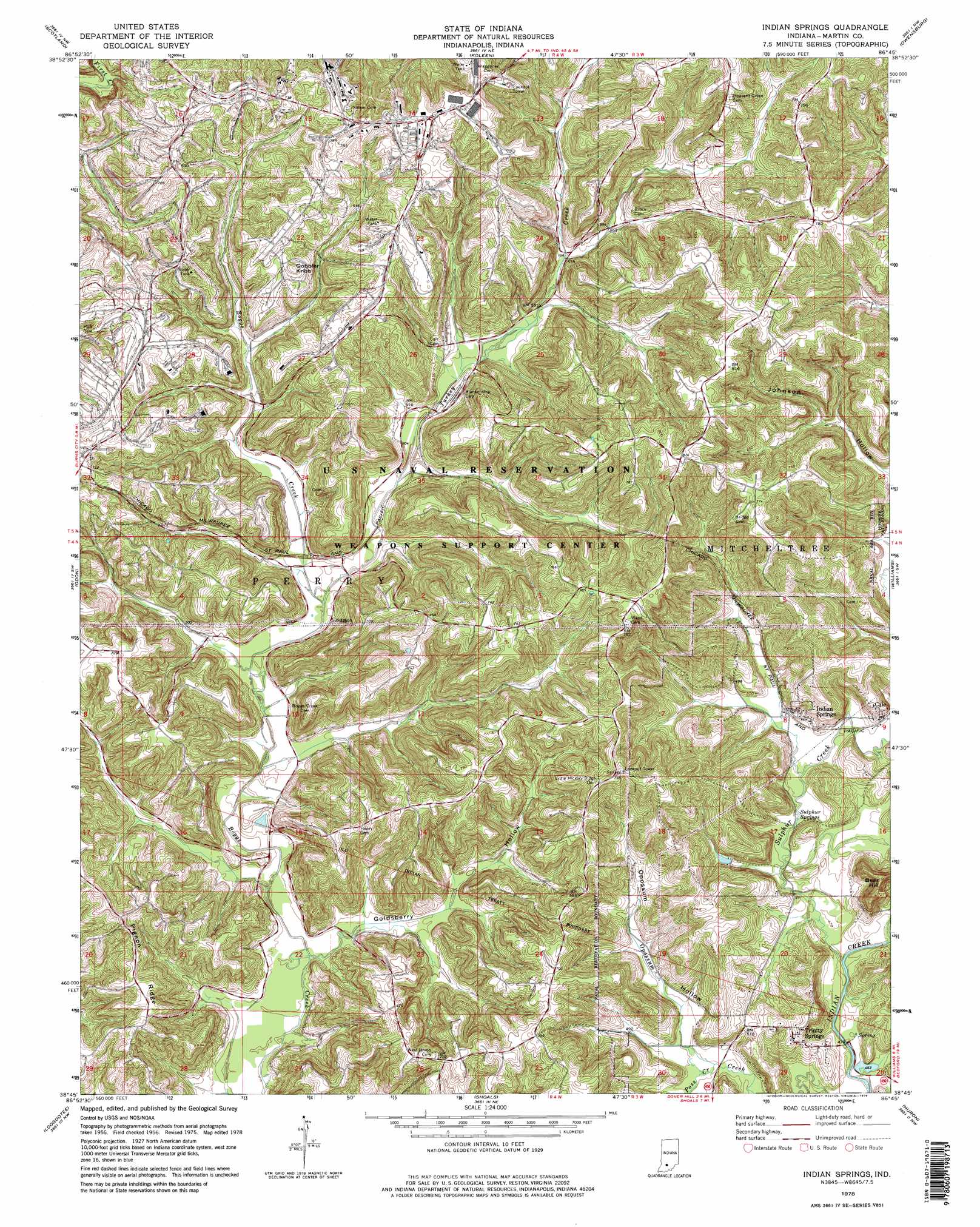
USGS Topo Quad 38086g7 - 1:24,000 scale
| Topo Map Name: | Indian Springs |
| USGS Topo Quad ID: | 38086g7 |
| Print Size: | ca. 21 1/4" wide x 27" high |
| Southeast Coordinates: | 38.75° N latitude / 86.75° W longitude |
| Map Center Coordinates: | 38.8125° N latitude / 86.8125° W longitude |
| U.S. State: | IN |
| Filename: | o38086g7.jpg |
| Download Map JPG Image: | Indian Springs topo map 1:24,000 scale |
| Map Type: | Topographic |
| Topo Series: | 7.5´ |
| Map Scale: | 1:24,000 |
| Source of Map Images: | United States Geological Survey (USGS) |
| Alternate Map Versions: |
Indian Springs IN 1956, updated 1959 Download PDF Buy paper map Indian Springs IN 1956, updated 1974 Download PDF Buy paper map Indian Springs IN 1978, updated 1978 Download PDF Buy paper map Indian Springs IN 1978, updated 1978 Download PDF Buy paper map Indian Springs IN 2010 Download PDF Buy paper map Indian Springs IN 2013 Download PDF Buy paper map Indian Springs IN 2016 Download PDF Buy paper map |
| FStopo: | US Forest Service topo Indian Springs is available: Download FStopo PDF Download FStopo TIF |
1:24,000 Topo Quads surrounding Indian Springs
Switz City |
Bloomfield |
Solsberry |
Stanford |
Clear Creek |
Lyons |
Scotland |
Koleen |
Owensburg |
Oolitic |
Epsom |
Odon |
Indian Springs |
Williams |
Bedford West |
Montgomery |
Loogootee |
Shoals |
Huron |
Georgia |
Glendale |
Alfordsville |
Rusk |
Hillham |
French Lick |
> Back to 38086e1 at 1:100,000 scale
> Back to 38086a1 at 1:250,000 scale
> Back to U.S. Topo Maps home
Indian Springs topo map: Gazetteer
Indian Springs: Populated Places
Cale elevation 162m 531′Indian Springs elevation 159m 521′
Indian Springs: Post Offices
Dye Post Office (historical) elevation 149m 488′Indian Springs: Ridges
Pigeon Ridge elevation 208m 682′Indian Springs: Springs
Sulphur Springs elevation 143m 469′Trinity Springs elevation 146m 479′
Trinity Springs elevation 183m 600′
Indian Springs: Streams
Poss Creek elevation 143m 469′Sulphur Creek elevation 143m 469′
Turkey Creek elevation 144m 472′
Indian Springs: Summits
Bear Hill elevation 210m 688′Gobbler Knob elevation 218m 715′
Indian Springs: Valleys
Goldsberry Hollow elevation 146m 479′Opossum Hollow elevation 143m 469′
Indian Springs digital topo map on disk
Buy this Indian Springs topo map showing relief, roads, GPS coordinates and other geographical features, as a high-resolution digital map file on DVD: