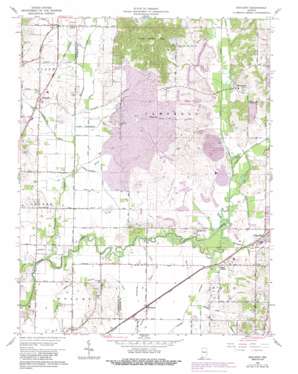
Daylight Topo Map Indiana
To zoom in, hover over the map of Daylight
USGS Topo Quad 38087a4 - 1:24,000 scale
| Topo Map Name: | Daylight |
| USGS Topo Quad ID: | 38087a4 |
| Print Size: | ca. 21 1/4" wide x 27" high |
| Southeast Coordinates: | 38° N latitude / 87.375° W longitude |
| Map Center Coordinates: | 38.0625° N latitude / 87.4375° W longitude |
| U.S. State: | IN |
| Filename: | o38087a4.jpg |
| Download Map JPG Image: | Daylight topo map 1:24,000 scale |
| Map Type: | Topographic |
| Topo Series: | 7.5´ |
| Map Scale: | 1:24,000 |
| Source of Map Images: | United States Geological Survey (USGS) |
| Alternate Map Versions: |
Daylight IN 1961, updated 1963 Download PDF Buy paper map Daylight IN 1961, updated 1972 Download PDF Buy paper map Daylight IN 1961, updated 1981 Download PDF Buy paper map Daylight IN 1961, updated 1988 Download PDF Buy paper map Daylight IN 2010 Download PDF Buy paper map Daylight IN 2013 Download PDF Buy paper map Daylight IN 2016 Download PDF Buy paper map |
1:24,000 Topo Quads surrounding Daylight
> Back to 38087a1 at 1:100,000 scale
> Back to 38086a1 at 1:250,000 scale
> Back to U.S. Topo Maps home
Daylight topo map: Gazetteer
Daylight: Canals
Angel Ditch elevation 116m 380′Barnes Ditch elevation 122m 400′
Boesche Ditch elevation 114m 374′
Brinkmeyer Ditch elevation 116m 380′
Crawford Brandeis Ditch elevation 114m 374′
Dennis Klippel Ditch elevation 116m 380′
Dennis Wagner Ditch elevation 116m 380′
Fehd Ditch elevation 116m 380′
Gardner Webb Ditch elevation 117m 383′
Hansen Ditch (historical) elevation 114m 374′
Howard Ditch elevation 118m 387′
Schlensker Ditch elevation 116m 380′
Stollberg Ditch elevation 115m 377′
Stubbs Fruedenberg Ditch elevation 116m 380′
Wabash and Erie Canal elevation 130m 426′
Weinsheimer Ditch elevation 115m 377′
Woods Ditch elevation 116m 380′
Daylight: Populated Places
Baugh City elevation 122m 400′Castle Garden elevation 120m 393′
Daylight elevation 124m 406′
Elliott elevation 127m 416′
Fisherville elevation 135m 442′
Millersburg elevation 116m 380′
Saint John elevation 131m 429′
Stevenson elevation 117m 383′
Daylight: Reservoirs
Perdido Lake (historical) elevation 126m 413′Daylight: Streams
Bluegrass Creek elevation 109m 357′Euler Branch elevation 113m 370′
Firlick Creek elevation 113m 370′
Licking Creek elevation 109m 357′
Squaw Creek elevation 112m 367′
Daylight: Summits
Little Ditney Hill elevation 149m 488′Daylight digital topo map on disk
Buy this Daylight topo map showing relief, roads, GPS coordinates and other geographical features, as a high-resolution digital map file on DVD:


