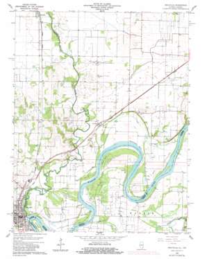
Grayville Topo Map Illinois
To zoom in, hover over the map of Grayville
USGS Topo Quad 38087c8 - 1:24,000 scale
| Topo Map Name: | Grayville |
| USGS Topo Quad ID: | 38087c8 |
| Print Size: | ca. 21 1/4" wide x 27" high |
| Southeast Coordinates: | 38.25° N latitude / 87.875° W longitude |
| Map Center Coordinates: | 38.3125° N latitude / 87.9375° W longitude |
| U.S. States: | IL, IN |
| Filename: | o38087c8.jpg |
| Download Map JPG Image: | Grayville topo map 1:24,000 scale |
| Map Type: | Topographic |
| Topo Series: | 7.5´ |
| Map Scale: | 1:24,000 |
| Source of Map Images: | United States Geological Survey (USGS) |
| Alternate Map Versions: |
Grayville IL 1959, updated 1961 Download PDF Buy paper map Grayville IL 1959, updated 1975 Download PDF Buy paper map Grayville IL 1959, updated 1981 Download PDF Buy paper map Grayville IL 2010 Download PDF Buy paper map Grayville IL 2012 Download PDF Buy paper map Grayville IL 2015 Download PDF Buy paper map |
1:24,000 Topo Quads surrounding Grayville
> Back to 38087a1 at 1:100,000 scale
> Back to 38086a1 at 1:250,000 scale
> Back to U.S. Topo Maps home
Grayville topo map: Gazetteer
Grayville: Areas
Frazier Prairie elevation 121m 396′Grayville: Bends
Peankishaw Bend elevation 116m 380′Peankishaw Bend elevation 116m 380′
Schuh Bend elevation 112m 367′
Grayville: Cliffs
McCleary Bluff elevation 118m 387′Grayville: Islands
Pearl Island elevation 113m 370′Grayville: Levees
Denham Levee elevation 116m 380′Grayville: Populated Places
Cowling elevation 120m 393′Grayville elevation 131m 429′
Logansburgh (historical) elevation 122m 400′
Grayville: Post Offices
Cowling Post Office (historical) elevation 119m 390′Grayville: Streams
Bonpas Creek elevation 108m 354′Mud Creek elevation 113m 370′
Grayville digital topo map on disk
Buy this Grayville topo map showing relief, roads, GPS coordinates and other geographical features, as a high-resolution digital map file on DVD:


