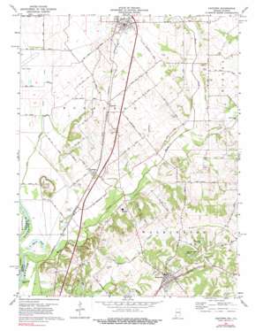
Oaktown Topo Map Indiana
To zoom in, hover over the map of Oaktown
USGS Topo Quad 38087g4 - 1:24,000 scale
| Topo Map Name: | Oaktown |
| USGS Topo Quad ID: | 38087g4 |
| Print Size: | ca. 21 1/4" wide x 27" high |
| Southeast Coordinates: | 38.75° N latitude / 87.375° W longitude |
| Map Center Coordinates: | 38.8125° N latitude / 87.4375° W longitude |
| U.S. States: | IN, IL |
| Filename: | o38087g4.jpg |
| Download Map JPG Image: | Oaktown topo map 1:24,000 scale |
| Map Type: | Topographic |
| Topo Series: | 7.5´ |
| Map Scale: | 1:24,000 |
| Source of Map Images: | United States Geological Survey (USGS) |
| Alternate Map Versions: |
Oaktown IN 1943 Download PDF Buy paper map Oaktown IN 1958, updated 1959 Download PDF Buy paper map Oaktown IN 1958, updated 1959 Download PDF Buy paper map Oaktown IN 1974, updated 1975 Download PDF Buy paper map Oaktown IN 1974, updated 1984 Download PDF Buy paper map Oaktown IN 2010 Download PDF Buy paper map Oaktown IN 2013 Download PDF Buy paper map Oaktown IN 2016 Download PDF Buy paper map |
1:24,000 Topo Quads surrounding Oaktown
> Back to 38087e1 at 1:100,000 scale
> Back to 38086a1 at 1:250,000 scale
> Back to U.S. Topo Maps home
Oaktown topo map: Gazetteer
Oaktown: Airports
Green Airport elevation 129m 423′Oaktown: Canals
Lower Shaker Prairie Ditch elevation 128m 419′Shaker Prairie Ditch elevation 128m 419′
Oaktown: Dams
Cleveland Pond Dam elevation 158m 518′Rod and Gun Club Dam elevation 157m 515′
Oaktown: Flats
Shaker Prairie elevation 128m 419′Oaktown: Islands
Sevenmile Island elevation 125m 410′Oaktown: Lakes
Maria Pond elevation 123m 403′Oaktown: Parks
Camp Arthur elevation 145m 475′Oaktown: Populated Places
Bruceville elevation 169m 554′Busseron elevation 142m 465′
Emison elevation 141m 462′
Oaktown elevation 144m 472′
Oaktown: Reservoirs
Cleveland Pond elevation 157m 515′Rod and Gun Club Lake elevation 157m 515′
Oaktown: Streams
Cotton Branch elevation 129m 423′Maria Creek elevation 124m 406′
South Fork Smalls Creek elevation 131m 429′
Oaktown: Summits
Wolf Hill elevation 159m 521′Oaktown digital topo map on disk
Buy this Oaktown topo map showing relief, roads, GPS coordinates and other geographical features, as a high-resolution digital map file on DVD:


