Birds Topo Map Illinois
To zoom in, hover over the map of Birds
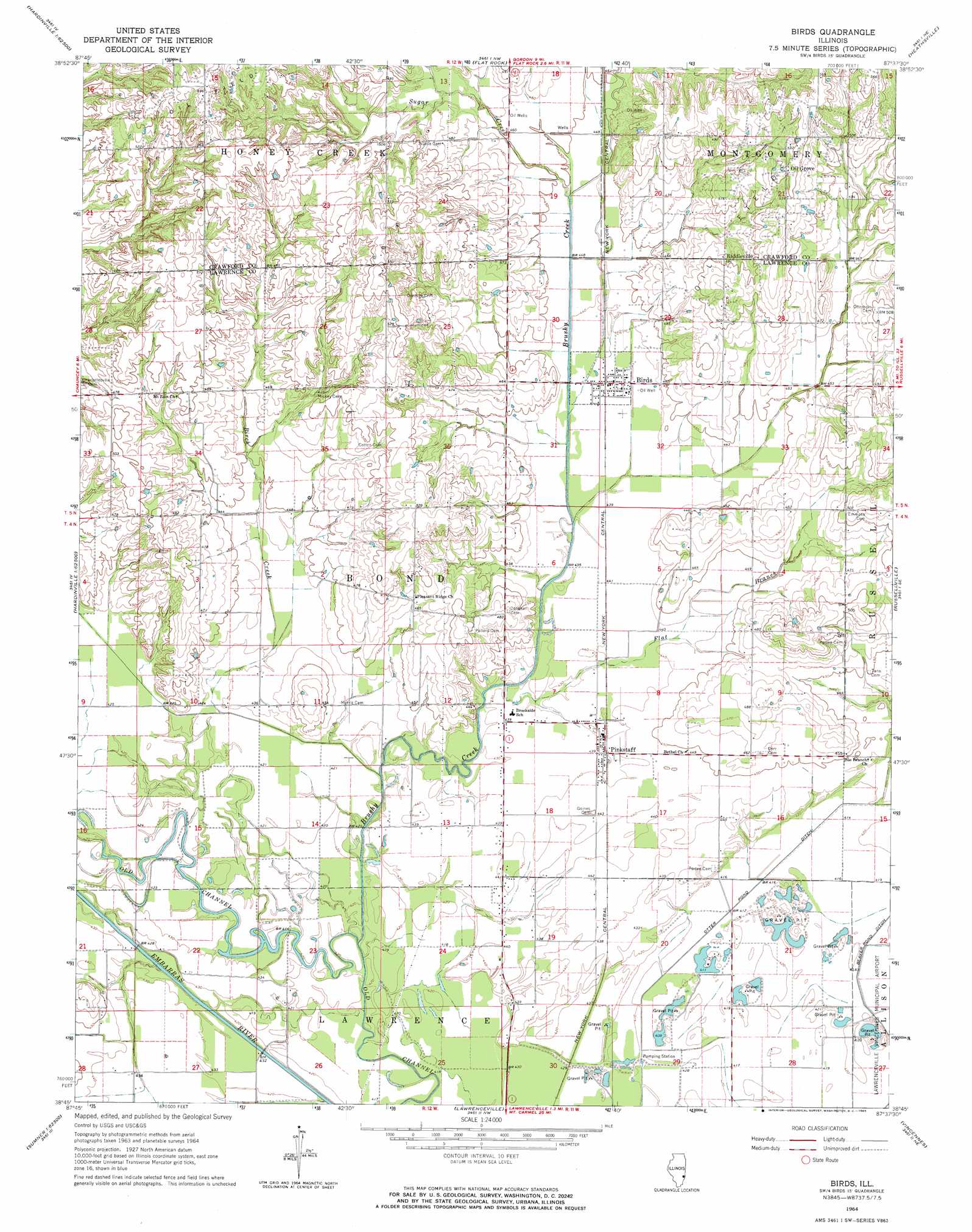
USGS Topo Quad 38087g6 - 1:24,000 scale
| Topo Map Name: | Birds |
| USGS Topo Quad ID: | 38087g6 |
| Print Size: | ca. 21 1/4" wide x 27" high |
| Southeast Coordinates: | 38.75° N latitude / 87.625° W longitude |
| Map Center Coordinates: | 38.8125° N latitude / 87.6875° W longitude |
| U.S. State: | IL |
| Filename: | o38087g6.jpg |
| Download Map JPG Image: | Birds topo map 1:24,000 scale |
| Map Type: | Topographic |
| Topo Series: | 7.5´ |
| Map Scale: | 1:24,000 |
| Source of Map Images: | United States Geological Survey (USGS) |
| Alternate Map Versions: |
Birds IL 1964, updated 1965 Download PDF Buy paper map Birds IL 2012 Download PDF Buy paper map Birds IL 2015 Download PDF Buy paper map |
1:24,000 Topo Quads surrounding Birds
Oblong North |
Eaton |
Hutsonville |
Merom |
Sullivan |
Oblong South |
Stoy |
Flat Rock |
Heathsville |
Carlisle |
Landes |
Chauncey |
Birds |
Russellville |
Oaktown |
Claremont |
Sumner |
Lawrenceville |
Vincennes |
Fritchton |
Berryville |
Lancaster |
Saint Francisville |
Decker |
Iona |
> Back to 38087e1 at 1:100,000 scale
> Back to 38086a1 at 1:250,000 scale
> Back to U.S. Topo Maps home
Birds topo map: Gazetteer
Birds: Canals
Otter Pond Ditch elevation 125m 410′Birds: Populated Places
Birds elevation 133m 436′Crawfordsville (historical) elevation 137m 449′
Oil Grove elevation 170m 557′
Pinkstaff elevation 134m 439′
Riddleville elevation 151m 495′
Birds: Post Offices
Pinkstaff Post Office elevation 134m 439′Birds: Streams
Birch Creek elevation 128m 419′Brushy Creek elevation 128m 419′
Flat Branch elevation 129m 423′
Sugar Creek elevation 134m 439′
Birds digital topo map on disk
Buy this Birds topo map showing relief, roads, GPS coordinates and other geographical features, as a high-resolution digital map file on DVD: