Ewing Topo Map Illinois
To zoom in, hover over the map of Ewing
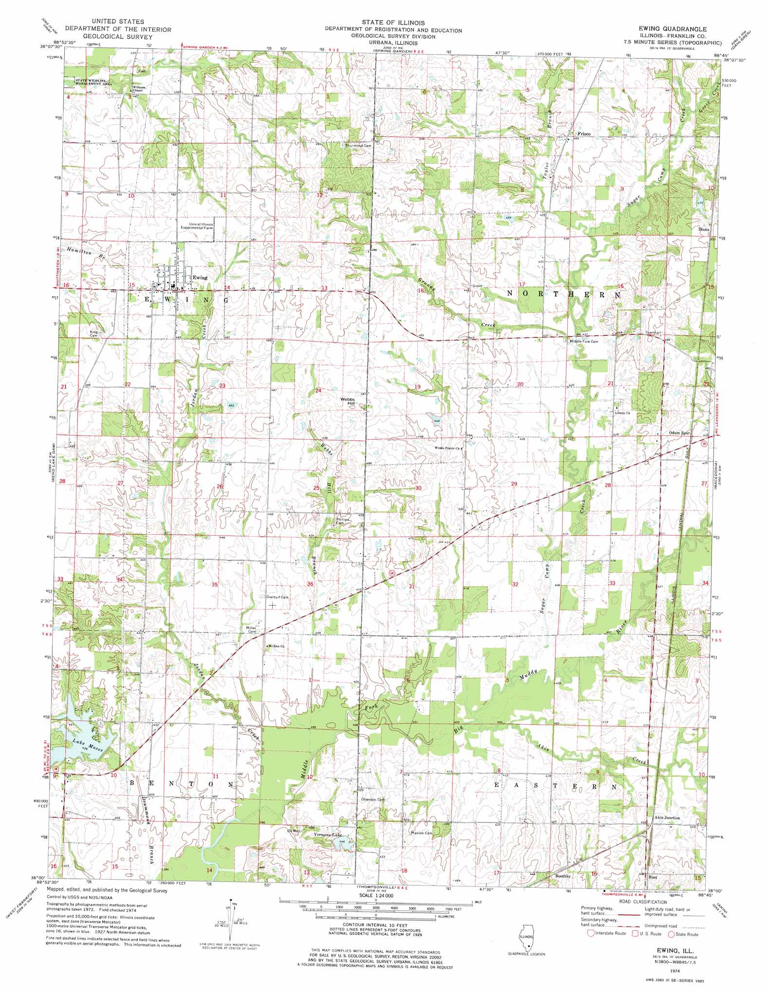
USGS Topo Quad 38088a7 - 1:24,000 scale
| Topo Map Name: | Ewing |
| USGS Topo Quad ID: | 38088a7 |
| Print Size: | ca. 21 1/4" wide x 27" high |
| Southeast Coordinates: | 38° N latitude / 88.75° W longitude |
| Map Center Coordinates: | 38.0625° N latitude / 88.8125° W longitude |
| U.S. State: | IL |
| Filename: | o38088a7.jpg |
| Download Map JPG Image: | Ewing topo map 1:24,000 scale |
| Map Type: | Topographic |
| Topo Series: | 7.5´ |
| Map Scale: | 1:24,000 |
| Source of Map Images: | United States Geological Survey (USGS) |
| Alternate Map Versions: |
Ewing IL 1974, updated 1977 Download PDF Buy paper map Ewing IL 2012 Download PDF Buy paper map Ewing IL 2015 Download PDF Buy paper map |
1:24,000 Topo Quads surrounding Ewing
Woodlawn |
Mount Vernon |
Opdyke |
Bluford |
Wayne City |
Waltonville |
Ina |
Spring Garden |
Dahlgren |
Belle Prairie City |
Sesser |
Rend Lake Dam |
Ewing |
Macedonia |
Mcleansboro |
Christopher |
West Frankfort |
Thompsonville |
Akin |
Walpole |
Herrin |
Johnston City |
Pittsburg |
Harco |
Galatia |
> Back to 38088a1 at 1:100,000 scale
> Back to 38088a1 at 1:250,000 scale
> Back to U.S. Topo Maps home
Ewing topo map: Gazetteer
Ewing: Dams
Lake Moses Dam elevation 129m 423′Ewing: Lakes
Vernons Lake elevation 136m 446′Ewing: Populated Places
Akin Junction elevation 132m 433′Boothby elevation 139m 456′
Diana elevation 150m 492′
Ewing elevation 143m 469′
Frisco elevation 140m 459′
Rust elevation 139m 456′
Taylor Hill elevation 143m 469′
Ewing: Post Offices
Taylor Hill Post Office (historical) elevation 145m 475′Webbs Prairie Post Office (historical) elevation 130m 426′
Ewing: Reservoirs
Lake Moses elevation 129m 423′Ewing: Streams
Akin Creek elevation 124m 406′Goose Creek elevation 134m 439′
Granny Creek elevation 128m 419′
Jordan Creek elevation 121m 396′
Sugar Camp Creek elevation 124m 406′
Taylor Branch elevation 128m 419′
Webbs Hill Branch elevation 121m 396′
Ewing: Summits
Webbs Hill elevation 152m 498′Ewing digital topo map on disk
Buy this Ewing topo map showing relief, roads, GPS coordinates and other geographical features, as a high-resolution digital map file on DVD: