Harmony Topo Map Illinois
To zoom in, hover over the map of Harmony
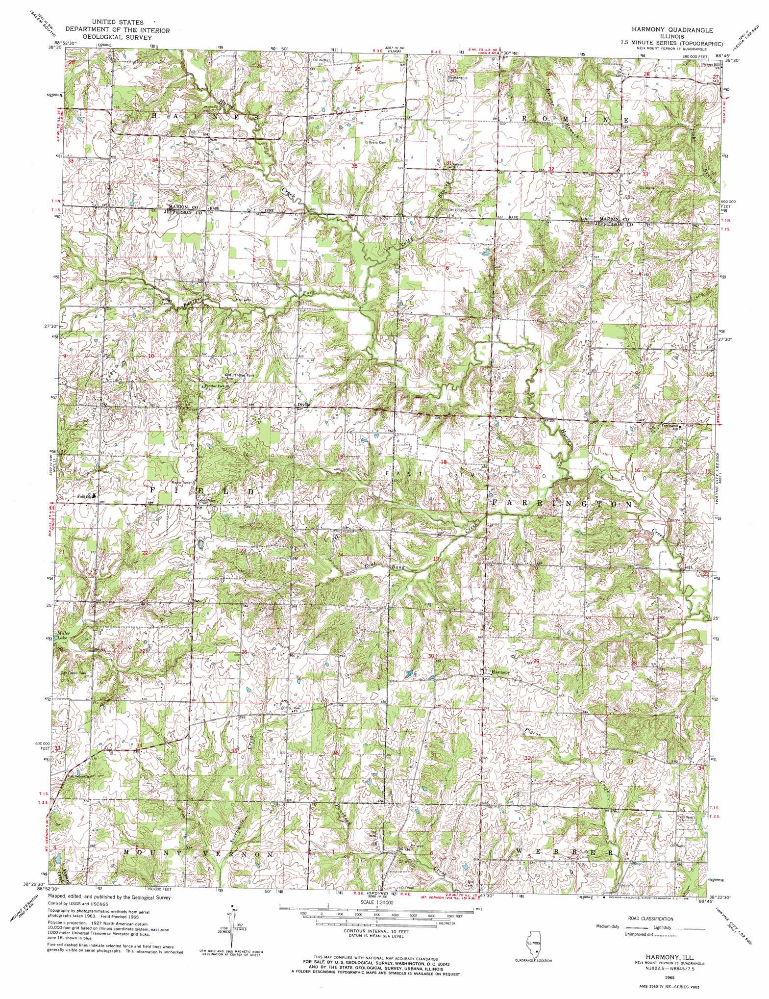
USGS Topo Quad 38088d7 - 1:24,000 scale
| Topo Map Name: | Harmony |
| USGS Topo Quad ID: | 38088d7 |
| Print Size: | ca. 21 1/4" wide x 27" high |
| Southeast Coordinates: | 38.375° N latitude / 88.75° W longitude |
| Map Center Coordinates: | 38.4375° N latitude / 88.8125° W longitude |
| U.S. State: | IL |
| Filename: | o38088d7.jpg |
| Download Map JPG Image: | Harmony topo map 1:24,000 scale |
| Map Type: | Topographic |
| Topo Series: | 7.5´ |
| Map Scale: | 1:24,000 |
| Source of Map Images: | United States Geological Survey (USGS) |
| Alternate Map Versions: |
Harmony IL 1965, updated 1966 Download PDF Buy paper map Harmony IL 2012 Download PDF Buy paper map Harmony IL 2015 Download PDF Buy paper map |
1:24,000 Topo Quads surrounding Harmony
Fairman |
Salem North |
Omega |
Xenia |
Xenia Ne |
Centralia East |
Salem South |
Iuka |
Orchardville |
Johnsonville |
Walnut Hill |
Kell |
Harmony |
Shields |
Crisp |
Woodlawn |
Mount Vernon |
Opdyke |
Bluford |
Wayne City |
Waltonville |
Ina |
Spring Garden |
Dahlgren |
Belle Prairie City |
> Back to 38088a1 at 1:100,000 scale
> Back to 38088a1 at 1:250,000 scale
> Back to U.S. Topo Maps home
Harmony topo map: Gazetteer
Harmony: Oilfields
Divide Oil Field elevation 168m 551′East Divide Oil Field elevation 158m 518′
Harmony: Populated Places
Divide elevation 165m 541′Harmony elevation 165m 541′
Hickory Hill elevation 165m 541′
Pigeon (historical) elevation 167m 547′
Harmony: Streams
Coal Bank Creek elevation 137m 449′Panther Fork elevation 144m 472′
Salty Branch elevation 146m 479′
Harmony digital topo map on disk
Buy this Harmony topo map showing relief, roads, GPS coordinates and other geographical features, as a high-resolution digital map file on DVD: