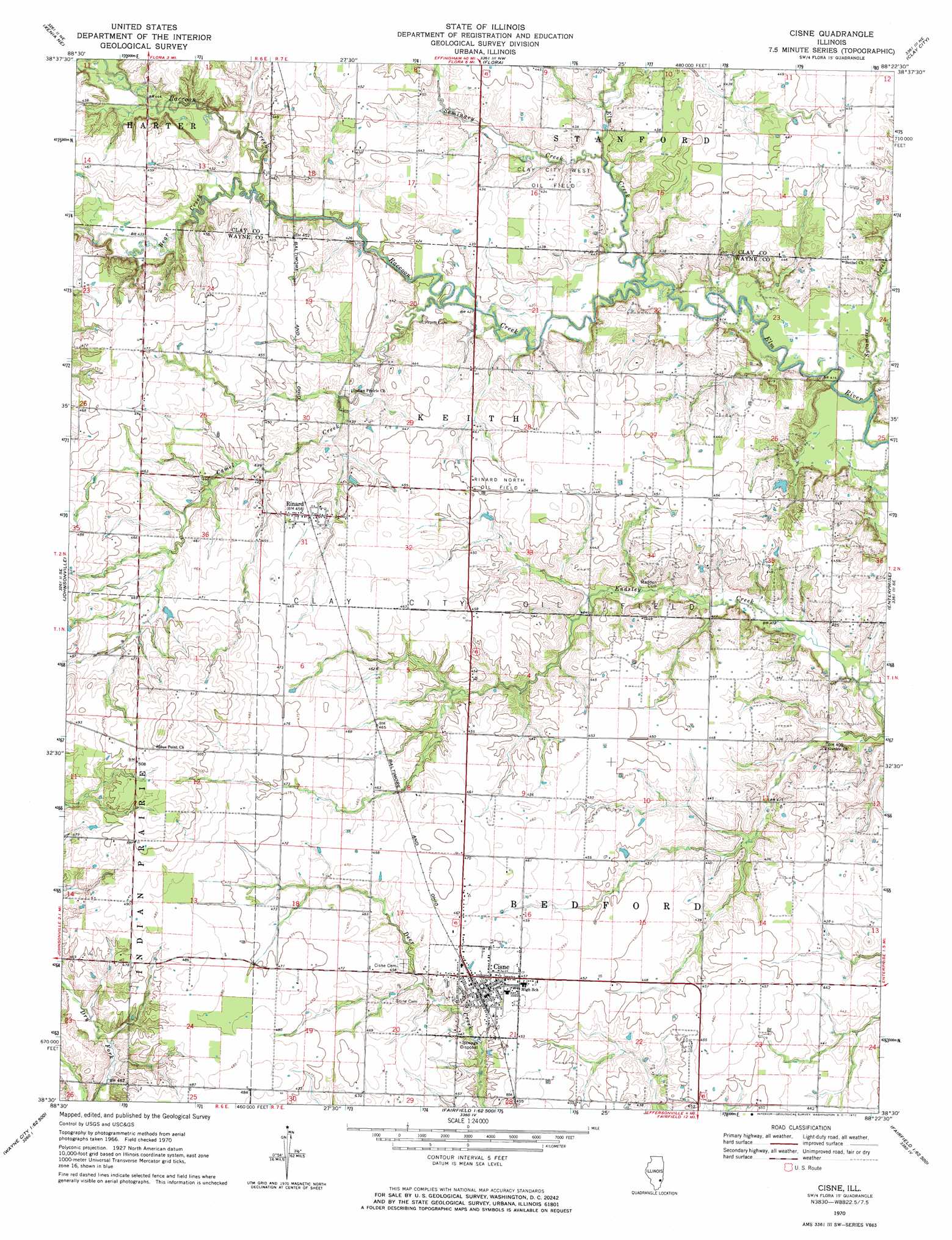
Cisne Topo Map Illinois
To zoom in, hover over the map of Cisne
USGS Topo Quad 38088e4 - 1:24,000 scale
| Topo Map Name: | Cisne |
| USGS Topo Quad ID: | 38088e4 |
| Print Size: | ca. 21 1/4" wide x 27" high |
| Southeast Coordinates: | 38.5° N latitude / 88.375° W longitude |
| Map Center Coordinates: | 38.5625° N latitude / 88.4375° W longitude |
| U.S. State: | IL |
| Filename: | o38088e4.jpg |
| Download Map JPG Image: | Cisne topo map 1:24,000 scale |
| Map Type: | Topographic |
| Topo Series: | 7.5´ |
| Map Scale: | 1:24,000 |
| Source of Map Images: | United States Geological Survey (USGS) |
| Alternate Map Versions: |
Cisne IL 1970, updated 1972 Download PDF Buy paper map Cisne IL 2012 Download PDF Buy paper map Cisne IL 2015 Download PDF Buy paper map |
1:24,000 Topo Quads surrounding Cisne
Oskaloosa |
Louisville West |
Louisville East |
Sailor Springs |
Wakefield |
Xenia |
Xenia Ne |
Flora |
Clay City |
Noble |
Orchardville |
Johnsonville |
Cisne |
Enterprise |
Mount Erie |
Shields |
Crisp |
Geff |
Fairfield |
Albion Nw |
Bluford |
Wayne City |
Boylestown |
Burnt Prairie |
Golden Gate |
> Back to 38088e1 at 1:100,000 scale
> Back to 38088a1 at 1:250,000 scale
> Back to U.S. Topo Maps home
Cisne topo map: Gazetteer
Cisne: Oilfields
Rinard North Oil Field elevation 137m 449′Cisne: Populated Places
Blue Point elevation 155m 508′Cisne elevation 140m 459′
Rinard elevation 140m 459′
Cisne: Post Offices
Rinard Post Office elevation 139m 456′Cisne: Streams
Bear Creek elevation 129m 423′Camel Creek elevation 127m 416′
Elm Creek elevation 125m 410′
Raccoon Creek elevation 126m 413′
Seminary Creek elevation 125m 410′
Sycamore Creek elevation 123m 403′
Cisne digital topo map on disk
Buy this Cisne topo map showing relief, roads, GPS coordinates and other geographical features, as a high-resolution digital map file on DVD: