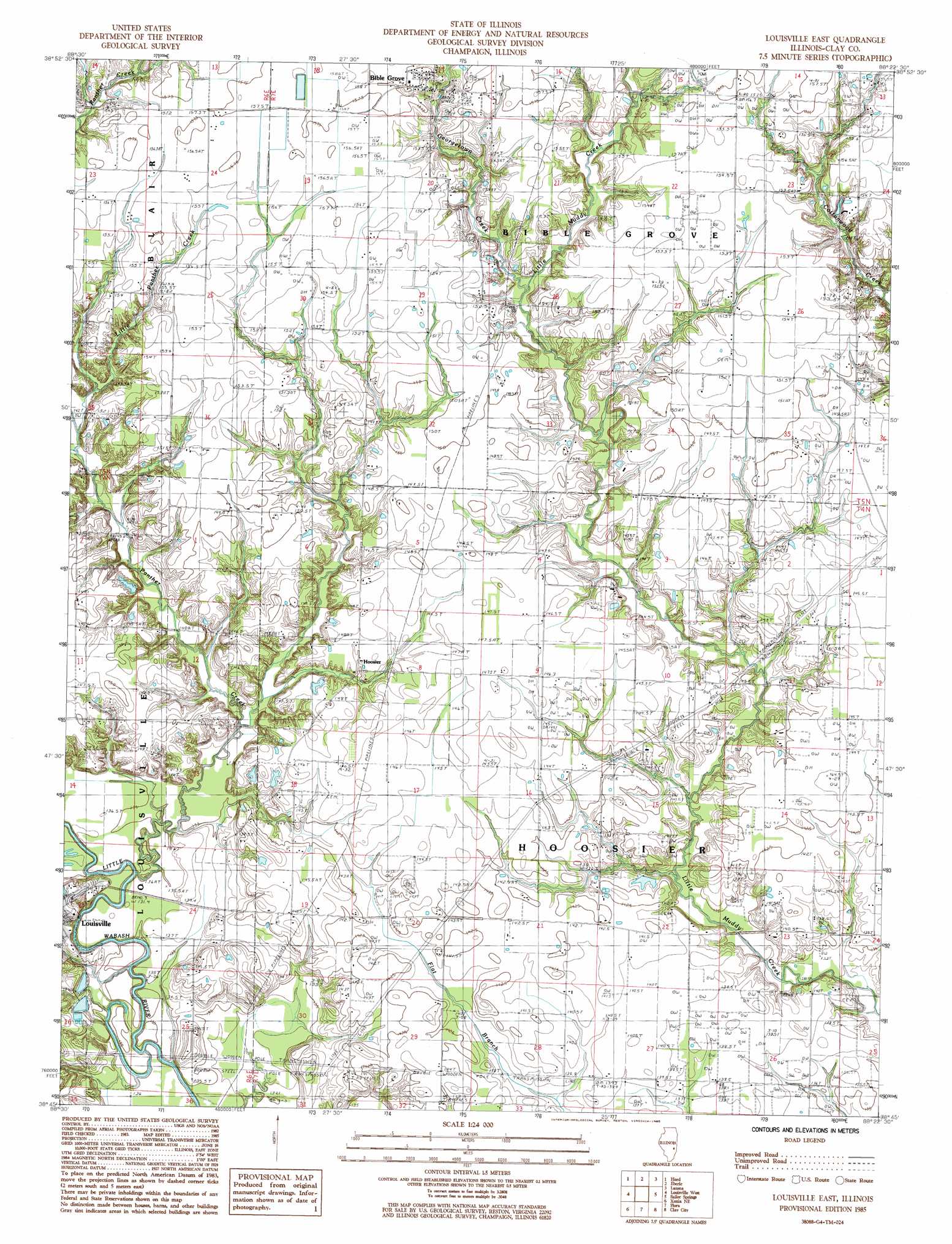
Louisville East Topo Map Illinois
To zoom in, hover over the map of Louisville East
USGS Topo Quad 38088g4 - 1:24,000 scale
| Topo Map Name: | Louisville East |
| USGS Topo Quad ID: | 38088g4 |
| Print Size: | ca. 21 1/4" wide x 27" high |
| Southeast Coordinates: | 38.75° N latitude / 88.375° W longitude |
| Map Center Coordinates: | 38.8125° N latitude / 88.4375° W longitude |
| U.S. State: | IL |
| Filename: | o38088g4.jpg |
| Download Map JPG Image: | Louisville East topo map 1:24,000 scale |
| Map Type: | Topographic |
| Topo Series: | 7.5´ |
| Map Scale: | 1:24,000 |
| Source of Map Images: | United States Geological Survey (USGS) |
| Alternate Map Versions: |
Louisville East IL 1985, updated 1985 Download PDF Buy paper map Louisville East IL 2012 Download PDF Buy paper map Louisville East IL 2015 Download PDF Buy paper map |
1:24,000 Topo Quads surrounding Louisville East
Altamont East |
Effingham South |
Dieterich |
Wheeler |
Rose Hill |
Edgewood |
Hord |
Eberle |
Latona |
Newton |
Oskaloosa |
Louisville West |
Louisville East |
Sailor Springs |
Wakefield |
Xenia |
Xenia Ne |
Flora |
Clay City |
Noble |
Orchardville |
Johnsonville |
Cisne |
Enterprise |
Mount Erie |
> Back to 38088e1 at 1:100,000 scale
> Back to 38088a1 at 1:250,000 scale
> Back to U.S. Topo Maps home
Louisville East topo map: Gazetteer
Louisville East: Oilfields
Sailor Springs Oil Field elevation 136m 446′Louisville East: Populated Places
Bible Grove elevation 155m 508′Hoosier elevation 145m 475′
Louisville East: Streams
Georgetown Creek elevation 146m 479′Little Panther Creek elevation 142m 465′
Panther Creek elevation 135m 442′
Louisville East digital topo map on disk
Buy this Louisville East topo map showing relief, roads, GPS coordinates and other geographical features, as a high-resolution digital map file on DVD: