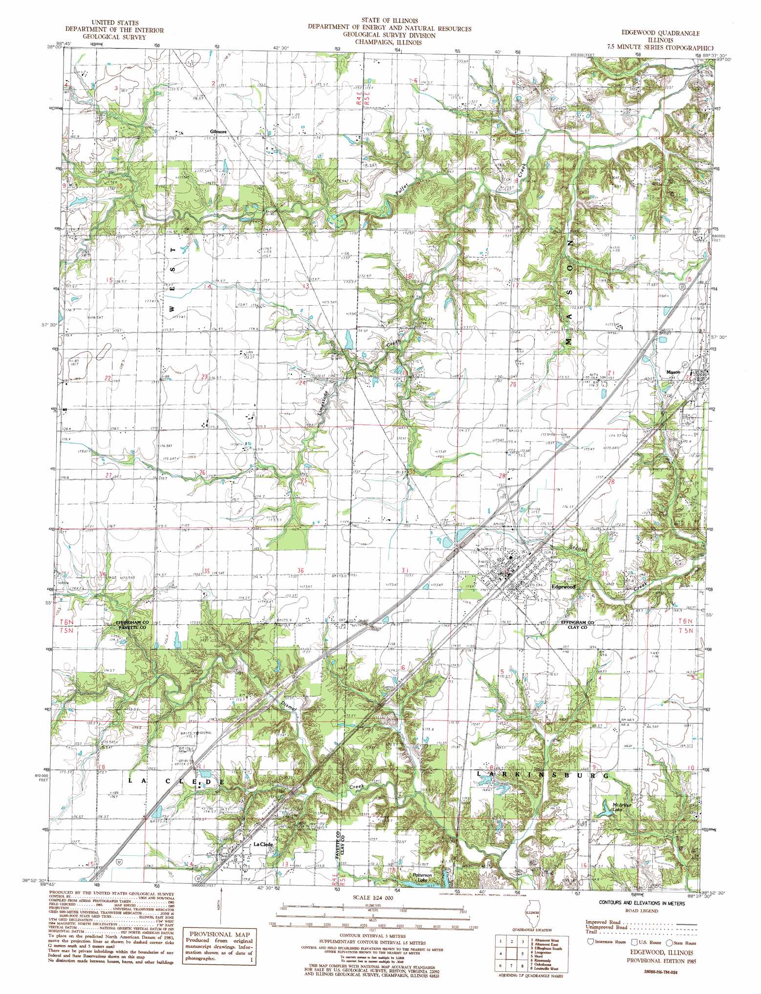
Edgewood Topo Map Illinois
To zoom in, hover over the map of Edgewood
USGS Topo Quad 38088h6 - 1:24,000 scale
| Topo Map Name: | Edgewood |
| USGS Topo Quad ID: | 38088h6 |
| Print Size: | ca. 21 1/4" wide x 27" high |
| Southeast Coordinates: | 38.875° N latitude / 88.625° W longitude |
| Map Center Coordinates: | 38.9375° N latitude / 88.6875° W longitude |
| U.S. State: | IL |
| Filename: | o38088h6.jpg |
| Download Map JPG Image: | Edgewood topo map 1:24,000 scale |
| Map Type: | Topographic |
| Topo Series: | 7.5´ |
| Map Scale: | 1:24,000 |
| Source of Map Images: | United States Geological Survey (USGS) |
| Alternate Map Versions: |
Edgewood IL 1985, updated 1985 Download PDF Buy paper map Edgewood IL 2012 Download PDF Buy paper map Edgewood IL 2015 Download PDF Buy paper map |
1:24,000 Topo Quads surrounding Edgewood
Herrick |
Beecher City |
Shumway |
Effingham North |
Teutopolis |
Avena |
Altamont West |
Altamont East |
Effingham South |
Dieterich |
Brownstown |
Loogootee |
Edgewood |
Hord |
Eberle |
Saint Paul |
Kinmundy |
Oskaloosa |
Louisville West |
Louisville East |
Salem North |
Omega |
Xenia |
Xenia Ne |
Flora |
> Back to 38088e1 at 1:100,000 scale
> Back to 38088a1 at 1:250,000 scale
> Back to U.S. Topo Maps home
Edgewood topo map: Gazetteer
Edgewood: Crossings
Interchange 145 elevation 174m 570′Edgewood: Dams
Patterson Lake Dam elevation 162m 531′Edgewood: Populated Places
Bristol (historical) elevation 169m 554′Edgewood elevation 175m 574′
Gilmore elevation 177m 580′
La Clede elevation 174m 570′
Edgewood: Post Offices
Edgewood Post Office elevation 176m 577′Laclede Post Office elevation 175m 574′
Edgewood: Reservoirs
McArthur Lake elevation 164m 538′Edgewood: Streams
Limestone Creek elevation 155m 508′Edgewood digital topo map on disk
Buy this Edgewood topo map showing relief, roads, GPS coordinates and other geographical features, as a high-resolution digital map file on DVD: