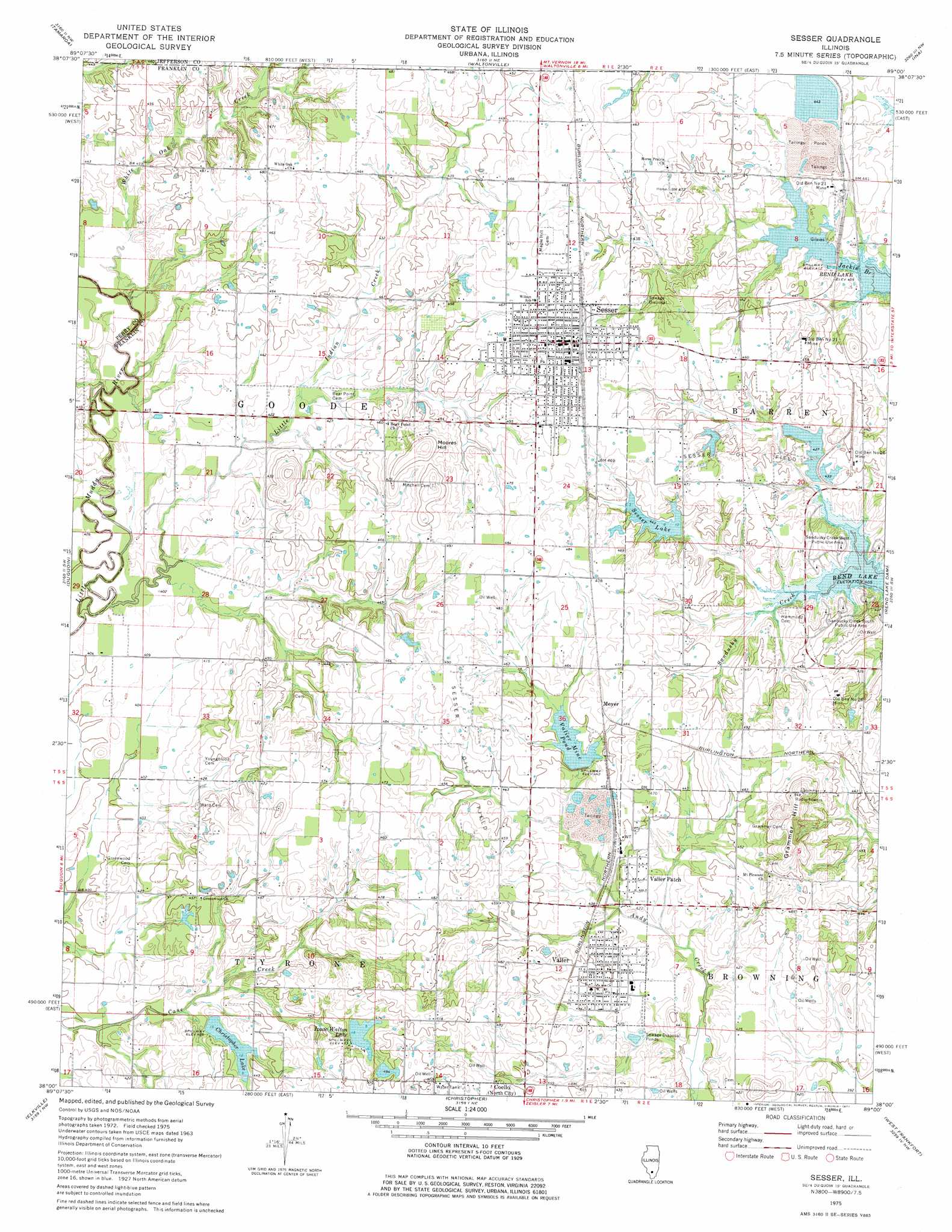
Sesser Topo Map Illinois
To zoom in, hover over the map of Sesser
USGS Topo Quad 38089a1 - 1:24,000 scale
| Topo Map Name: | Sesser |
| USGS Topo Quad ID: | 38089a1 |
| Print Size: | ca. 21 1/4" wide x 27" high |
| Southeast Coordinates: | 38° N latitude / 89° W longitude |
| Map Center Coordinates: | 38.0625° N latitude / 89.0625° W longitude |
| U.S. State: | IL |
| Filename: | o38089a1.jpg |
| Download Map JPG Image: | Sesser topo map 1:24,000 scale |
| Map Type: | Topographic |
| Topo Series: | 7.5´ |
| Map Scale: | 1:24,000 |
| Source of Map Images: | United States Geological Survey (USGS) |
| Alternate Map Versions: |
Sesser IL 1975, updated 1977 Download PDF Buy paper map Sesser IL 1998, updated 2000 Download PDF Buy paper map Sesser IL 2012 Download PDF Buy paper map Sesser IL 2015 Download PDF Buy paper map |
1:24,000 Topo Quads surrounding Sesser
Beaucoup |
Ashley |
Woodlawn |
Mount Vernon |
Opdyke |
Todds Mill |
Tamaroa |
Waltonville |
Ina |
Spring Garden |
Pyatts |
Du Quoin |
Sesser |
Rend Lake Dam |
Ewing |
Vergennes |
Elkville |
Christopher |
West Frankfort |
Thompsonville |
Murphysboro |
Desoto |
Herrin |
Johnston City |
Pittsburg |
> Back to 38089a1 at 1:100,000 scale
> Back to 38088a1 at 1:250,000 scale
> Back to U.S. Topo Maps home
Sesser topo map: Gazetteer
Sesser: Bridges
Gallaway Bridge (historical) elevation 122m 400′Sesser: Dams
Christopher New Reservoir Dam elevation 132m 433′City of Sesser Reservoir Dam elevation 135m 442′
Mine Number 21 Dam elevation 132m 433′
Valier Lake Dam elevation 133m 436′
Sesser: Mines
Old Ben Number 21 Mine elevation 135m 442′Old Ben Number 21 Mine elevation 138m 452′
Old Ben Number 26 Mine elevation 138m 452′
Old Ben Number 26 Mine elevation 140m 459′
Old Keller Mine elevation 142m 465′
Sesser: Oilfields
Sesser Oil Field elevation 143m 469′Sesser: Parks
Sandusky Creek South Public Use Area elevation 129m 423′Sandusky Creek West Public Use Area elevation 132m 433′
Sesser: Populated Places
Meyer elevation 143m 469′Sesser elevation 146m 479′
Valier elevation 140m 459′
Valier Patch elevation 131m 429′
Sesser: Post Offices
Prosperity Post Office (historical) elevation 139m 456′Sesser: Reservoirs
Christopher Lake elevation 133m 436′Christopher New Reservoir elevation 132m 433′
Izaac Walton Lake elevation 145m 475′
Mine Number 21 Reservoir elevation 132m 433′
Sesser Lake elevation 135m 442′
Valier Lake elevation 135m 442′
Valier Mine Pond elevation 133m 436′
Sesser: Streams
Little Indian Creek elevation 122m 400′White Oak Creek elevation 122m 400′
Sesser: Summits
Grammer Hill elevation 167m 547′Moores Hill elevation 163m 534′
Sesser digital topo map on disk
Buy this Sesser topo map showing relief, roads, GPS coordinates and other geographical features, as a high-resolution digital map file on DVD: