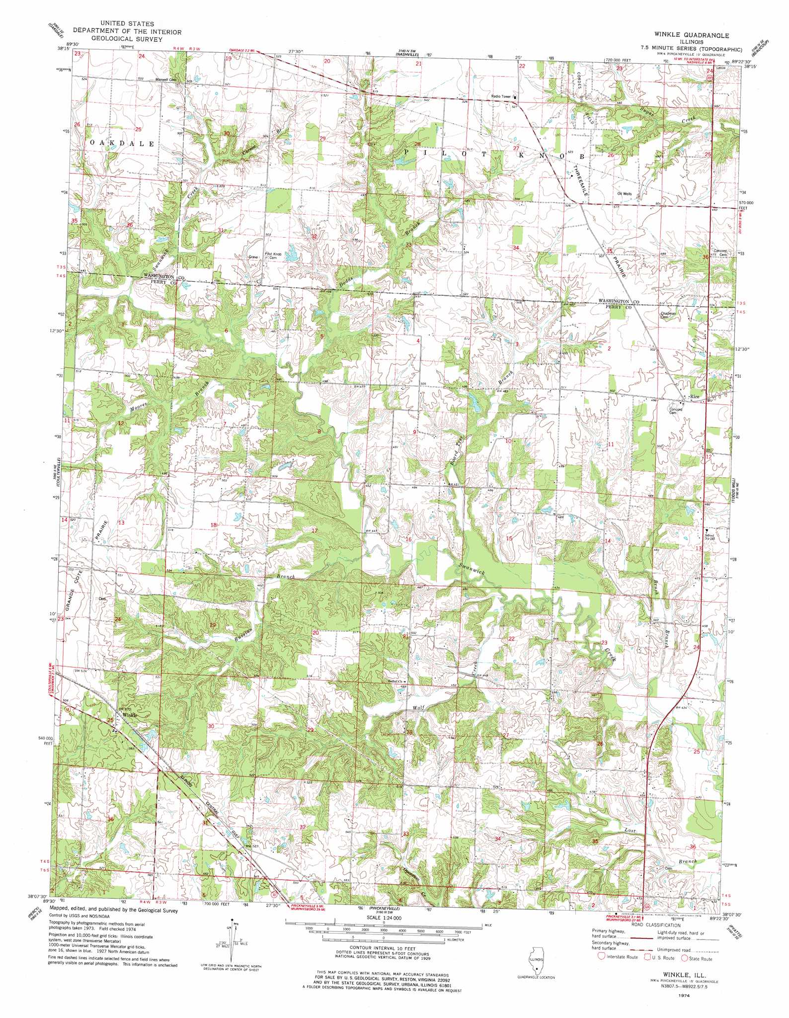
Winkle Topo Map Illinois
To zoom in, hover over the map of Winkle
USGS Topo Quad 38089b4 - 1:24,000 scale
| Topo Map Name: | Winkle |
| USGS Topo Quad ID: | 38089b4 |
| Print Size: | ca. 21 1/4" wide x 27" high |
| Southeast Coordinates: | 38.125° N latitude / 89.375° W longitude |
| Map Center Coordinates: | 38.1875° N latitude / 89.4375° W longitude |
| U.S. State: | IL |
| Filename: | o38089b4.jpg |
| Download Map JPG Image: | Winkle topo map 1:24,000 scale |
| Map Type: | Topographic |
| Topo Series: | 7.5´ |
| Map Scale: | 1:24,000 |
| Source of Map Images: | United States Geological Survey (USGS) |
| Alternate Map Versions: |
Winkle IL 1974, updated 1978 Download PDF Buy paper map Winkle IL 2012 Download PDF Buy paper map Winkle IL 2015 Download PDF Buy paper map |
1:24,000 Topo Quads surrounding Winkle
Venedy |
Okawville |
Addieville |
Hoyleton |
Irvington |
Saint Libory |
Oakdale |
Nashville |
Beaucoup |
Ashley |
Tilden |
Coulterville |
Winkle |
Todds Mill |
Tamaroa |
Steeleville |
Percy |
Pinckneyville |
Pyatts |
Du Quoin |
Welge |
Willisville |
Ava |
Vergennes |
Elkville |
> Back to 38089a1 at 1:100,000 scale
> Back to 38088a1 at 1:250,000 scale
> Back to U.S. Topo Maps home
Winkle topo map: Gazetteer
Winkle: Airports
Schumaier RLA Airport elevation 161m 528′Winkle: Flats
Threemile Prairie elevation 158m 518′Winkle: Populated Places
Rice elevation 155m 508′Winkle elevation 171m 561′
Winkle: Streams
Board Tree Branch elevation 131m 429′Brush Branch elevation 128m 419′
Carson Branch elevation 148m 485′
Dodds Branch elevation 138m 452′
Moores Branch elevation 139m 456′
Russian Branch elevation 134m 439′
Wolf Creek elevation 131m 429′
Winkle digital topo map on disk
Buy this Winkle topo map showing relief, roads, GPS coordinates and other geographical features, as a high-resolution digital map file on DVD: