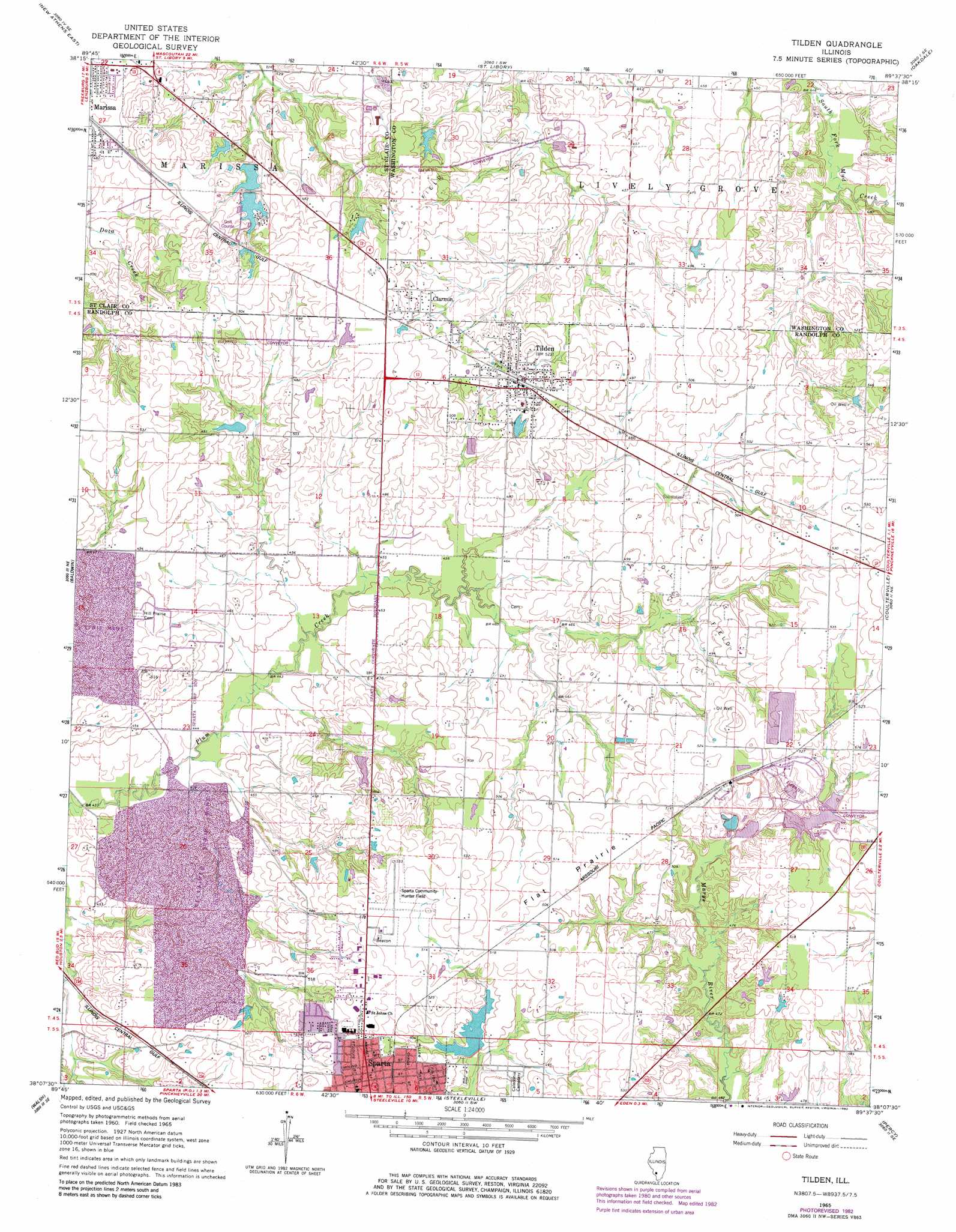
Tilden Topo Map Illinois
To zoom in, hover over the map of Tilden
USGS Topo Quad 38089b6 - 1:24,000 scale
| Topo Map Name: | Tilden |
| USGS Topo Quad ID: | 38089b6 |
| Print Size: | ca. 21 1/4" wide x 27" high |
| Southeast Coordinates: | 38.125° N latitude / 89.625° W longitude |
| Map Center Coordinates: | 38.1875° N latitude / 89.6875° W longitude |
| U.S. State: | IL |
| Filename: | o38089b6.jpg |
| Download Map JPG Image: | Tilden topo map 1:24,000 scale |
| Map Type: | Topographic |
| Topo Series: | 7.5´ |
| Map Scale: | 1:24,000 |
| Source of Map Images: | United States Geological Survey (USGS) |
| Alternate Map Versions: |
Tilden IL 1965, updated 1966 Download PDF Buy paper map Tilden IL 1965, updated 1982 Download PDF Buy paper map Tilden IL 2012 Download PDF Buy paper map Tilden IL 2015 Download PDF Buy paper map |
1:24,000 Topo Quads surrounding Tilden
Freeburg |
Mascoutah |
Venedy |
Okawville |
Addieville |
New Athens West |
New Athens East |
Saint Libory |
Oakdale |
Nashville |
Red Bud |
Baldwin |
Tilden |
Coulterville |
Winkle |
Evansville |
Walsh |
Steeleville |
Percy |
Pinckneyville |
Kaskaskia |
Chester |
Welge |
Willisville |
Ava |
> Back to 38089a1 at 1:100,000 scale
> Back to 38088a1 at 1:250,000 scale
> Back to U.S. Topo Maps home
Tilden topo map: Gazetteer
Tilden: Airports
Herschel Hunter Airport elevation 159m 521′Sparta Community Airport elevation 161m 528′
Tilden: Dams
Illinois No Name Number 2023 Dam elevation 152m 498′Marissa Recreation Association North Lake Dam elevation 138m 452′
Marissa Recreation Association South Lake Dam elevation 142m 465′
New City Reservoir Dam elevation 145m 475′
Shaufler Pond Dam elevation 146m 479′
Tilden: Flats
Flat Prairie elevation 157m 515′Tilden: Parks
Tom Reid Park elevation 161m 528′Tilden: Populated Places
Clarmin elevation 153m 501′Tilden elevation 160m 524′
Whiteoak elevation 155m 508′
Tilden: Reservoirs
Marissa Recreation Association Lake elevation 138m 452′Marissa Recreation Association South Lake elevation 142m 465′
New City Reservoir elevation 145m 475′
Shaufler Pond elevation 146m 479′
Tilden digital topo map on disk
Buy this Tilden topo map showing relief, roads, GPS coordinates and other geographical features, as a high-resolution digital map file on DVD: