Saint Libory Topo Map Illinois
To zoom in, hover over the map of Saint Libory
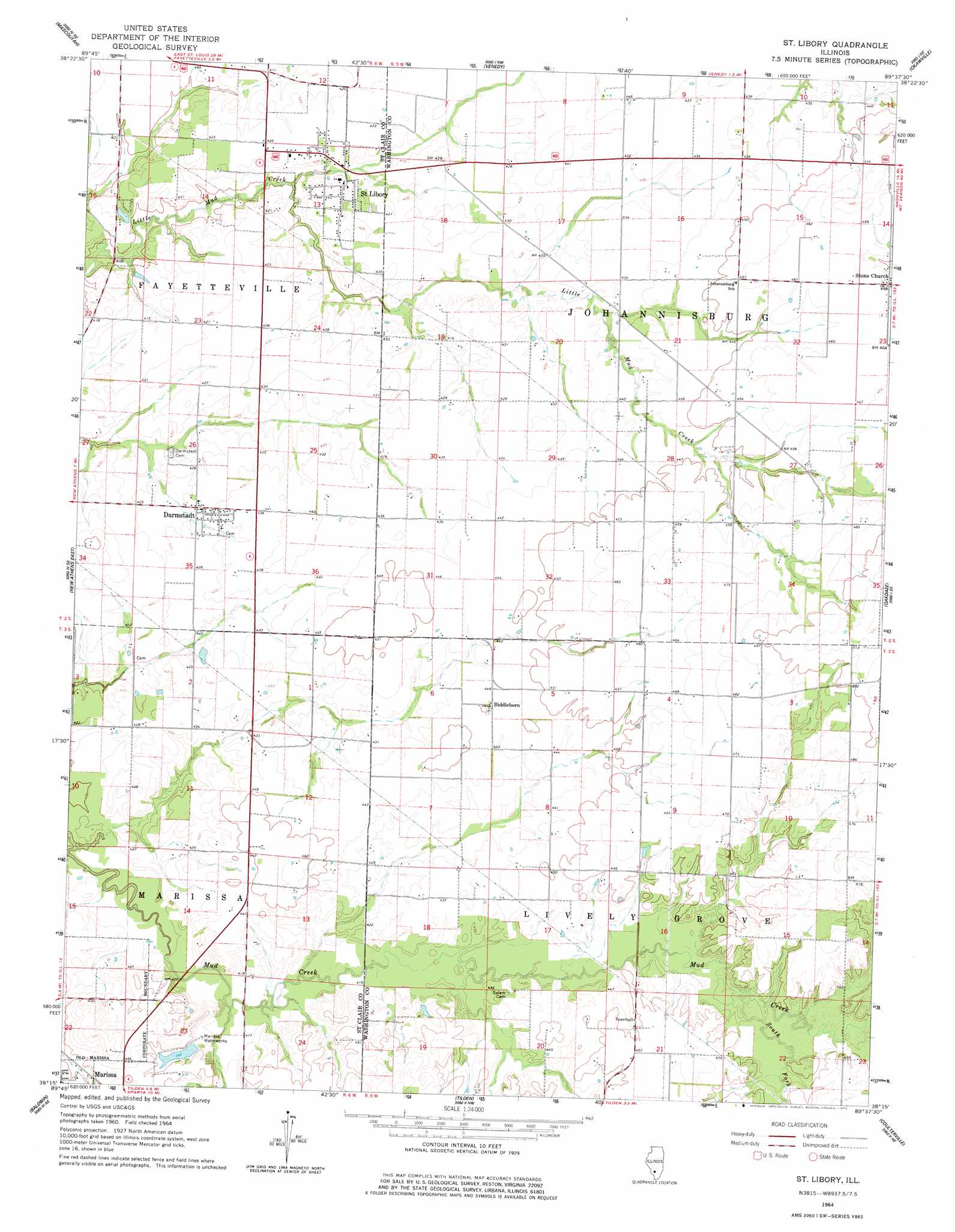
USGS Topo Quad 38089c6 - 1:24,000 scale
| Topo Map Name: | Saint Libory |
| USGS Topo Quad ID: | 38089c6 |
| Print Size: | ca. 21 1/4" wide x 27" high |
| Southeast Coordinates: | 38.25° N latitude / 89.625° W longitude |
| Map Center Coordinates: | 38.3125° N latitude / 89.6875° W longitude |
| U.S. State: | IL |
| Filename: | o38089c6.jpg |
| Download Map JPG Image: | Saint Libory topo map 1:24,000 scale |
| Map Type: | Topographic |
| Topo Series: | 7.5´ |
| Map Scale: | 1:24,000 |
| Source of Map Images: | United States Geological Survey (USGS) |
| Alternate Map Versions: |
St. Libory IL 1964, updated 1977 Download PDF Buy paper map Saint Libory IL 2012 Download PDF Buy paper map Saint Libory IL 2015 Download PDF Buy paper map |
1:24,000 Topo Quads surrounding Saint Libory
O'Fallon |
Lebanon |
Trenton |
Breese |
Beckemeyer |
Freeburg |
Mascoutah |
Venedy |
Okawville |
Addieville |
New Athens West |
New Athens East |
Saint Libory |
Oakdale |
Nashville |
Red Bud |
Baldwin |
Tilden |
Coulterville |
Winkle |
Evansville |
Walsh |
Steeleville |
Percy |
Pinckneyville |
> Back to 38089a1 at 1:100,000 scale
> Back to 38088a1 at 1:250,000 scale
> Back to U.S. Topo Maps home
Saint Libory topo map: Gazetteer
Saint Libory: Airports
Shubert Airport elevation 143m 469′Saint Libory: Dams
Marissa Reservoir Dam elevation 135m 442′Saint Libory: Populated Places
Biddleborn elevation 136m 446′Caspars elevation 140m 459′
Darmstadt elevation 128m 419′
Saint Libory elevation 124m 406′
Stone Church elevation 140m 459′
Saint Libory: Post Offices
Caspars Post Office (historical) elevation 140m 459′Stone Church Post Office (historical) elevation 140m 459′
Saint Libory: Reservoirs
Marissa Reservoir elevation 135m 442′Saint Libory: Streams
South Fork Mud Creek elevation 130m 426′Saint Libory digital topo map on disk
Buy this Saint Libory topo map showing relief, roads, GPS coordinates and other geographical features, as a high-resolution digital map file on DVD: