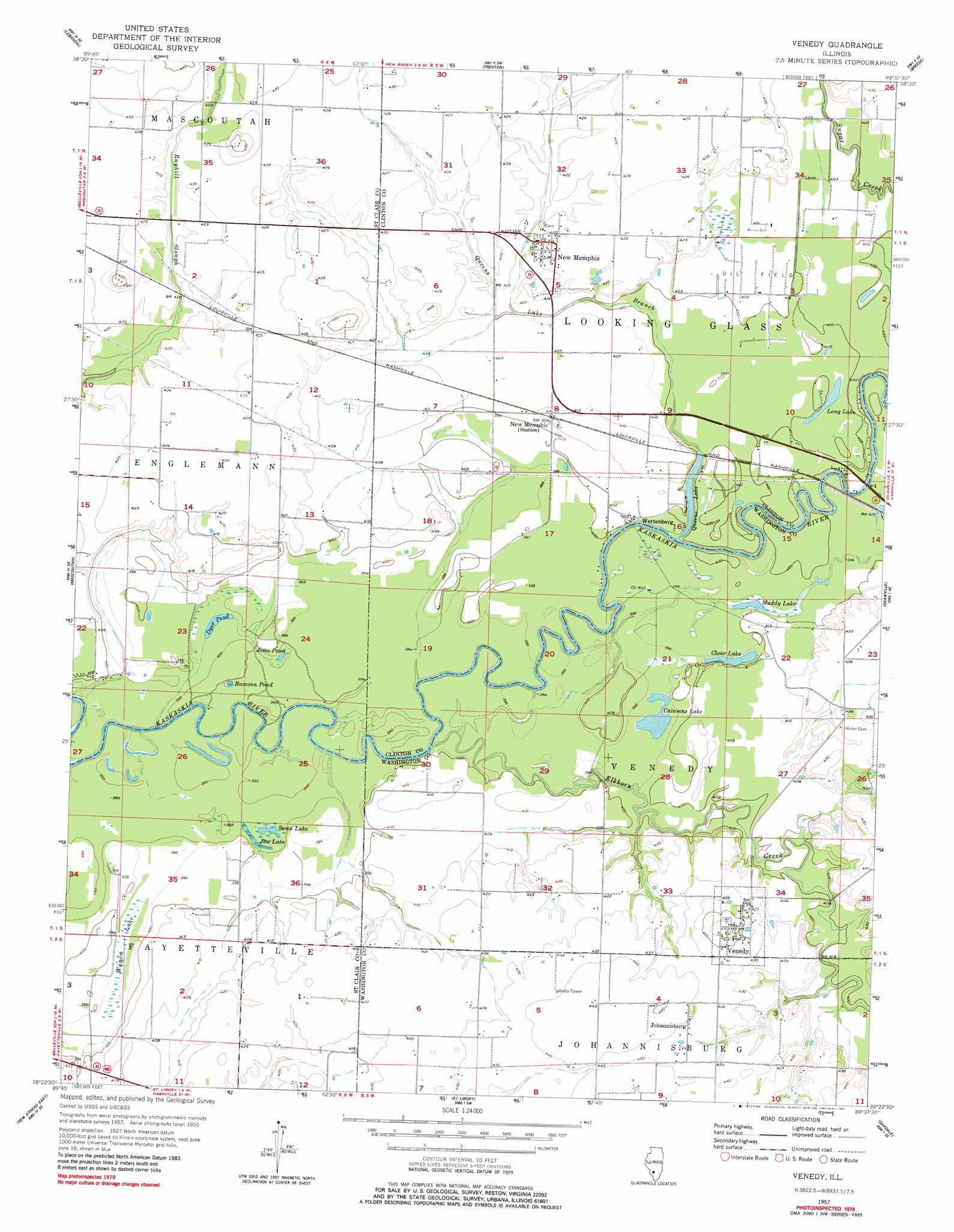
Venedy Topo Map Illinois
To zoom in, hover over the map of Venedy
USGS Topo Quad 38089d6 - 1:24,000 scale
| Topo Map Name: | Venedy |
| USGS Topo Quad ID: | 38089d6 |
| Print Size: | ca. 21 1/4" wide x 27" high |
| Southeast Coordinates: | 38.375° N latitude / 89.625° W longitude |
| Map Center Coordinates: | 38.4375° N latitude / 89.6875° W longitude |
| U.S. State: | IL |
| Filename: | o38089d6.jpg |
| Download Map JPG Image: | Venedy topo map 1:24,000 scale |
| Map Type: | Topographic |
| Topo Series: | 7.5´ |
| Map Scale: | 1:24,000 |
| Source of Map Images: | United States Geological Survey (USGS) |
| Alternate Map Versions: |
Venedy IL 1957, updated 1958 Download PDF Buy paper map Venedy IL 1957, updated 1981 Download PDF Buy paper map Venedy IL 2012 Download PDF Buy paper map Venedy IL 2015 Download PDF Buy paper map |
1:24,000 Topo Quads surrounding Venedy
Collinsville |
Saint Jacob |
Highland |
Saint Rose |
Stolletown |
O'Fallon |
Lebanon |
Trenton |
Breese |
Beckemeyer |
Freeburg |
Mascoutah |
Venedy |
Okawville |
Addieville |
New Athens West |
New Athens East |
Saint Libory |
Oakdale |
Nashville |
Red Bud |
Baldwin |
Tilden |
Coulterville |
Winkle |
> Back to 38089a1 at 1:100,000 scale
> Back to 38088a1 at 1:250,000 scale
> Back to U.S. Topo Maps home
Venedy topo map: Gazetteer
Venedy: Airports
Fischers RLA Airport elevation 129m 423′Venedy: Lakes
Calamus Lake elevation 120m 393′Clear Lake elevation 120m 393′
Dyer Pond elevation 120m 393′
Jims Pond elevation 119m 390′
Long Lake elevation 120m 393′
Muddy Lake elevation 120m 393′
Queens Lake elevation 117m 383′
Swan Lake elevation 119m 390′
Venedy: Populated Places
Johannisburg elevation 134m 439′New Memphis elevation 128m 419′
New Memphis Station elevation 125m 410′
Venedy elevation 138m 452′
Wertenberg elevation 122m 400′
Venedy: Post Offices
New Memphis Post Office elevation 127m 416′Venedy: Streams
Elkhorn Creek elevation 119m 390′Queens Lake Branch elevation 118m 387′
Venedy: Swamps
Jew Lake elevation 118m 387′Raccoon Pond elevation 119m 390′
Wagon Lake elevation 120m 393′
Venedy digital topo map on disk
Buy this Venedy topo map showing relief, roads, GPS coordinates and other geographical features, as a high-resolution digital map file on DVD: