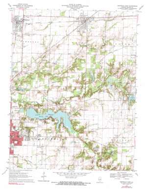
Centralia East Topo Map Illinois
To zoom in, hover over the map of Centralia East
USGS Topo Quad 38089e1 - 1:24,000 scale
| Topo Map Name: | Centralia East |
| USGS Topo Quad ID: | 38089e1 |
| Print Size: | ca. 21 1/4" wide x 27" high |
| Southeast Coordinates: | 38.5° N latitude / 89° W longitude |
| Map Center Coordinates: | 38.5625° N latitude / 89.0625° W longitude |
| U.S. State: | IL |
| Filename: | o38089e1.jpg |
| Download Map JPG Image: | Centralia East topo map 1:24,000 scale |
| Map Type: | Topographic |
| Topo Series: | 7.5´ |
| Map Scale: | 1:24,000 |
| Source of Map Images: | United States Geological Survey (USGS) |
| Alternate Map Versions: |
Centralia East IL 1970, updated 1971 Download PDF Buy paper map Centralia East IL 1970, updated 1990 Download PDF Buy paper map Centralia East IL 1970, updated 1990 Download PDF Buy paper map Centralia East IL 2012 Download PDF Buy paper map Centralia East IL 2015 Download PDF Buy paper map |
1:24,000 Topo Quads surrounding Centralia East
> Back to 38089e1 at 1:100,000 scale
> Back to 38088a1 at 1:250,000 scale
> Back to U.S. Topo Maps home
Centralia East topo map: Gazetteer
Centralia East: Airports
Centralia Municipal Airport elevation 159m 521′Centralia East: Dams
Kings Lake Dam elevation 158m 518′Lake Centralia Dam elevation 155m 508′
Old Reservoir Dam elevation 145m 475′
Raccoon Lake Dam elevation 145m 475′
Centralia East: Oilfields
Raccoon Lake Oil Field elevation 155m 508′Salem Consolidation Oil Field elevation 160m 524′
Centralia East: Parks
Centralia Foundation Park elevation 152m 498′Community Beach Park elevation 147m 482′
Finger Park elevation 152m 498′
Raccoon Lake Park elevation 153m 501′
Centralia East: Populated Places
Hubbard Woods elevation 161m 528′Odin elevation 161m 528′
Sandoval elevation 155m 508′
Centralia East: Reservoirs
Centralia Reservoir elevation 145m 475′Kings Lake elevation 158m 518′
Lake Centralia elevation 155m 508′
Old Reservoir elevation 145m 475′
Raccoon Lake elevation 145m 475′
Centralia East: Streams
Raccoon Creek elevation 137m 449′Turkey Run elevation 141m 462′
Centralia East: Summits
Fikes Hill elevation 176m 577′Centralia East digital topo map on disk
Buy this Centralia East topo map showing relief, roads, GPS coordinates and other geographical features, as a high-resolution digital map file on DVD:


