Patoka Topo Map Illinois
To zoom in, hover over the map of Patoka
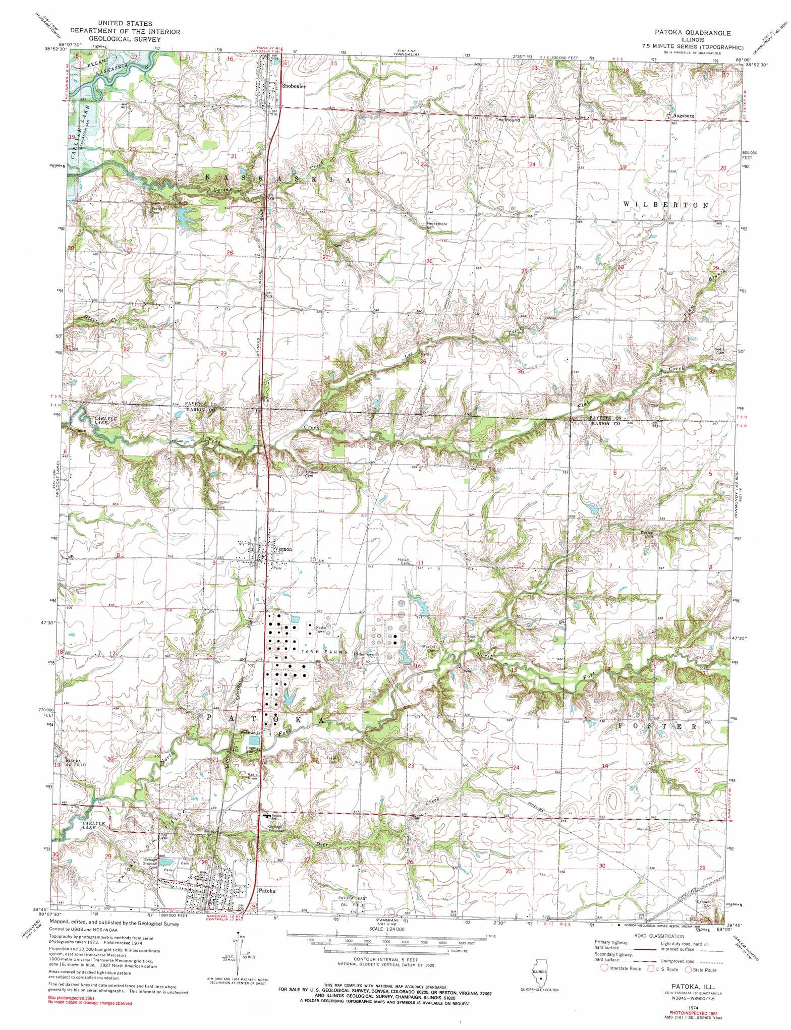
USGS Topo Quad 38089g1 - 1:24,000 scale
| Topo Map Name: | Patoka |
| USGS Topo Quad ID: | 38089g1 |
| Print Size: | ca. 21 1/4" wide x 27" high |
| Southeast Coordinates: | 38.75° N latitude / 89° W longitude |
| Map Center Coordinates: | 38.8125° N latitude / 89.0625° W longitude |
| U.S. State: | IL |
| Filename: | o38089g1.jpg |
| Download Map JPG Image: | Patoka topo map 1:24,000 scale |
| Map Type: | Topographic |
| Topo Series: | 7.5´ |
| Map Scale: | 1:24,000 |
| Source of Map Images: | United States Geological Survey (USGS) |
| Alternate Map Versions: |
Patoka IL 1974, updated 1977 Download PDF Buy paper map Patoka IL 1974, updated 1991 Download PDF Buy paper map Patoka IL 2012 Download PDF Buy paper map Patoka IL 2015 Download PDF Buy paper map |
1:24,000 Topo Quads surrounding Patoka
Fillmore |
Bingham |
Vera |
Avena |
Altamont West |
Mulberry Grove |
Hagarstown |
Vandalia |
Brownstown |
Loogootee |
Pleasant Mound |
Wildcat Lake |
Patoka |
Saint Paul |
Kinmundy |
Keyesport |
Boulder |
Fairman |
Salem North |
Omega |
Carlyle |
Centralia West |
Centralia East |
Salem South |
Iuka |
> Back to 38089e1 at 1:100,000 scale
> Back to 38088a1 at 1:250,000 scale
> Back to U.S. Topo Maps home
Patoka topo map: Gazetteer
Patoka: Dams
Illinois No Name Number 2040 Dam elevation 153m 501′Patoka: Oilfields
Patoka Oil Field elevation 151m 495′Patoka: Populated Places
Augsburg elevation 171m 561′Patoka elevation 154m 505′
Shobonier elevation 157m 515′
Vernon elevation 157m 515′
Patoka: Post Offices
Shobonier Post Office elevation 157m 515′Patoka: Reservoirs
Illinois No Name Number 2040 Reservoir elevation 153m 501′Patoka: Streams
Deer Creek elevation 142m 465′Lee Creek elevation 147m 482′
Plum Branch elevation 155m 508′
Patoka: Summits
The Mound elevation 174m 570′Patoka digital topo map on disk
Buy this Patoka topo map showing relief, roads, GPS coordinates and other geographical features, as a high-resolution digital map file on DVD: