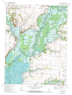
Wildcat Lake Topo Map Illinois
To zoom in, hover over the map of Wildcat Lake
USGS Topo Quad 38089g2 - 1:24,000 scale
| Topo Map Name: | Wildcat Lake |
| USGS Topo Quad ID: | 38089g2 |
| Print Size: | ca. 21 1/4" wide x 27" high |
| Southeast Coordinates: | 38.75° N latitude / 89.125° W longitude |
| Map Center Coordinates: | 38.8125° N latitude / 89.1875° W longitude |
| U.S. State: | IL |
| Filename: | o38089g2.jpg |
| Download Map JPG Image: | Wildcat Lake topo map 1:24,000 scale |
| Map Type: | Topographic |
| Topo Series: | 7.5´ |
| Map Scale: | 1:24,000 |
| Source of Map Images: | United States Geological Survey (USGS) |
| Alternate Map Versions: |
Wildcat Lake IL 1974, updated 1977 Download PDF Buy paper map Wildcat Lake IL 1974, updated 1991 Download PDF Buy paper map Wildcat Lake IL 2012 Download PDF Buy paper map Wildcat Lake IL 2015 Download PDF Buy paper map |
1:24,000 Topo Quads surrounding Wildcat Lake
> Back to 38089e1 at 1:100,000 scale
> Back to 38088a1 at 1:250,000 scale
> Back to U.S. Topo Maps home
Wildcat Lake topo map: Gazetteer
Wildcat Lake: Canals
Muddy Creek Ditch elevation 137m 449′Wildcat Ditch elevation 137m 449′
Wildcat Lake: Capes
Hermit Point elevation 150m 492′Wildcat Lake: Lakes
Goose Pond elevation 136m 446′Grass Pond elevation 137m 449′
Half Mile Pond elevation 136m 446′
Hem Pond elevation 137m 449′
Old River Lake (historical) elevation 136m 446′
Otter Pond elevation 137m 449′
Soper Lake (historical) elevation 136m 446′
Wildcat Lake elevation 137m 449′
Wildcat Lake: Parks
Carlyle Lake State Wildlife Management Area elevation 136m 446′Wildcat Lake: Populated Places
Pittsburg elevation 162m 531′Wildcat Lake: Reservoirs
Carlyle Lake elevation 137m 449′Wildcat Lake: Streams
Bear Creek elevation 137m 449′Buck Creek elevation 137m 449′
Cassar Creek elevation 138m 452′
East Fork Kaskaskia River elevation 136m 446′
Flat Creek elevation 137m 449′
Hurricane Creek elevation 136m 446′
Maggot Creek elevation 136m 446′
Muddy Creek elevation 139m 456′
Steve Creek elevation 138m 452′
Willow Branch elevation 137m 449′
Wildcat Lake digital topo map on disk
Buy this Wildcat Lake topo map showing relief, roads, GPS coordinates and other geographical features, as a high-resolution digital map file on DVD:


