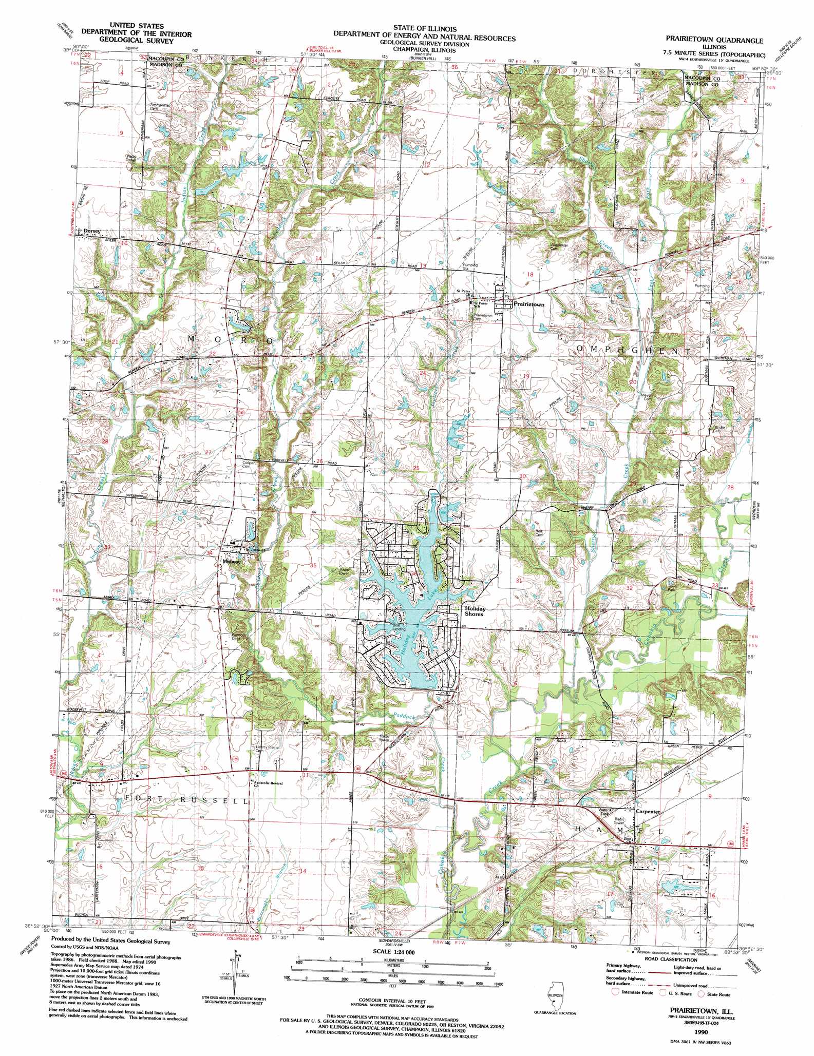
Prairietown Topo Map Illinois
To zoom in, hover over the map of Prairietown
USGS Topo Quad 38089h8 - 1:24,000 scale
| Topo Map Name: | Prairietown |
| USGS Topo Quad ID: | 38089h8 |
| Print Size: | ca. 21 1/4" wide x 27" high |
| Southeast Coordinates: | 38.875° N latitude / 89.875° W longitude |
| Map Center Coordinates: | 38.9375° N latitude / 89.9375° W longitude |
| U.S. State: | IL |
| Filename: | o38089h8.jpg |
| Download Map JPG Image: | Prairietown topo map 1:24,000 scale |
| Map Type: | Topographic |
| Topo Series: | 7.5´ |
| Map Scale: | 1:24,000 |
| Source of Map Images: | United States Geological Survey (USGS) |
| Alternate Map Versions: |
Prairietown IL 1954, updated 1959 Download PDF Buy paper map Prairietown IL 1954, updated 1969 Download PDF Buy paper map Prairietown IL 1954, updated 1975 Download PDF Buy paper map Prairietown IL 1990, updated 1991 Download PDF Buy paper map Prairietown IL 2012 Download PDF Buy paper map Prairietown IL 2015 Download PDF Buy paper map |
1:24,000 Topo Quads surrounding Prairietown
Medora |
Summerville |
Plainview |
Gillespie North |
Litchfield |
Brighton |
Shipman |
Bunker Hill |
Gillespie South |
Mount Olive |
Alton |
Bethalto |
Prairietown |
Worden |
New Douglas |
Columbia Bottom |
Wood River |
Edwardsville |
Marine |
Grantfork |
Granite City |
Monks Mound |
Collinsville |
Saint Jacob |
Highland |
> Back to 38089e1 at 1:100,000 scale
> Back to 38088a1 at 1:250,000 scale
> Back to U.S. Topo Maps home
Prairietown topo map: Gazetteer
Prairietown: Dams
Holiday Shores Lake Dam elevation 147m 482′Joyces Lake Dam elevation 176m 577′
Lake Heights Dam elevation 171m 561′
Lake Meadow Dam elevation 161m 528′
Yates Lake Dam elevation 164m 538′
Prairietown: Mines
Klondike Mine elevation 169m 554′Prairietown: Populated Places
Carpenter elevation 162m 531′Holiday Shores elevation 158m 518′
Midway elevation 168m 551′
Prairietown elevation 176m 577′
Prairietown: Post Offices
Omphghent Post Office (historical) elevation 159m 521′Prairietown: Reservoirs
Holiday Lake elevation 154m 505′Joyces Lake elevation 176m 577′
Lake Heights elevation 171m 561′
Lake Meadow elevation 161m 528′
Yates Lake elevation 164m 538′
Prairietown: Streams
Dentons Branch elevation 146m 479′East Fork Sherry Creek elevation 149m 488′
Joulters Creek elevation 140m 459′
Paddock Creek elevation 138m 452′
Sherry Creek elevation 140m 459′
White Rock Creek elevation 146m 479′
Prairietown digital topo map on disk
Buy this Prairietown topo map showing relief, roads, GPS coordinates and other geographical features, as a high-resolution digital map file on DVD: