Lonedell Topo Map Missouri
To zoom in, hover over the map of Lonedell
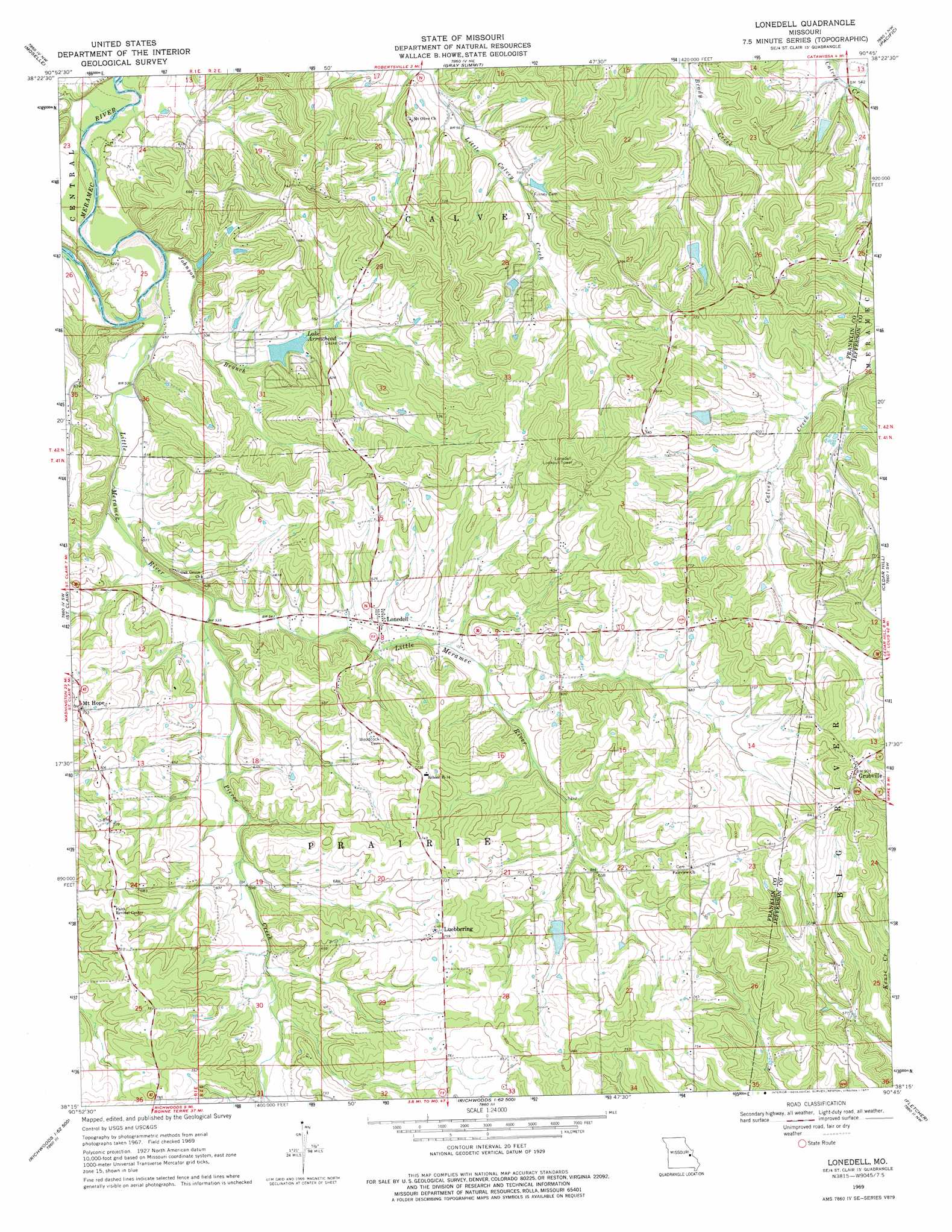
USGS Topo Quad 38090c7 - 1:24,000 scale
| Topo Map Name: | Lonedell |
| USGS Topo Quad ID: | 38090c7 |
| Print Size: | ca. 21 1/4" wide x 27" high |
| Southeast Coordinates: | 38.25° N latitude / 90.75° W longitude |
| Map Center Coordinates: | 38.3125° N latitude / 90.8125° W longitude |
| U.S. State: | MO |
| Filename: | o38090c7.jpg |
| Download Map JPG Image: | Lonedell topo map 1:24,000 scale |
| Map Type: | Topographic |
| Topo Series: | 7.5´ |
| Map Scale: | 1:24,000 |
| Source of Map Images: | United States Geological Survey (USGS) |
| Alternate Map Versions: |
Lonedell MO 1969, updated 1971 Download PDF Buy paper map Lonedell MO 1969, updated 1977 Download PDF Buy paper map Lonedell MO 2012 Download PDF Buy paper map Lonedell MO 2015 Download PDF Buy paper map |
1:24,000 Topo Quads surrounding Lonedell
Washington West |
Washington East |
Labadie |
Eureka |
Manchester |
Union |
Moselle |
Gray Summit |
Pacific |
House Springs |
Stanton |
Saint Clair |
Lonedell |
Cedar Hill |
Belew Creek |
Meramec State Park |
Cyclone Hollow |
Richwoods |
Fletcher |
Desoto |
Anthonies Mill |
Ebo |
Old Mines |
Tiff |
Vineland |
> Back to 38090a1 at 1:100,000 scale
> Back to 38090a1 at 1:250,000 scale
> Back to U.S. Topo Maps home
Lonedell topo map: Gazetteer
Lonedell: Dams
Anderson Lake Dam elevation 208m 682′Emmett Brison Dam elevation 210m 688′
G Williams Dam elevation 201m 659′
Lake Arrowhead Dam elevation 160m 524′
Lake Marion Dam elevation 173m 567′
Lake Torino Dam elevation 207m 679′
Lake Von Der Rosa Dam elevation 194m 636′
Swantner Lake Dam elevation 231m 757′
Von Der Ahe Dam elevation 176m 577′
Von Derosa Number 2 Lake Dam elevation 203m 666′
Von Derosa Number 3 Lake Dam elevation 207m 679′
Watters Lake Dam elevation 184m 603′
Lonedell: Populated Places
Calvey (historical) elevation 200m 656′Grubville elevation 276m 905′
Hemker elevation 231m 757′
Lonedell elevation 175m 574′
Luebbering elevation 234m 767′
Mount Hope elevation 214m 702′
Lonedell: Reservoirs
Al Swantner Reservoir elevation 231m 757′Emmett Brison Reservoir elevation 210m 688′
Lake Arrowhead elevation 160m 524′
Lake Torino elevation 207m 679′
Von Der Rosa Number 2 Reservoir elevation 176m 577′
Williams Lake elevation 201m 659′
Lonedell: Streams
Johnson Branch elevation 152m 498′Little Meramec River elevation 146m 479′
Pierce Creek elevation 158m 518′
Lonedell digital topo map on disk
Buy this Lonedell topo map showing relief, roads, GPS coordinates and other geographical features, as a high-resolution digital map file on DVD: