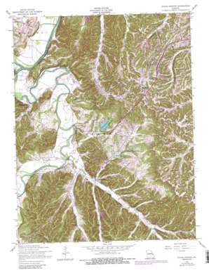
House Springs Topo Map Missouri
To zoom in, hover over the map of House Springs
USGS Topo Quad 38090d5 - 1:24,000 scale
| Topo Map Name: | House Springs |
| USGS Topo Quad ID: | 38090d5 |
| Print Size: | ca. 21 1/4" wide x 27" high |
| Southeast Coordinates: | 38.375° N latitude / 90.5° W longitude |
| Map Center Coordinates: | 38.4375° N latitude / 90.5625° W longitude |
| U.S. State: | MO |
| Filename: | o38090d5.jpg |
| Download Map JPG Image: | House Springs topo map 1:24,000 scale |
| Map Type: | Topographic |
| Topo Series: | 7.5´ |
| Map Scale: | 1:24,000 |
| Source of Map Images: | United States Geological Survey (USGS) |
| Alternate Map Versions: |
Pacific NE MO 1931 Download PDF Buy paper map Pacific NE MO 1931 Download PDF Buy paper map House Springs MO 1954, updated 1956 Download PDF Buy paper map House Springs MO 1954, updated 1959 Download PDF Buy paper map House Springs MO 1954, updated 1965 Download PDF Buy paper map House Springs MO 1954, updated 1969 Download PDF Buy paper map House Springs MO 1954, updated 1975 Download PDF Buy paper map House Springs MO 1954, updated 1982 Download PDF Buy paper map House Springs MO 1954, updated 1988 Download PDF Buy paper map House Springs MO 1954, updated 1988 Download PDF Buy paper map House Springs MO 2012 Download PDF Buy paper map House Springs MO 2015 Download PDF Buy paper map |
1:24,000 Topo Quads surrounding House Springs
> Back to 38090a1 at 1:100,000 scale
> Back to 38090a1 at 1:250,000 scale
> Back to U.S. Topo Maps home
House Springs topo map: Gazetteer
House Springs: Airports
Moders Airport elevation 141m 462′House Springs: Dams
Highway 21 Lake Dam elevation 224m 734′Lake Kearney Dam elevation 211m 692′
Lake Montowese Dam elevation 168m 551′
Land of Lakes Dam elevation 172m 564′
Number 264 Dam elevation 178m 583′
Sevan Dam elevation 180m 590′
Steeger Lake Dam elevation 231m 757′
Tamarack Dam elevation 149m 488′
Volumer Dam elevation 143m 469′
Weber Hill Terrace Lake Dam elevation 183m 600′
House Springs: Parks
Twin River Park elevation 134m 439′House Springs: Populated Places
Byrnes Mill elevation 143m 469′Echo Lake Ranch elevation 160m 524′
High Ridge elevation 281m 921′
Hoene Spring elevation 132m 433′
House Springs elevation 142m 465′
Parkdale elevation 230m 754′
Rockford Beach elevation 134m 439′
Scotsdale elevation 155m 508′
Weber Hill elevation 203m 666′
House Springs: Post Offices
High Ridge Post Office elevation 213m 698′House Springs: Reservoirs
Lake Montowese elevation 168m 551′Lake Pottawatomie elevation 165m 541′
Lake Sevan elevation 176m 577′
Lake Tamarack elevation 149m 488′
Steeger Lake elevation 231m 757′
Volumer Lake elevation 143m 469′
House Springs: Springs
Big Spring elevation 140m 459′House Springs: Streams
Bear Creek elevation 143m 469′Big River elevation 123m 403′
Bourne Creek elevation 142m 465′
Dulin Creek elevation 137m 449′
Heads Creek elevation 131m 429′
House Springs digital topo map on disk
Buy this House Springs topo map showing relief, roads, GPS coordinates and other geographical features, as a high-resolution digital map file on DVD:


