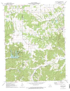
New Melle Topo Map Missouri
To zoom in, hover over the map of New Melle
USGS Topo Quad 38090f8 - 1:24,000 scale
| Topo Map Name: | New Melle |
| USGS Topo Quad ID: | 38090f8 |
| Print Size: | ca. 21 1/4" wide x 27" high |
| Southeast Coordinates: | 38.625° N latitude / 90.875° W longitude |
| Map Center Coordinates: | 38.6875° N latitude / 90.9375° W longitude |
| U.S. State: | MO |
| Filename: | o38090f8.jpg |
| Download Map JPG Image: | New Melle topo map 1:24,000 scale |
| Map Type: | Topographic |
| Topo Series: | 7.5´ |
| Map Scale: | 1:24,000 |
| Source of Map Images: | United States Geological Survey (USGS) |
| Alternate Map Versions: |
New Melle MO 1972, updated 1973 Download PDF Buy paper map New Melle MO 1972, updated 1973 Download PDF Buy paper map New Melle MO 2012 Download PDF Buy paper map New Melle MO 2015 Download PDF Buy paper map |
1:24,000 Topo Quads surrounding New Melle
> Back to 38090e1 at 1:100,000 scale
> Back to 38090a1 at 1:250,000 scale
> Back to U.S. Topo Maps home
New Melle topo map: Gazetteer
New Melle: Dams
Arp Choille Company Section 23 Dam elevation 192m 629′Borgelt Lake Dam elevation 208m 682′
Felix Struckoff Dam elevation 171m 561′
Kutryb Lake Dam elevation 249m 816′
Lake Belle-Ann Dam elevation 201m 659′
Lake Eleanor Dam elevation 228m 748′
Lake Robin Hood Dam elevation 220m 721′
Lake Sherwood Dam elevation 190m 623′
Langosch Lake Dam elevation 204m 669′
Lost Lake Dam elevation 204m 669′
Marian Lake Dam elevation 206m 675′
Parkers Dam elevation 192m 629′
Stergen Lake Dam elevation 225m 738′
Sugar Hollow Lake Dam elevation 208m 682′
Timber Lake Dam elevation 243m 797′
Wolk Lake Dam elevation 219m 718′
New Melle: Populated Places
Cappeln elevation 251m 823′Femme Osage elevation 200m 656′
New Melle elevation 235m 770′
New Melle: Reservoirs
Cady Lake elevation 192m 629′Felix Struckhoff Lake elevation 171m 561′
Flemming Lake elevation 243m 797′
Greenfelder Lake elevation 204m 669′
Lake Alan elevation 221m 725′
Lake Belle-Ann elevation 201m 659′
Lake Eleanor elevation 228m 748′
Lake Marian elevation 206m 675′
Lake Robin Hood elevation 220m 721′
Lake Sherwood elevation 190m 623′
Langosch Lake elevation 204m 669′
Parker Lake elevation 192m 629′
Sugar Hollow Lake elevation 208m 682′
New Melle: Streams
Becker Branch elevation 173m 567′New Melle digital topo map on disk
Buy this New Melle topo map showing relief, roads, GPS coordinates and other geographical features, as a high-resolution digital map file on DVD:


