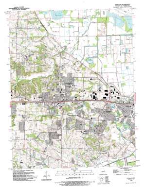
O'Fallon Topo Map Missouri
To zoom in, hover over the map of O'Fallon
USGS Topo Quad 38090g6 - 1:24,000 scale
| Topo Map Name: | O'Fallon |
| USGS Topo Quad ID: | 38090g6 |
| Print Size: | ca. 21 1/4" wide x 27" high |
| Southeast Coordinates: | 38.75° N latitude / 90.625° W longitude |
| Map Center Coordinates: | 38.8125° N latitude / 90.6875° W longitude |
| U.S. State: | MO |
| Filename: | o38090g6.jpg |
| Download Map JPG Image: | O'Fallon topo map 1:24,000 scale |
| Map Type: | Topographic |
| Topo Series: | 7.5´ |
| Map Scale: | 1:24,000 |
| Source of Map Images: | United States Geological Survey (USGS) |
| Alternate Map Versions: |
O'Fallon MO 1954, updated 1959 Download PDF Buy paper map O'Fallon MO 1954, updated 1969 Download PDF Buy paper map O'Fallon MO 1954, updated 1975 Download PDF Buy paper map O'Fallon MO 1954, updated 1975 Download PDF Buy paper map O'Fallon MO 1994, updated 1995 Download PDF Buy paper map O'Fallon MO 2002, updated 2003 Download PDF Buy paper map O'Fallon MO 2012 Download PDF Buy paper map O'Fallon MO 2015 Download PDF Buy paper map |
1:24,000 Topo Quads surrounding O'Fallon
> Back to 38090e1 at 1:100,000 scale
> Back to 38090a1 at 1:250,000 scale
> Back to U.S. Topo Maps home
O'Fallon topo map: Gazetteer
O'Fallon: Airports
Waldmeister Farm Airport elevation 131m 429′O'Fallon: Crossings
Interchange 216 elevation 179m 587′Interchange 217 elevation 165m 541′
Interchange 220 elevation 141m 462′
O'Fallon: Dams
Browns Lake Dam elevation 166m 544′Oakridge Estates Lake Dam elevation 158m 518′
Podhorns Dam elevation 148m 485′
Robert Schulte Dam elevation 151m 495′
Schidinger-Hannigan-Hoffman Lake Dam elevation 161m 528′
Schulte Lake Section 18 Dam elevation 148m 485′
O'Fallon: Lakes
Grassy Lake elevation 132m 433′Pallardy Lake elevation 131m 429′
O'Fallon: Parks
Fort Zumwalt State Park elevation 183m 600′Paul A Westhoff Park elevation 147m 482′
O'Fallon: Populated Places
All Saints Village elevation 158m 518′Dardenne Prairie elevation 187m 613′
O'Fallon elevation 165m 541′
Saint Paul elevation 157m 515′
Saint Peters elevation 135m 442′
O'Fallon: Reservoirs
Oakridge Estates Lake elevation 158m 518′Podhorns Lake elevation 148m 485′
Schulte Lake elevation 151m 495′
O'Fallon: Streams
Crooked Creek elevation 136m 446′O'Fallon: Swamps
Dardenne Lake elevation 130m 426′O'Fallon digital topo map on disk
Buy this O'Fallon topo map showing relief, roads, GPS coordinates and other geographical features, as a high-resolution digital map file on DVD:


