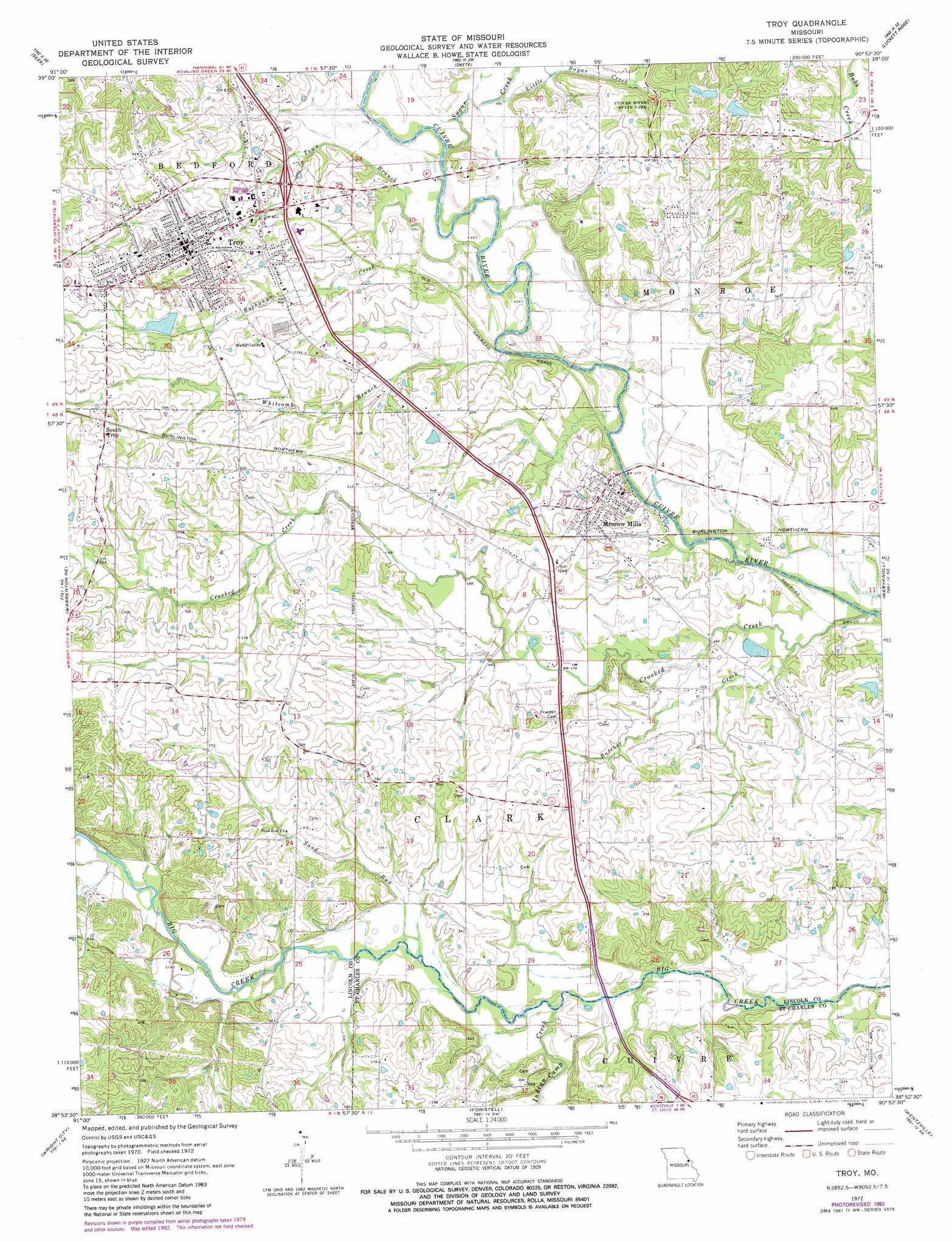
Troy Topo Map Missouri
To zoom in, hover over the map of Troy
USGS Topo Quad 38090h8 - 1:24,000 scale
| Topo Map Name: | Troy |
| USGS Topo Quad ID: | 38090h8 |
| Print Size: | ca. 21 1/4" wide x 27" high |
| Southeast Coordinates: | 38.875° N latitude / 90.875° W longitude |
| Map Center Coordinates: | 38.9375° N latitude / 90.9375° W longitude |
| U.S. State: | MO |
| Filename: | o38090h8.jpg |
| Download Map JPG Image: | Troy topo map 1:24,000 scale |
| Map Type: | Topographic |
| Topo Series: | 7.5´ |
| Map Scale: | 1:24,000 |
| Source of Map Images: | United States Geological Survey (USGS) |
| Alternate Map Versions: |
Troy MO 1972, updated 1973 Download PDF Buy paper map Troy MO 1972, updated 1982 Download PDF Buy paper map Troy MO 1979, updated 1980 Download PDF Buy paper map Troy MO 2012 Download PDF Buy paper map Troy MO 2015 Download PDF Buy paper map |
1:24,000 Topo Quads surrounding Troy
Louisville |
Eolia |
Auburn |
Elsberry |
Hamburg |
Truxton |
Silex |
Okete |
Luckett Ridge |
Foley |
Hawk Point |
Warrenton Ne |
Troy |
Maryknoll |
Winfield |
Warrenton |
Wright City |
Foristell |
Wentzville |
O'Fallon |
Treloar |
Marthasville |
New Melle |
Defiance |
Weldon Spring |
> Back to 38090e1 at 1:100,000 scale
> Back to 38090a1 at 1:250,000 scale
> Back to U.S. Topo Maps home
Troy topo map: Gazetteer
Troy: Areas
East-West Gateway Planning Region elevation 152m 498′Troy: Dams
Gooch Lake Dam elevation 158m 518′Marie Cook Dam elevation 161m 528′
Moore Lake Dam elevation 183m 600′
Spring Branch Farm Lake Dam elevation 169m 554′
Trojan Lake Dam elevation 169m 554′
Troy: Populated Places
Moscow Mills elevation 164m 538′South Troy elevation 190m 623′
Troy elevation 165m 541′
Troy: Reservoirs
Gooch Lake elevation 158m 518′Marie Cook Lake elevation 161m 528′
Moore Lake elevation 183m 600′
Spring Branch Farm Lake elevation 169m 554′
Trojan Lake elevation 169m 554′
Troy: Streams
Buchanan Creek elevation 139m 456′Butcher Creek elevation 135m 442′
Crooked Creek elevation 135m 442′
Indian Camp Creek elevation 139m 456′
Little Sugar Creek elevation 140m 459′
Sand Run elevation 141m 462′
Sugar Creek elevation 140m 459′
Town Branch elevation 140m 459′
Whitcomb Branch elevation 134m 439′
Troy digital topo map on disk
Buy this Troy topo map showing relief, roads, GPS coordinates and other geographical features, as a high-resolution digital map file on DVD: