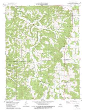
Vichy Topo Map Missouri
To zoom in, hover over the map of Vichy
USGS Topo Quad 38091a7 - 1:24,000 scale
| Topo Map Name: | Vichy |
| USGS Topo Quad ID: | 38091a7 |
| Print Size: | ca. 21 1/4" wide x 27" high |
| Southeast Coordinates: | 38° N latitude / 91.75° W longitude |
| Map Center Coordinates: | 38.0625° N latitude / 91.8125° W longitude |
| U.S. State: | MO |
| Filename: | o38091a7.jpg |
| Download Map JPG Image: | Vichy topo map 1:24,000 scale |
| Map Type: | Topographic |
| Topo Series: | 7.5´ |
| Map Scale: | 1:24,000 |
| Source of Map Images: | United States Geological Survey (USGS) |
| Alternate Map Versions: |
Vichy MO 1980, updated 1981 Download PDF Buy paper map Vichy MO 2012 Download PDF Buy paper map Vichy MO 2015 Download PDF Buy paper map |
1:24,000 Topo Quads surrounding Vichy
> Back to 38091a1 at 1:100,000 scale
> Back to 38090a1 at 1:250,000 scale
> Back to U.S. Topo Maps home
Vichy topo map: Gazetteer
Vichy: Dams
Whalen Dam elevation 320m 1049′Vichy: Populated Places
Davis Ford elevation 228m 748′Signal (historical) elevation 275m 902′
Vichy elevation 338m 1108′
Vichy: Reservoirs
Ed Whalen Lake elevation 320m 1049′Vichy: Ridges
Pea Ridge elevation 266m 872′Weaver Ridge elevation 253m 830′
Vichy: Streams
Little Spring Creek elevation 197m 646′Mill Creek elevation 213m 698′
Miller Branch elevation 233m 764′
Morresy Branch elevation 225m 738′
Rocky Branch elevation 227m 744′
Wildcat Branch elevation 244m 800′
Vichy: Summits
Pilot Knob elevation 286m 938′Vichy digital topo map on disk
Buy this Vichy topo map showing relief, roads, GPS coordinates and other geographical features, as a high-resolution digital map file on DVD:


