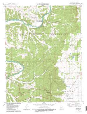
Paydown Topo Map Missouri
To zoom in, hover over the map of Paydown
USGS Topo Quad 38091b7 - 1:24,000 scale
| Topo Map Name: | Paydown |
| USGS Topo Quad ID: | 38091b7 |
| Print Size: | ca. 21 1/4" wide x 27" high |
| Southeast Coordinates: | 38.125° N latitude / 91.75° W longitude |
| Map Center Coordinates: | 38.1875° N latitude / 91.8125° W longitude |
| U.S. State: | MO |
| Filename: | o38091b7.jpg |
| Download Map JPG Image: | Paydown topo map 1:24,000 scale |
| Map Type: | Topographic |
| Topo Series: | 7.5´ |
| Map Scale: | 1:24,000 |
| Source of Map Images: | United States Geological Survey (USGS) |
| Alternate Map Versions: |
Paydown MO 1981, updated 1981 Download PDF Buy paper map Paydown MO 1981, updated 1981 Download PDF Buy paper map Paydown MO 2012 Download PDF Buy paper map Paydown MO 2015 Download PDF Buy paper map |
1:24,000 Topo Quads surrounding Paydown
> Back to 38091a1 at 1:100,000 scale
> Back to 38090a1 at 1:250,000 scale
> Back to U.S. Topo Maps home
Paydown topo map: Gazetteer
Paydown: Airports
Rolla National Airport elevation 343m 1125′Paydown: Mines
Terrill Clay Pit elevation 311m 1020′Paydown: Parks
Spring Creek Gap Roadside Park elevation 313m 1026′Paydown: Populated Places
Bend elevation 267m 875′Henderson Ford (historical) elevation 189m 620′
Lindell elevation 311m 1020′
Lois elevation 337m 1105′
Paydown elevation 185m 606′
Paydown Ford (historical) elevation 186m 610′
Paydown: Slopes
Tie Slide elevation 213m 698′Paydown: Springs
Given Spring elevation 205m 672′Paydown Springs elevation 191m 626′
Paydown: Streams
Boardman Creek elevation 184m 603′Cedar Creek elevation 189m 620′
Divins Creek elevation 181m 593′
Long Creek elevation 180m 590′
Mill Spring Creek elevation 187m 613′
Wolf Creek elevation 190m 623′
Paydown: Summits
Indian House Mounds elevation 328m 1076′Paydown: Valleys
Hallaway Hollow elevation 179m 587′Paradise Valley elevation 189m 620′
Paydown digital topo map on disk
Buy this Paydown topo map showing relief, roads, GPS coordinates and other geographical features, as a high-resolution digital map file on DVD:


