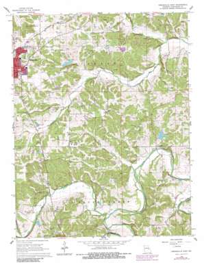
Owensville East Topo Map Missouri
To zoom in, hover over the map of Owensville East
USGS Topo Quad 38091c4 - 1:24,000 scale
| Topo Map Name: | Owensville East |
| USGS Topo Quad ID: | 38091c4 |
| Print Size: | ca. 21 1/4" wide x 27" high |
| Southeast Coordinates: | 38.25° N latitude / 91.375° W longitude |
| Map Center Coordinates: | 38.3125° N latitude / 91.4375° W longitude |
| U.S. State: | MO |
| Filename: | o38091c4.jpg |
| Download Map JPG Image: | Owensville East topo map 1:24,000 scale |
| Map Type: | Topographic |
| Topo Series: | 7.5´ |
| Map Scale: | 1:24,000 |
| Source of Map Images: | United States Geological Survey (USGS) |
| Alternate Map Versions: |
Owensville East MO 1966, updated 1967 Download PDF Buy paper map Owensville East MO 1966, updated 1980 Download PDF Buy paper map Owensville East MO 2012 Download PDF Buy paper map Owensville East MO 2015 Download PDF Buy paper map |
1:24,000 Topo Quads surrounding Owensville East
> Back to 38091a1 at 1:100,000 scale
> Back to 38090a1 at 1:250,000 scale
> Back to U.S. Topo Maps home
Owensville East topo map: Gazetteer
Owensville East: Dams
Bains Lake Dam elevation 257m 843′Bay Lake Dam elevation 259m 849′
Hensley Lake Dam elevation 273m 895′
Kehr Lake Dam elevation 245m 803′
Landwehr Lake Dam elevation 259m 849′
Mistler Lake Dam elevation 252m 826′
Mueller Lake Dam elevation 235m 770′
Raack Lake Dam elevation 229m 751′
Tayloe Lake Dam East elevation 236m 774′
Tayloe Lake Dam West elevation 236m 774′
Tea Lake Dam Number 2 elevation 235m 770′
Tea Lakes Dam Number 1 elevation 225m 738′
Wagner Lake Dam elevation 236m 774′
Owensville East: Parks
Lions Park elevation 286m 938′Owensville East: Populated Places
Bem elevation 253m 830′Tea elevation 228m 748′
Owensville East: Reservoirs
Arno Kreter Lake elevation 259m 849′Homer Hensley Lake elevation 273m 895′
Number 72 Reservoir elevation 229m 751′
Number 74 Lake elevation 259m 849′
Tea Lake elevation 225m 738′
Tea Lakes elevation 218m 715′
Owensville East: Streams
Block Branch elevation 212m 695′Dan Branch elevation 211m 692′
Dry Fork elevation 216m 708′
Nicks Branch elevation 226m 741′
Soap Creek elevation 214m 702′
Owensville East digital topo map on disk
Buy this Owensville East topo map showing relief, roads, GPS coordinates and other geographical features, as a high-resolution digital map file on DVD:


