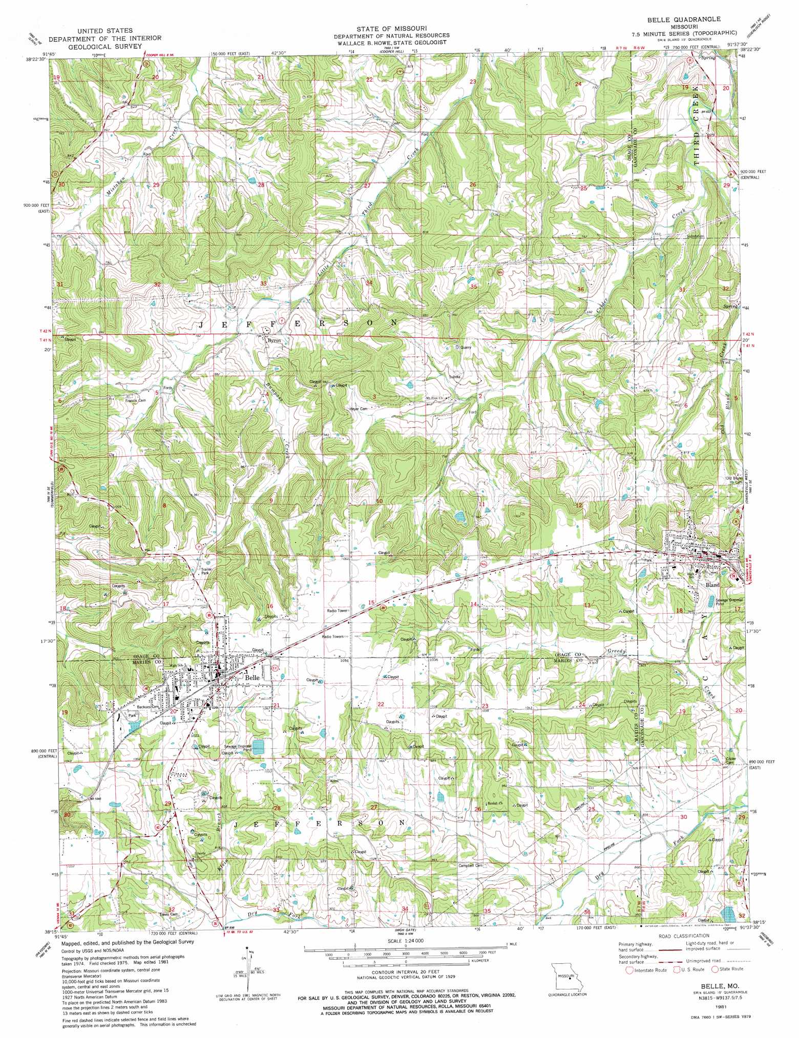
Belle Topo Map Missouri
To zoom in, hover over the map of Belle
USGS Topo Quad 38091c6 - 1:24,000 scale
| Topo Map Name: | Belle |
| USGS Topo Quad ID: | 38091c6 |
| Print Size: | ca. 21 1/4" wide x 27" high |
| Southeast Coordinates: | 38.25° N latitude / 91.625° W longitude |
| Map Center Coordinates: | 38.3125° N latitude / 91.6875° W longitude |
| U.S. State: | MO |
| Filename: | o38091c6.jpg |
| Download Map JPG Image: | Belle topo map 1:24,000 scale |
| Map Type: | Topographic |
| Topo Series: | 7.5´ |
| Map Scale: | 1:24,000 |
| Source of Map Images: | United States Geological Survey (USGS) |
| Alternate Map Versions: |
Belle MO 1981, updated 1981 Download PDF Buy paper map Belle MO 2012 Download PDF Buy paper map Belle MO 2015 Download PDF Buy paper map |
1:24,000 Topo Quads surrounding Belle
Loose Creek |
Luystown |
Fredericksburg |
Pershing |
Swiss |
Westphalia East |
Linn |
Cooper Hill |
Coerlisch Ridge |
Rosebud |
Freeburg |
Summerfield |
Belle |
Owensville West |
Owensville East |
Vienna |
Paydown |
High Gate |
Redbird |
Oak Hill |
Nagogami Lodge |
Vichy |
Safe |
Rosati |
Cuba |
> Back to 38091a1 at 1:100,000 scale
> Back to 38090a1 at 1:250,000 scale
> Back to U.S. Topo Maps home
Belle topo map: Gazetteer
Belle: Dams
Hedenkamp Lake Dam elevation 279m 915′Belle: Populated Places
Belle elevation 313m 1026′Bland elevation 309m 1013′
Byron elevation 243m 797′
Dingley (historical) elevation 316m 1036′
Belle: Streams
Bumpass Creek elevation 221m 725′Clear Fork elevation 190m 623′
Klein Branch elevation 269m 882′
Belle: Valleys
Skillet Hollow elevation 212m 695′Belle digital topo map on disk
Buy this Belle topo map showing relief, roads, GPS coordinates and other geographical features, as a high-resolution digital map file on DVD: