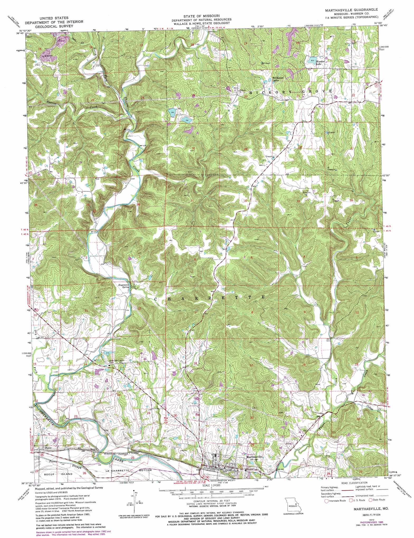
Marthasville Topo Map Missouri
To zoom in, hover over the map of Marthasville
USGS Topo Quad 38091f1 - 1:24,000 scale
| Topo Map Name: | Marthasville |
| USGS Topo Quad ID: | 38091f1 |
| Print Size: | ca. 21 1/4" wide x 27" high |
| Southeast Coordinates: | 38.625° N latitude / 91° W longitude |
| Map Center Coordinates: | 38.6875° N latitude / 91.0625° W longitude |
| U.S. State: | MO |
| Filename: | o38091f1.jpg |
| Download Map JPG Image: | Marthasville topo map 1:24,000 scale |
| Map Type: | Topographic |
| Topo Series: | 7.5´ |
| Map Scale: | 1:24,000 |
| Source of Map Images: | United States Geological Survey (USGS) |
| Alternate Map Versions: |
Marthasville MO 1972, updated 1975 Download PDF Buy paper map Marthasville MO 1972, updated 1986 Download PDF Buy paper map Marthasville MO 2012 Download PDF Buy paper map Marthasville MO 2015 Download PDF Buy paper map |
1:24,000 Topo Quads surrounding Marthasville
Bellflower South |
Hawk Point |
Warrenton Ne |
Troy |
Maryknoll |
Jonesburg |
Warrenton |
Wright City |
Foristell |
Wentzville |
Berger |
Treloar |
Marthasville |
New Melle |
Defiance |
Dissen |
New Haven |
Washington West |
Washington East |
Labadie |
Gerald |
Leslie |
Union |
Moselle |
Gray Summit |
> Back to 38091e1 at 1:100,000 scale
> Back to 38090a1 at 1:250,000 scale
> Back to U.S. Topo Maps home
Marthasville topo map: Gazetteer
Marthasville: Bends
La Charrette Bottom elevation 147m 482′Marthasville: Dams
D Bunge Lake Dam elevation 160m 524′Forest Haven Lake Dam elevation 241m 790′
H Bunge Lake Dam elevation 177m 580′
Koepke Lake North Dam elevation 257m 843′
Koepke Lake South Dam elevation 241m 790′
Lake of the Woods Dam elevation 229m 751′
Vatterot Dam elevation 245m 803′
Marthasville: Lakes
Wildwood Lakes elevation 253m 830′Marthasville: Parks
American Legion Park elevation 184m 603′Marthasville: Populated Places
Charrette (historical) elevation 175m 574′Marthasville elevation 171m 561′
Peers elevation 151m 495′
Marthasville: Reservoirs
Wonder Lake elevation 245m 803′Marthasville: Ridges
Tuque Ridge elevation 258m 846′Marthasville: Springs
Engemann Spring elevation 158m 518′Marthasville: Streams
Cave Creek elevation 170m 557′College Creek elevation 156m 511′
Dry Fork elevation 147m 482′
Hearse Creek elevation 164m 538′
North Fork Charrette Creek elevation 164m 538′
Owl Creek elevation 181m 593′
Wolf Creek elevation 149m 488′
Marthasville: Valleys
Grand Canyon elevation 146m 479′Marthasville digital topo map on disk
Buy this Marthasville topo map showing relief, roads, GPS coordinates and other geographical features, as a high-resolution digital map file on DVD: