Morrison Topo Map Missouri
To zoom in, hover over the map of Morrison
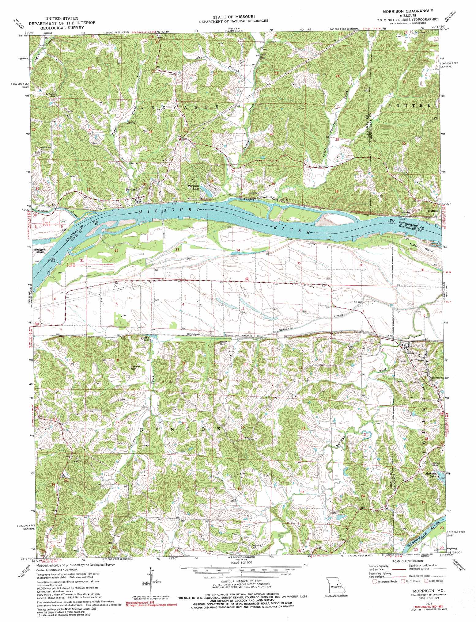
USGS Topo Quad 38091f6 - 1:24,000 scale
| Topo Map Name: | Morrison |
| USGS Topo Quad ID: | 38091f6 |
| Print Size: | ca. 21 1/4" wide x 27" high |
| Southeast Coordinates: | 38.625° N latitude / 91.625° W longitude |
| Map Center Coordinates: | 38.6875° N latitude / 91.6875° W longitude |
| U.S. State: | MO |
| Filename: | o38091f6.jpg |
| Download Map JPG Image: | Morrison topo map 1:24,000 scale |
| Map Type: | Topographic |
| Topo Series: | 7.5´ |
| Map Scale: | 1:24,000 |
| Source of Map Images: | United States Geological Survey (USGS) |
| Alternate Map Versions: |
Morrison MO 1974, updated 1976 Download PDF Buy paper map Morrison MO 1974, updated 1991 Download PDF Buy paper map Morrison MO 2012 Download PDF Buy paper map Morrison MO 2015 Download PDF Buy paper map |
1:24,000 Topo Quads surrounding Morrison
Kingdom City |
Calwood |
Williamsburg |
Montgomery City |
New Florence |
Fulton |
Reform |
Readsville |
Americus |
Pinnacle Lake |
Mokane West |
Mokane East |
Morrison |
Gasconade |
Hermann |
Loose Creek |
Luystown |
Fredericksburg |
Pershing |
Swiss |
Westphalia East |
Linn |
Cooper Hill |
Coerlisch Ridge |
Rosebud |
> Back to 38091e1 at 1:100,000 scale
> Back to 38090a1 at 1:250,000 scale
> Back to U.S. Topo Maps home
Morrison topo map: Gazetteer
Morrison: Dams
Paradise Lake Dam elevation 160m 524′Walkenbach Lake North Dam elevation 156m 511′
Morrison: Islands
Miller Island elevation 157m 515′Morrison: Populated Places
Heilburn (historical) elevation 167m 547′Morrison elevation 160m 524′
Portland elevation 170m 557′
Morrison: Reservoirs
Paradise Lake elevation 160m 524′Morrison: Streams
Eagle Creek elevation 159m 521′Little Tavern Creek elevation 154m 505′
Logan Creek elevation 155m 508′
Meyers Branch elevation 162m 531′
Mollie Dozier Chute elevation 157m 515′
Shawnee Creek elevation 153m 501′
Shobes Branch elevation 192m 629′
Synthianna Creek elevation 156m 511′
Tavern Creek elevation 158m 518′
Morrison digital topo map on disk
Buy this Morrison topo map showing relief, roads, GPS coordinates and other geographical features, as a high-resolution digital map file on DVD: