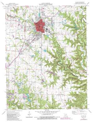
Fulton Topo Map Missouri
To zoom in, hover over the map of Fulton
USGS Topo Quad 38091g8 - 1:24,000 scale
| Topo Map Name: | Fulton |
| USGS Topo Quad ID: | 38091g8 |
| Print Size: | ca. 21 1/4" wide x 27" high |
| Southeast Coordinates: | 38.75° N latitude / 91.875° W longitude |
| Map Center Coordinates: | 38.8125° N latitude / 91.9375° W longitude |
| U.S. State: | MO |
| Filename: | o38091g8.jpg |
| Download Map JPG Image: | Fulton topo map 1:24,000 scale |
| Map Type: | Topographic |
| Topo Series: | 7.5´ |
| Map Scale: | 1:24,000 |
| Source of Map Images: | United States Geological Survey (USGS) |
| Alternate Map Versions: |
Fulton MO 1975, updated 1977 Download PDF Buy paper map Fulton MO 1975, updated 1986 Download PDF Buy paper map Fulton MO 2000, updated 2003 Download PDF Buy paper map Fulton MO 2012 Download PDF Buy paper map Fulton MO 2015 Download PDF Buy paper map |
| FStopo: | US Forest Service topo Fulton is available: Download FStopo PDF Download FStopo TIF |
1:24,000 Topo Quads surrounding Fulton
> Back to 38091e1 at 1:100,000 scale
> Back to 38090a1 at 1:250,000 scale
> Back to U.S. Topo Maps home
Fulton topo map: Gazetteer
Fulton: Areas
Hams Prairie elevation 258m 846′Mays Prairie elevation 263m 862′
Fulton: Dams
Glover Spring Lake Dam elevation 190m 623′Harbison-Walker Refractory Lake Dam elevation 222m 728′
Hauck Lake Dam elevation 253m 830′
Herring Lake Dam elevation 215m 705′
Junior Lake Dam elevation 245m 803′
Lac Piete Dam elevation 245m 803′
Richardson Lake Dam elevation 236m 774′
Fulton: Parks
Memorial Park elevation 223m 731′Fulton: Populated Places
Fulton elevation 233m 764′Hams Prairie elevation 257m 843′
Pitcher elevation 239m 784′
Fulton: Reservoirs
Glover Lake elevation 190m 623′Glover Spring Lake elevation 191m 626′
Hauck Lake elevation 253m 830′
Lac Piete elevation 245m 803′
Paul Herring Lake elevation 215m 705′
Fulton: Ridges
Devils Backbone elevation 245m 803′Fulton: Streams
Dunlap Creek elevation 214m 702′Lake Branch elevation 214m 702′
Rockhouse Creek elevation 200m 656′
Smith Branch elevation 213m 698′
Youngs Creek elevation 188m 616′
Fulton: Valleys
Big Hollow elevation 202m 662′Dark Hollow elevation 191m 626′
Maddox Hollow elevation 173m 567′
Pace Hollow elevation 171m 561′
Spring Hollow elevation 214m 702′
Fulton digital topo map on disk
Buy this Fulton topo map showing relief, roads, GPS coordinates and other geographical features, as a high-resolution digital map file on DVD:


