New Florence Topo Map Missouri
To zoom in, hover over the map of New Florence
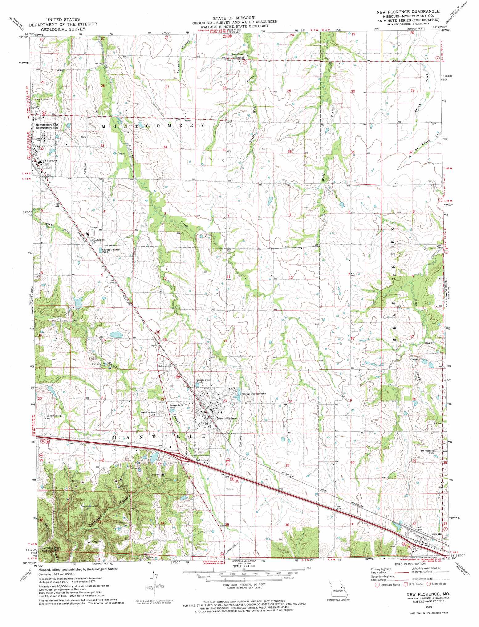
USGS Topo Quad 38091h4 - 1:24,000 scale
| Topo Map Name: | New Florence |
| USGS Topo Quad ID: | 38091h4 |
| Print Size: | ca. 21 1/4" wide x 27" high |
| Southeast Coordinates: | 38.875° N latitude / 91.375° W longitude |
| Map Center Coordinates: | 38.9375° N latitude / 91.4375° W longitude |
| U.S. State: | MO |
| Filename: | o38091h4.jpg |
| Download Map JPG Image: | New Florence topo map 1:24,000 scale |
| Map Type: | Topographic |
| Topo Series: | 7.5´ |
| Map Scale: | 1:24,000 |
| Source of Map Images: | United States Geological Survey (USGS) |
| Alternate Map Versions: |
New Florence MO 1973, updated 1975 Download PDF Buy paper map New Florence MO 2012 Download PDF Buy paper map New Florence MO 2015 Download PDF Buy paper map |
1:24,000 Topo Quads surrounding New Florence
Laddonia |
Vandalia Lake |
Middletown |
New Hartford |
Louisville |
Martinsburg |
Wellsville |
Buell |
Bellflower North |
Truxton |
Williamsburg |
Montgomery City |
New Florence |
Bellflower South |
Hawk Point |
Readsville |
Americus |
Pinnacle Lake |
Jonesburg |
Warrenton |
Morrison |
Gasconade |
Hermann |
Berger |
Treloar |
> Back to 38091e1 at 1:100,000 scale
> Back to 38090a1 at 1:250,000 scale
> Back to U.S. Topo Maps home
New Florence topo map: Gazetteer
New Florence: Dams
Bethel Lake Dam elevation 258m 846′Carl Dreyer Lake Dam elevation 239m 784′
Cates Dam elevation 252m 826′
Easterday East Dam elevation 241m 790′
Frumar Lake Dam elevation 254m 833′
Johnson Lake Dam elevation 249m 816′
Roy-L Incorporated Dam elevation 243m 797′
New Florence: Populated Places
High Hill elevation 272m 892′New Florence elevation 266m 872′
New Florence: Reservoirs
Carl Dreyer Lake elevation 239m 784′Cates Lake elevation 252m 826′
Frumar Lake elevation 254m 833′
Number 219 Reservoir elevation 241m 790′
New Florence digital topo map on disk
Buy this New Florence topo map showing relief, roads, GPS coordinates and other geographical features, as a high-resolution digital map file on DVD: