Van Cleve Topo Map Missouri
To zoom in, hover over the map of Van Cleve
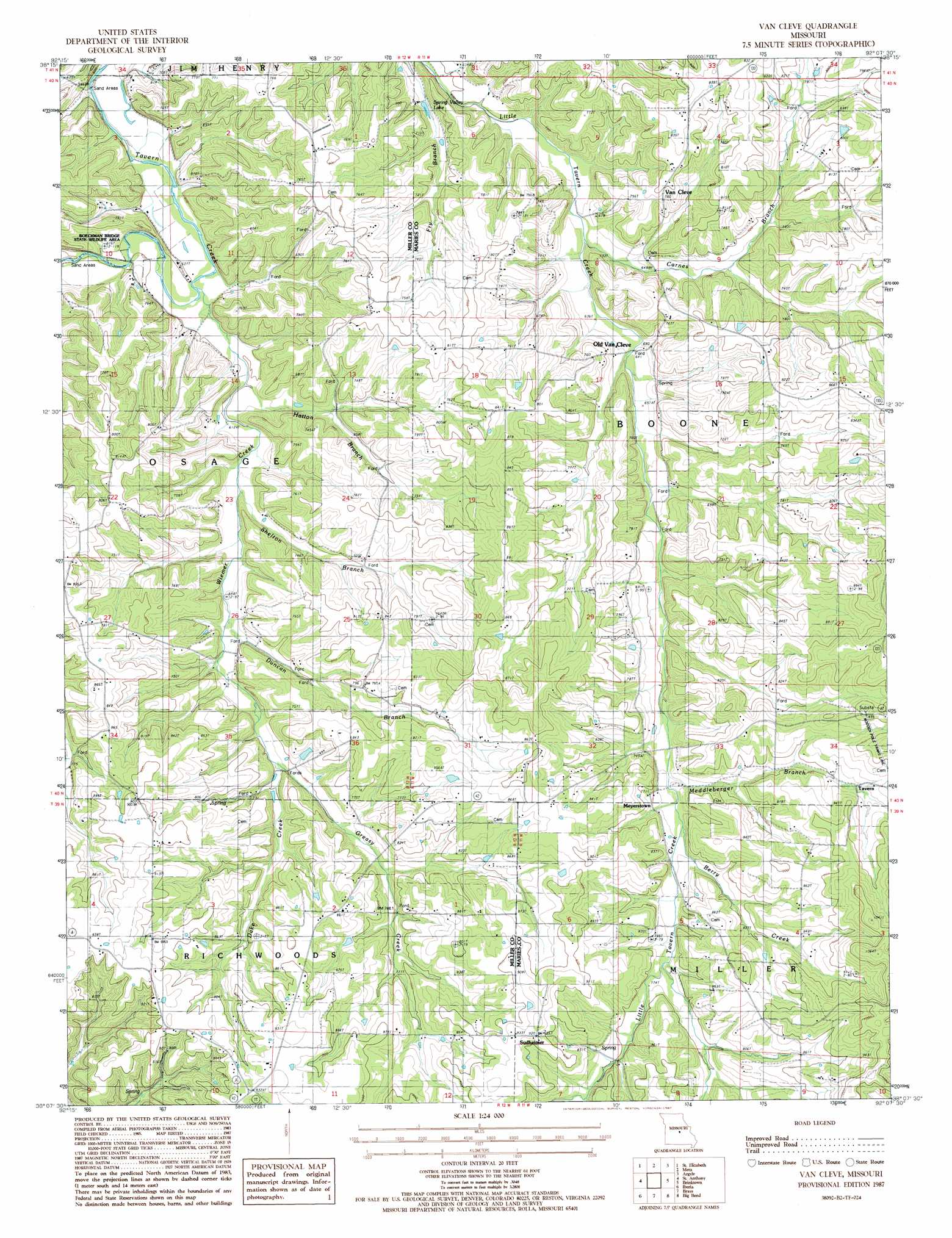
USGS Topo Quad 38092b2 - 1:24,000 scale
| Topo Map Name: | Van Cleve |
| USGS Topo Quad ID: | 38092b2 |
| Print Size: | ca. 21 1/4" wide x 27" high |
| Southeast Coordinates: | 38.125° N latitude / 92.125° W longitude |
| Map Center Coordinates: | 38.1875° N latitude / 92.1875° W longitude |
| U.S. State: | MO |
| Filename: | o38092b2.jpg |
| Download Map JPG Image: | Van Cleve topo map 1:24,000 scale |
| Map Type: | Topographic |
| Topo Series: | 7.5´ |
| Map Scale: | 1:24,000 |
| Source of Map Images: | United States Geological Survey (USGS) |
| Alternate Map Versions: |
Van Cleve MO 1987, updated 1987 Download PDF Buy paper map Van Cleve MO 2011 Download PDF Buy paper map Van Cleve MO 2015 Download PDF Buy paper map |
1:24,000 Topo Quads surrounding Van Cleve
Enon |
Brazito |
Wardsville |
Westphalia West |
Westphalia East |
Eugene |
Saint Elizabeth |
Meta |
Argyle |
Freeburg |
Tuscumbia |
Saint Anthony |
Van Cleve |
Brinktown |
Vienna |
Brumley |
Iberia |
Brays |
Big Bend |
Nagogami Lodge |
Conns Creek |
Crocker |
Hancock |
Dixon |
Newburg |
> Back to 38092a1 at 1:100,000 scale
> Back to 38092a1 at 1:250,000 scale
> Back to U.S. Topo Maps home
Van Cleve topo map: Gazetteer
Van Cleve: Parks
Boeckman Bridge State Wildlife Area elevation 180m 590′Van Cleve: Populated Places
Meyerstown elevation 235m 770′Sudheimer elevation 281m 921′
Tavern elevation 250m 820′
Van Cleve elevation 246m 807′
Van Cleve: Reservoirs
Spring Valley Lake elevation 190m 623′Van Cleve: Streams
Berry Creek elevation 224m 734′Carnes Branch elevation 188m 616′
Dake Creek elevation 209m 685′
Duncan Branch elevation 195m 639′
Greasy Creek elevation 207m 679′
Hatton Branch elevation 182m 597′
Meddleberger Branch elevation 218m 715′
Shelton Branch elevation 187m 613′
Wiemer Creek elevation 177m 580′
Van Cleve digital topo map on disk
Buy this Van Cleve topo map showing relief, roads, GPS coordinates and other geographical features, as a high-resolution digital map file on DVD: