Tuscumbia Topo Map Missouri
To zoom in, hover over the map of Tuscumbia
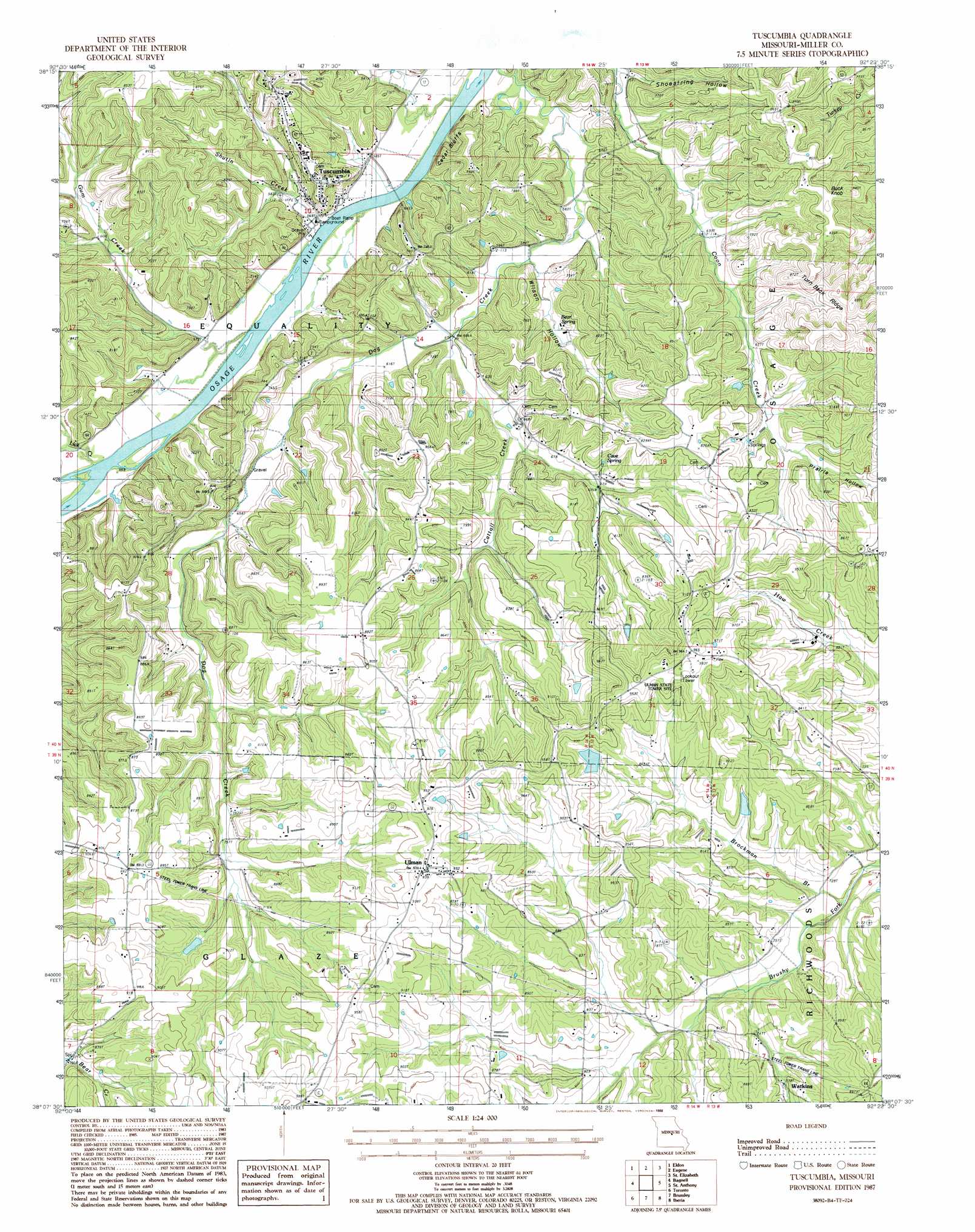
USGS Topo Quad 38092b4 - 1:24,000 scale
| Topo Map Name: | Tuscumbia |
| USGS Topo Quad ID: | 38092b4 |
| Print Size: | ca. 21 1/4" wide x 27" high |
| Southeast Coordinates: | 38.125° N latitude / 92.375° W longitude |
| Map Center Coordinates: | 38.1875° N latitude / 92.4375° W longitude |
| U.S. State: | MO |
| Filename: | o38092b4.jpg |
| Download Map JPG Image: | Tuscumbia topo map 1:24,000 scale |
| Map Type: | Topographic |
| Topo Series: | 7.5´ |
| Map Scale: | 1:24,000 |
| Source of Map Images: | United States Geological Survey (USGS) |
| Alternate Map Versions: |
Tuscumbia MO 1987, updated 1988 Download PDF Buy paper map Tuscumbia MO 2011 Download PDF Buy paper map Tuscumbia MO 2015 Download PDF Buy paper map |
1:24,000 Topo Quads surrounding Tuscumbia
Barnett |
Olean |
Enon |
Brazito |
Wardsville |
Rocky Mount |
Eldon |
Eugene |
Saint Elizabeth |
Meta |
Lake Ozark |
Bagnell |
Tuscumbia |
Saint Anthony |
Van Cleve |
Camdenton |
Toronto |
Brumley |
Iberia |
Brays |
Decaturville |
Montreal |
Conns Creek |
Crocker |
Hancock |
> Back to 38092a1 at 1:100,000 scale
> Back to 38092a1 at 1:250,000 scale
> Back to U.S. Topo Maps home
Tuscumbia topo map: Gazetteer
Tuscumbia: Cliffs
Cedar Bluffs elevation 177m 580′Tuscumbia: Dams
Helton Lake Dam elevation 261m 856′Procks Dam elevation 215m 705′
Truman Helton Dam elevation 216m 708′
Tuscumbia: Populated Places
Tuscumbia elevation 176m 577′Ulman elevation 284m 931′
Tuscumbia: Reservoirs
Lake Lottawatch elevation 215m 705′Truman Helton Lake elevation 216m 708′
Tuscumbia: Ridges
Turn Back Ridge elevation 276m 905′Tuscumbia: Springs
Bear Spring elevation 190m 623′Cave Spring elevation 216m 708′
Tuscumbia: Streams
Cattail Creek elevation 182m 597′Dog Creek elevation 171m 561′
Gum Creek elevation 167m 547′
Lick Creek elevation 168m 551′
Shutin Creek elevation 167m 547′
Tuscumbia: Summits
Buck Knob elevation 268m 879′Tuscumbia: Valleys
Prairie Hollow elevation 235m 770′Shoestring Hollow elevation 179m 587′
Wilson Hollow elevation 180m 590′
Tuscumbia digital topo map on disk
Buy this Tuscumbia topo map showing relief, roads, GPS coordinates and other geographical features, as a high-resolution digital map file on DVD: