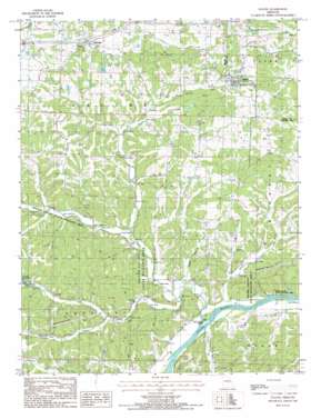
Eugene Topo Map Missouri
To zoom in, hover over the map of Eugene
USGS Topo Quad 38092c4 - 1:24,000 scale
| Topo Map Name: | Eugene |
| USGS Topo Quad ID: | 38092c4 |
| Print Size: | ca. 21 1/4" wide x 27" high |
| Southeast Coordinates: | 38.25° N latitude / 92.375° W longitude |
| Map Center Coordinates: | 38.3125° N latitude / 92.4375° W longitude |
| U.S. State: | MO |
| Filename: | o38092c4.jpg |
| Download Map JPG Image: | Eugene topo map 1:24,000 scale |
| Map Type: | Topographic |
| Topo Series: | 7.5´ |
| Map Scale: | 1:24,000 |
| Source of Map Images: | United States Geological Survey (USGS) |
| Alternate Map Versions: |
Eugene MO 1987, updated 1987 Download PDF Buy paper map Eugene MO 2011 Download PDF Buy paper map Eugene MO 2015 Download PDF Buy paper map |
1:24,000 Topo Quads surrounding Eugene
> Back to 38092a1 at 1:100,000 scale
> Back to 38092a1 at 1:250,000 scale
> Back to U.S. Topo Maps home
Eugene topo map: Gazetteer
Eugene: Dams
Bittle Dam elevation 242m 793′Butzer Lake Dam elevation 172m 564′
Munson Dam elevation 227m 744′
Eugene: Islands
Coon Creek Island elevation 171m 561′Eugene: Parks
Kings Bluff State Wildlife Area elevation 173m 567′Saline Valley State Wildlife Area elevation 179m 587′
Eugene: Populated Places
Etterville elevation 269m 882′Eugene elevation 255m 836′
Eugene: Streams
Coon Creek elevation 170m 557′Cumpton Branch elevation 185m 606′
Dry Creek elevation 180m 590′
Eagle Branch elevation 168m 551′
Jack Buster Creek elevation 174m 570′
Jim Henry Creek elevation 168m 551′
Little Saline Creek elevation 169m 554′
Saline Creek elevation 166m 544′
Eugene digital topo map on disk
Buy this Eugene topo map showing relief, roads, GPS coordinates and other geographical features, as a high-resolution digital map file on DVD:


