Enon Topo Map Missouri
To zoom in, hover over the map of Enon
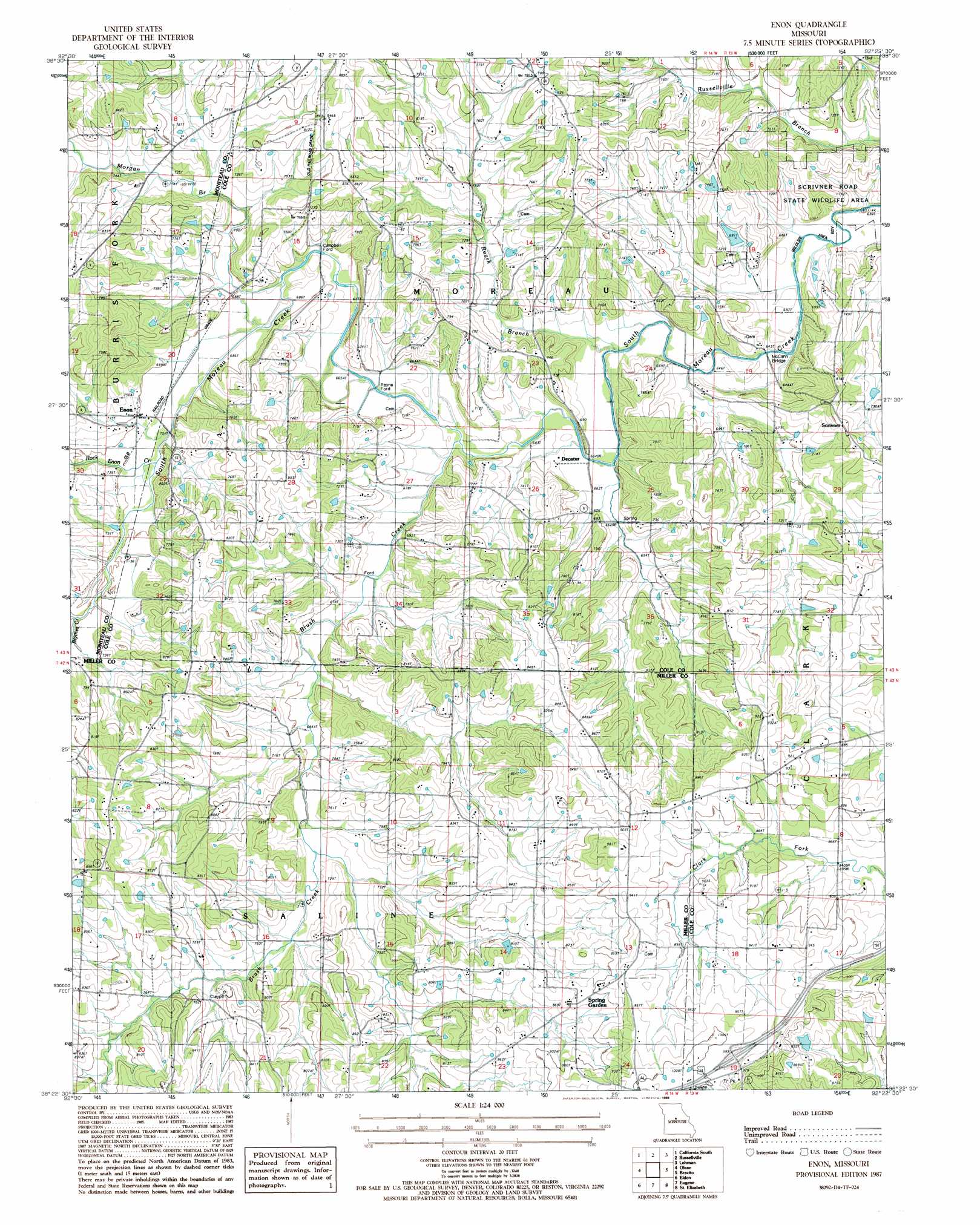
USGS Topo Quad 38092d4 - 1:24,000 scale
| Topo Map Name: | Enon |
| USGS Topo Quad ID: | 38092d4 |
| Print Size: | ca. 21 1/4" wide x 27" high |
| Southeast Coordinates: | 38.375° N latitude / 92.375° W longitude |
| Map Center Coordinates: | 38.4375° N latitude / 92.4375° W longitude |
| U.S. State: | MO |
| Filename: | o38092d4.jpg |
| Download Map JPG Image: | Enon topo map 1:24,000 scale |
| Map Type: | Topographic |
| Topo Series: | 7.5´ |
| Map Scale: | 1:24,000 |
| Source of Map Images: | United States Geological Survey (USGS) |
| Alternate Map Versions: |
Enon MO 1987, updated 1988 Download PDF Buy paper map Enon MO 2011 Download PDF Buy paper map Enon MO 2015 Download PDF Buy paper map |
1:24,000 Topo Quads surrounding Enon
Clarksburg |
California North |
Centertown Nw |
Hartsburg |
Jefferson City Nw |
Latham |
California South |
Russellville |
Lohman |
Jefferson City |
Barnett |
Olean |
Enon |
Brazito |
Wardsville |
Rocky Mount |
Eldon |
Eugene |
Saint Elizabeth |
Meta |
Lake Ozark |
Bagnell |
Tuscumbia |
Saint Anthony |
Van Cleve |
> Back to 38092a1 at 1:100,000 scale
> Back to 38092a1 at 1:250,000 scale
> Back to U.S. Topo Maps home
Enon topo map: Gazetteer
Enon: Bridges
McCann Bridge elevation 192m 629′Enon: Dams
Spring Rock Lake Dam elevation 229m 751′Washburn Lake Dam elevation 224m 734′
Winegar Lake Dam elevation 205m 672′
Enon: Parks
Scrivner Road State Wildlife Area elevation 226m 741′Enon: Populated Places
Decatur elevation 201m 659′Enon elevation 212m 695′
Payne Ford elevation 202m 662′
Scrivner elevation 236m 774′
Spring Garden elevation 268m 879′
Enon: Reservoirs
Winegar Lake elevation 205m 672′Enon: Streams
Blythes Creek elevation 214m 702′Brush Creek elevation 196m 643′
Morgan Branch elevation 204m 669′
Roark Branch elevation 193m 633′
Rock Enon Creek elevation 209m 685′
Enon digital topo map on disk
Buy this Enon topo map showing relief, roads, GPS coordinates and other geographical features, as a high-resolution digital map file on DVD: