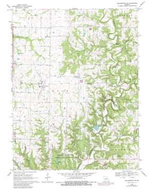
Millersburg Sw Topo Map Missouri
To zoom in, hover over the map of Millersburg Sw
USGS Topo Quad 38092g2 - 1:24,000 scale
| Topo Map Name: | Millersburg Sw |
| USGS Topo Quad ID: | 38092g2 |
| Print Size: | ca. 21 1/4" wide x 27" high |
| Southeast Coordinates: | 38.75° N latitude / 92.125° W longitude |
| Map Center Coordinates: | 38.8125° N latitude / 92.1875° W longitude |
| U.S. State: | MO |
| Filename: | o38092g2.jpg |
| Download Map JPG Image: | Millersburg Sw topo map 1:24,000 scale |
| Map Type: | Topographic |
| Topo Series: | 7.5´ |
| Map Scale: | 1:24,000 |
| Source of Map Images: | United States Geological Survey (USGS) |
| Alternate Map Versions: |
Millersburg SW MO 1969, updated 1971 Download PDF Buy paper map Millersburg SW MO 1969, updated 1978 Download PDF Buy paper map Millersburg SW MO 1969, updated 1982 Download PDF Buy paper map Millersburg SW MO 1969, updated 1982 Download PDF Buy paper map Millersburg SW MO 2000, updated 2003 Download PDF Buy paper map Millersburg SW MO 2012 Download PDF Buy paper map Millersburg SW MO 2015 Download PDF Buy paper map |
| FStopo: | US Forest Service topo Millersburg SW is available: Download FStopo PDF Download FStopo TIF |
1:24,000 Topo Quads surrounding Millersburg Sw
> Back to 38092e1 at 1:100,000 scale
> Back to 38092a1 at 1:250,000 scale
> Back to U.S. Topo Maps home
Millersburg Sw topo map: Gazetteer
Millersburg Sw: Airports
Columbia Regional Airport elevation 269m 882′Millersburg Sw: Bridges
Duley Mill Bridge elevation 188m 616′Millersburg Sw: Cliffs
Mill Site Bluff elevation 210m 688′Millersburg Sw: Dams
Doctor Windmiller Dam elevation 234m 767′Ginn Lake Dam elevation 248m 813′
Laboratory Dam elevation 222m 728′
Peterson Lake Dam elevation 251m 823′
Windmiller Dam Number 1 elevation 192m 629′
Windmiller Dam Number 2 elevation 192m 629′
Millersburg Sw: Parks
University of Missouri Ashland Wildlife Research Area elevation 238m 780′Millersburg Sw: Populated Places
Englewood elevation 267m 875′Ginlet elevation 262m 859′
Millers elevation 250m 820′
Summerville (historical) elevation 262m 859′
Millersburg Sw: Reservoirs
Ashland Lake elevation 222m 728′Bass Lake elevation 264m 866′
Curry Lake elevation 242m 793′
Doctor Windmiller Reservoir elevation 234m 767′
Eugene Windmiller Lake elevation 192m 629′
Ginn Lake elevation 248m 813′
Peterson Lake elevation 251m 823′
Millersburg Sw: Ridges
Devils Backbone elevation 202m 662′Millersburg Sw: Streams
Big Branch elevation 212m 695′Dry Fork elevation 176m 577′
Millers Creek elevation 207m 679′
North Fork Turkey Creek elevation 248m 813′
Owl Creek elevation 218m 715′
Smith Creek elevation 195m 639′
South Fork Turkey Creek elevation 248m 813′
Stump Creek elevation 207m 679′
Millersburg Sw: Trails
Cedar Creek Hiking Trail elevation 191m 626′Millersburg Sw digital topo map on disk
Buy this Millersburg Sw topo map showing relief, roads, GPS coordinates and other geographical features, as a high-resolution digital map file on DVD:


