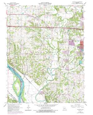
Huntsdale Topo Map Missouri
To zoom in, hover over the map of Huntsdale
USGS Topo Quad 38092h4 - 1:24,000 scale
| Topo Map Name: | Huntsdale |
| USGS Topo Quad ID: | 38092h4 |
| Print Size: | ca. 21 1/4" wide x 27" high |
| Southeast Coordinates: | 38.875° N latitude / 92.375° W longitude |
| Map Center Coordinates: | 38.9375° N latitude / 92.4375° W longitude |
| U.S. State: | MO |
| Filename: | o38092h4.jpg |
| Download Map JPG Image: | Huntsdale topo map 1:24,000 scale |
| Map Type: | Topographic |
| Topo Series: | 7.5´ |
| Map Scale: | 1:24,000 |
| Source of Map Images: | United States Geological Survey (USGS) |
| Alternate Map Versions: |
Huntsdale MO 1967, updated 1968 Download PDF Buy paper map Huntsdale MO 1967, updated 1975 Download PDF Buy paper map Huntsdale MO 1967, updated 1985 Download PDF Buy paper map Huntsdale MO 2011 Download PDF Buy paper map Huntsdale MO 2015 Download PDF Buy paper map |
1:24,000 Topo Quads surrounding Huntsdale
> Back to 38092e1 at 1:100,000 scale
> Back to 38092a1 at 1:250,000 scale
> Back to U.S. Topo Maps home
Huntsdale topo map: Gazetteer
Huntsdale: Bends
McBaine Bend elevation 172m 564′Searcys Bend elevation 172m 564′
Huntsdale: Dams
Cedar Lake Section 23 Dam elevation 212m 695′Fairview Lake Dam elevation 218m 715′
Hulen Lake East Dam elevation 194m 636′
Hulen Lake West Dam elevation 196m 643′
Rapp Lake Dam elevation 192m 629′
Sapp Lake Dam elevation 212m 695′
Smarr Lake Dam elevation 183m 600′
Huntsdale: Islands
Tadpole Island elevation 175m 574′Huntsdale: Lakes
Brushwood Lake elevation 172m 564′Huntsdale: Populated Places
Huntsdale elevation 180m 590′McBaine elevation 173m 567′
Midway elevation 197m 646′
Turner elevation 183m 600′
Huntsdale: Reservoirs
Cedar Lake elevation 212m 695′Fairview Lake elevation 218m 715′
Hulen Lake elevation 206m 675′
Hunt Lake elevation 183m 600′
Huntsdale: Streams
Bear Creek elevation 179m 587′Black Branch elevation 171m 561′
Callahan Creek elevation 174m 570′
County House Branch elevation 177m 580′
Goodin Branch elevation 176m 577′
Grocery Branch elevation 172m 564′
Harmony Creek elevation 174m 570′
Henderson Branch elevation 175m 574′
Hinkson Creek elevation 171m 561′
Merideth Branch elevation 171m 561′
Midway Branch elevation 177m 580′
Mill Creek elevation 171m 561′
Morton Branch elevation 184m 603′
Petite Saline Creek elevation 172m 564′
Rocky Fork Creek elevation 176m 577′
Scotts Branch elevation 181m 593′
Sugar Branch elevation 171m 561′
Terrapin Creek elevation 174m 570′
Huntsdale digital topo map on disk
Buy this Huntsdale topo map showing relief, roads, GPS coordinates and other geographical features, as a high-resolution digital map file on DVD:


