Monegaw Springs Topo Map Missouri
To zoom in, hover over the map of Monegaw Springs
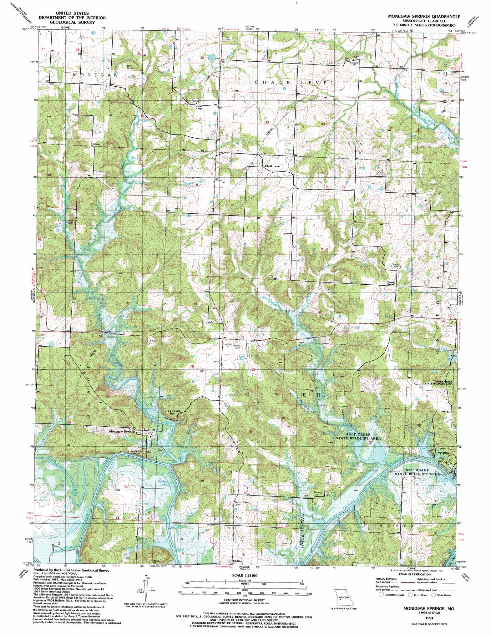
USGS Topo Quad 38093a7 - 1:24,000 scale
| Topo Map Name: | Monegaw Springs |
| USGS Topo Quad ID: | 38093a7 |
| Print Size: | ca. 21 1/4" wide x 27" high |
| Southeast Coordinates: | 38° N latitude / 93.75° W longitude |
| Map Center Coordinates: | 38.0625° N latitude / 93.8125° W longitude |
| U.S. State: | MO |
| Filename: | o38093a7.jpg |
| Download Map JPG Image: | Monegaw Springs topo map 1:24,000 scale |
| Map Type: | Topographic |
| Topo Series: | 7.5´ |
| Map Scale: | 1:24,000 |
| Source of Map Images: | United States Geological Survey (USGS) |
| Alternate Map Versions: |
Monegaw Springs MO 1938 Download PDF Buy paper map Monegaw Springs MO 1938, updated 1977 Download PDF Buy paper map Monegaw Springs MO 1940 Download PDF Buy paper map Monegaw Springs MO 1940 Download PDF Buy paper map Monegaw Springs MO 1991, updated 1991 Download PDF Buy paper map Monegaw Springs MO 2011 Download PDF Buy paper map Monegaw Springs MO 2015 Download PDF Buy paper map |
1:24,000 Topo Quads surrounding Monegaw Springs
Johnstown |
Montrose |
Clinton South |
Gaines |
Leesville |
Appleton City |
Monegaw Springs Nw |
Ohio |
Lowry City |
Valhalla |
Rockville |
Taberville |
Monegaw Springs |
Osceola |
Iconium |
Eldorado Springs North |
Tiffin |
Roscoe |
Vista |
Weaubleau |
Eldorado Springs South |
Filley |
Caplinger Mills |
Arnica |
Humansville |
> Back to 38093a1 at 1:100,000 scale
> Back to 38092a1 at 1:250,000 scale
> Back to U.S. Topo Maps home
Monegaw Springs topo map: Gazetteer
Monegaw Springs: Airports
Wixted Airport elevation 236m 774′Monegaw Springs: Dams
Mills Lake Dam elevation 226m 741′Number 565 Dam elevation 248m 813′
Upps Resort Lake Dam elevation 216m 708′
Monegaw Springs: Populated Places
Chalk Level elevation 274m 898′Monegaw Springs elevation 218m 715′
Monegaw Springs: Reservoirs
Spring Lake elevation 217m 711′Monegaw Springs: Springs
Magnolia Spring elevation 216m 708′Monegaw Springs: Streams
Finley Creek elevation 218m 715′Little Monegaw Creek elevation 217m 711′
Monegaw Creek elevation 216m 708′
Salt Creek elevation 216m 708′
Silver Creek elevation 217m 711′
Spill Creek elevation 226m 741′
Yellow Creek elevation 216m 708′
Monegaw Springs: Summits
Clubhouse Hill elevation 260m 853′Kibbie Hill elevation 269m 882′
Reader Hill elevation 283m 928′
Monegaw Springs digital topo map on disk
Buy this Monegaw Springs topo map showing relief, roads, GPS coordinates and other geographical features, as a high-resolution digital map file on DVD: