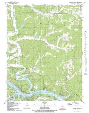
Lakeview Heights Topo Map Missouri
To zoom in, hover over the map of Lakeview Heights
USGS Topo Quad 38093c2 - 1:24,000 scale
| Topo Map Name: | Lakeview Heights |
| USGS Topo Quad ID: | 38093c2 |
| Print Size: | ca. 21 1/4" wide x 27" high |
| Southeast Coordinates: | 38.25° N latitude / 93.125° W longitude |
| Map Center Coordinates: | 38.3125° N latitude / 93.1875° W longitude |
| U.S. State: | MO |
| Filename: | o38093c2.jpg |
| Download Map JPG Image: | Lakeview Heights topo map 1:24,000 scale |
| Map Type: | Topographic |
| Topo Series: | 7.5´ |
| Map Scale: | 1:24,000 |
| Source of Map Images: | United States Geological Survey (USGS) |
| Alternate Map Versions: |
Lakeview Heights MO 1936 Download PDF Buy paper map Lakeview Heights MO 1936, updated 1955 Download PDF Buy paper map Lakeview Heights MO 1959, updated 1960 Download PDF Buy paper map Lakeview Heights MO 1959, updated 1975 Download PDF Buy paper map Lakeview Heights MO 1959, updated 1981 Download PDF Buy paper map Lakeview Heights MO 1983, updated 1983 Download PDF Buy paper map Lakeview Heights MO 2011 Download PDF Buy paper map Lakeview Heights MO 2014 Download PDF Buy paper map |
1:24,000 Topo Quads surrounding Lakeview Heights
> Back to 38093a1 at 1:100,000 scale
> Back to 38092a1 at 1:250,000 scale
> Back to U.S. Topo Maps home
Lakeview Heights topo map: Gazetteer
Lakeview Heights: Bays
Cole Camp Creek Arm elevation 201m 659′Spring Branch Cove elevation 201m 659′
Turkey Creek Cove elevation 201m 659′
Lakeview Heights: Capes
Gross Point elevation 201m 659′Lakeview Heights: Cliffs
Leeder Bluff elevation 231m 757′Lakeview Heights: Dams
Doctor A J Long Dam elevation 201m 659′Kyle Lake Dam elevation 274m 898′
Number 4 Dam elevation 226m 741′
Peebles Lake Dam elevation 243m 797′
Stelling-Junge Lake Dam elevation 232m 761′
Wray Lake Dam elevation 219m 718′
Lakeview Heights: Populated Places
Edmonson elevation 236m 774′Hilda elevation 248m 813′
Lakeview Heights elevation 240m 787′
Lakeview Heights: Reservoirs
Docs Retreat Reservoir elevation 201m 659′Junges Lake elevation 232m 761′
Lakeview Heights: Springs
Dillon Spring elevation 233m 764′Lakeview Heights: Streams
Boone Branch elevation 202m 662′Brushy Creek elevation 201m 659′
Byler Branch elevation 209m 685′
Cole Camp Creek elevation 201m 659′
Duran Creek elevation 210m 688′
Flat Rock Creek elevation 207m 679′
Mossy Creek elevation 201m 659′
Ross Creek elevation 212m 695′
Spring Branch elevation 201m 659′
Turkey Creek elevation 201m 659′
Lakeview Heights: Valleys
Brickley Hollow elevation 201m 659′Sam Allen Hollow elevation 238m 780′
Lakeview Heights digital topo map on disk
Buy this Lakeview Heights topo map showing relief, roads, GPS coordinates and other geographical features, as a high-resolution digital map file on DVD:


