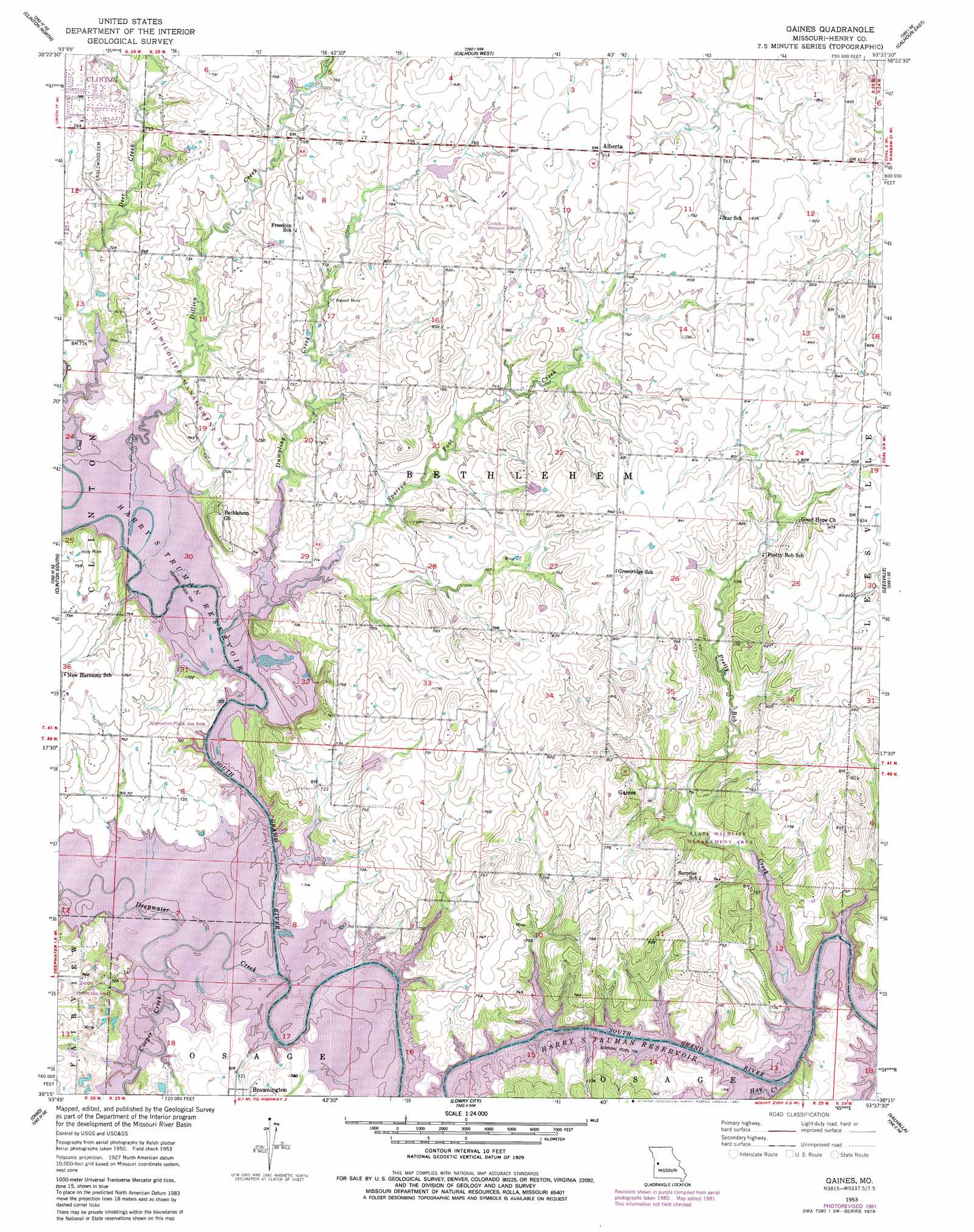
Gaines Topo Map Missouri
To zoom in, hover over the map of Gaines
USGS Topo Quad 38093c6 - 1:24,000 scale
| Topo Map Name: | Gaines |
| USGS Topo Quad ID: | 38093c6 |
| Print Size: | ca. 21 1/4" wide x 27" high |
| Southeast Coordinates: | 38.25° N latitude / 93.625° W longitude |
| Map Center Coordinates: | 38.3125° N latitude / 93.6875° W longitude |
| U.S. State: | MO |
| Filename: | o38093c6.jpg |
| Download Map JPG Image: | Gaines topo map 1:24,000 scale |
| Map Type: | Topographic |
| Topo Series: | 7.5´ |
| Map Scale: | 1:24,000 |
| Source of Map Images: | United States Geological Survey (USGS) |
| Alternate Map Versions: |
Gaines MO 1953, updated 1955 Download PDF Buy paper map Gaines MO 1953, updated 1978 Download PDF Buy paper map Gaines MO 1953, updated 1982 Download PDF Buy paper map Gaines MO 2011 Download PDF Buy paper map Gaines MO 2015 Download PDF Buy paper map |
1:24,000 Topo Quads surrounding Gaines
Blairstown |
Chilhowee |
Leeton |
Windsor |
Green Ridge South |
Hartwell |
Clinton North |
Calhoun West |
Calhoun East |
Lincoln Nw |
Montrose |
Clinton South |
Gaines |
Leesville |
Shawnee Bend |
Monegaw Springs Nw |
Ohio |
Lowry City |
Valhalla |
Warsaw West |
Taberville |
Monegaw Springs |
Osceola |
Iconium |
Quincy |
> Back to 38093a1 at 1:100,000 scale
> Back to 38092a1 at 1:250,000 scale
> Back to U.S. Topo Maps home
Gaines topo map: Gazetteer
Gaines: Airports
Clinton Memorial Airport elevation 248m 813′Gaines: Dams
E Burns Dam elevation 240m 787′Stotts Lake Dam elevation 230m 754′
White Lake Dam elevation 230m 754′
Gaines: Mines
Hilty Mine elevation 226m 741′Wastell Mine elevation 225m 738′
Gaines: Parks
Cooper Creek Public Use Area elevation 217m 711′Sparrowfoot Public Use Area elevation 219m 718′
Gaines: Populated Places
Alberta elevation 248m 813′Gaines elevation 234m 767′
Sparrow elevation 232m 761′
Gaines: Post Offices
Sparrow Post Office (historical) elevation 232m 761′Gaines: Streams
Cooper Creek elevation 215m 705′Deepwater Creek elevation 215m 705′
Dillion Creek elevation 215m 705′
Dumpling Creek elevation 215m 705′
Hay Creek elevation 215m 705′
Pretty Bob Creek elevation 215m 705′
Sparrow Foot Creek elevation 215m 705′
Gaines digital topo map on disk
Buy this Gaines topo map showing relief, roads, GPS coordinates and other geographical features, as a high-resolution digital map file on DVD: