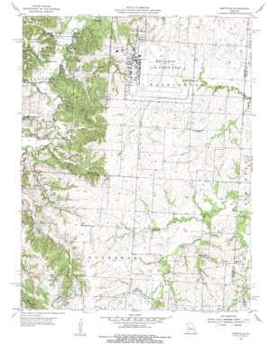
Burtville Topo Map Missouri
To zoom in, hover over the map of Burtville
USGS Topo Quad 38093f5 - 1:24,000 scale
| Topo Map Name: | Burtville |
| USGS Topo Quad ID: | 38093f5 |
| Print Size: | ca. 21 1/4" wide x 27" high |
| Southeast Coordinates: | 38.625° N latitude / 93.5° W longitude |
| Map Center Coordinates: | 38.6875° N latitude / 93.5625° W longitude |
| U.S. State: | MO |
| Filename: | o38093f5.jpg |
| Download Map JPG Image: | Burtville topo map 1:24,000 scale |
| Map Type: | Topographic |
| Topo Series: | 7.5´ |
| Map Scale: | 1:24,000 |
| Source of Map Images: | United States Geological Survey (USGS) |
| Alternate Map Versions: |
Burtville MO 1955, updated 1956 Download PDF Buy paper map Burtville MO 1955, updated 1956 Download PDF Buy paper map Burtville MO 2011 Download PDF Buy paper map Burtville MO 2015 Download PDF Buy paper map |
1:24,000 Topo Quads surrounding Burtville
> Back to 38093e1 at 1:100,000 scale
> Back to 38092a1 at 1:250,000 scale
> Back to U.S. Topo Maps home
Burtville topo map: Gazetteer
Burtville: Airports
Lake Sexton Airport elevation 262m 859′Burtville: Dams
Hall Lake Dam elevation 254m 833′Kranz Lake Dam elevation 257m 843′
Lake Buteo Dam elevation 233m 764′
Number 425 Dam elevation 253m 830′
Roberts Hunter Lake Dam elevation 226m 741′
Sexton Lake Dam elevation 246m 807′
Shirley Lake Dam elevation 256m 839′
Burtville: Lakes
Adams Pond elevation 255m 836′Lake Buleo elevation 230m 754′
Mallard Pond elevation 225m 738′
Shawnee Pond elevation 254m 833′
Burtville: Parks
Knob Noster State Park elevation 223m 731′Burtville: Populated Places
Burtville elevation 259m 849′Owsley elevation 275m 902′
Burtville: Post Offices
Charles Post Office (historical) elevation 270m 885′Burtville: Reservoirs
Kranz Lake elevation 257m 843′Lake Buteo elevation 233m 764′
Sexton Lake elevation 246m 807′
Shirley Lake elevation 256m 839′
Burtville: Streams
Brewer Branch elevation 222m 728′Buck Branch elevation 227m 744′
Crooked Creek elevation 245m 803′
Graham Branch elevation 229m 751′
Gribble Branch elevation 224m 734′
McAdoo Creek elevation 219m 718′
Plum Branch elevation 228m 748′
Vinegar Branch elevation 227m 744′
Burtville digital topo map on disk
Buy this Burtville topo map showing relief, roads, GPS coordinates and other geographical features, as a high-resolution digital map file on DVD:


