La Cygne Topo Map Kansas
To zoom in, hover over the map of La Cygne
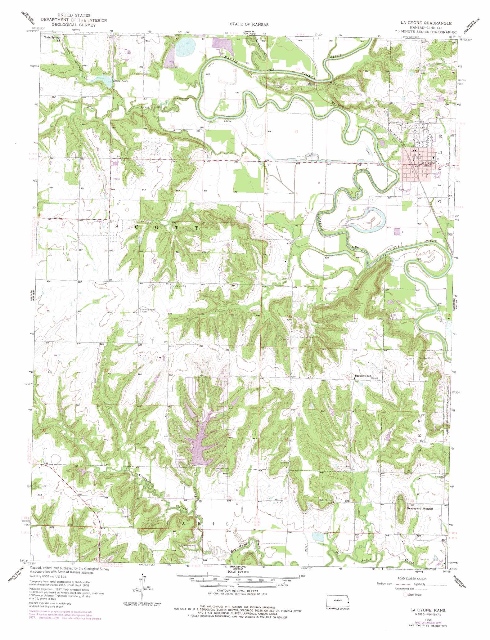
USGS Topo Quad 38094c7 - 1:24,000 scale
| Topo Map Name: | La Cygne |
| USGS Topo Quad ID: | 38094c7 |
| Print Size: | ca. 21 1/4" wide x 27" high |
| Southeast Coordinates: | 38.25° N latitude / 94.75° W longitude |
| Map Center Coordinates: | 38.3125° N latitude / 94.8125° W longitude |
| U.S. State: | KS |
| Filename: | o38094c7.jpg |
| Download Map JPG Image: | La Cygne topo map 1:24,000 scale |
| Map Type: | Topographic |
| Topo Series: | 7.5´ |
| Map Scale: | 1:24,000 |
| Source of Map Images: | United States Geological Survey (USGS) |
| Alternate Map Versions: |
La Cygne KS 1958, updated 1959 Download PDF Buy paper map La Cygne KS 1958, updated 1977 Download PDF Buy paper map La Cygne KS 1958, updated 1978 Download PDF Buy paper map La Cygne KS 2009 Download PDF Buy paper map La Cygne KS 2012 Download PDF Buy paper map La Cygne KS 2015 Download PDF Buy paper map |
1:24,000 Topo Quads surrounding La Cygne
Rantoul |
Paola West |
Paola East |
Louisburg |
Freeman |
Lane |
Osawatomie |
Fontana |
New Lancaster |
Drexel |
Garnett Se |
Parker |
La Cygne |
Boicourt |
Amoret |
Centerville |
Mound City Nw |
Mound City |
Pleasanton |
Worland |
Blue Mound |
Mapleton |
Mantey |
Prescott |
Hume |
> Back to 38094a1 at 1:100,000 scale
> Back to 38094a1 at 1:250,000 scale
> Back to U.S. Topo Maps home
La Cygne topo map: Gazetteer
La Cygne: Parks
Hurley Field elevation 251m 823′La Cygne: Populated Places
La Cygne elevation 255m 836′La Cygne: Reservoirs
Stave Lake elevation 248m 813′La Cygne: Streams
Elm Creek elevation 240m 787′Hickory Creek elevation 265m 869′
Middle Creek elevation 240m 787′
Richland Creek elevation 241m 790′
Turkey Creek elevation 241m 790′
Twin Springs Creek elevation 243m 797′
La Cygne: Summits
Graveyard Mound elevation 288m 944′La Cygne digital topo map on disk
Buy this La Cygne topo map showing relief, roads, GPS coordinates and other geographical features, as a high-resolution digital map file on DVD: