Fontana Topo Map Kansas
To zoom in, hover over the map of Fontana
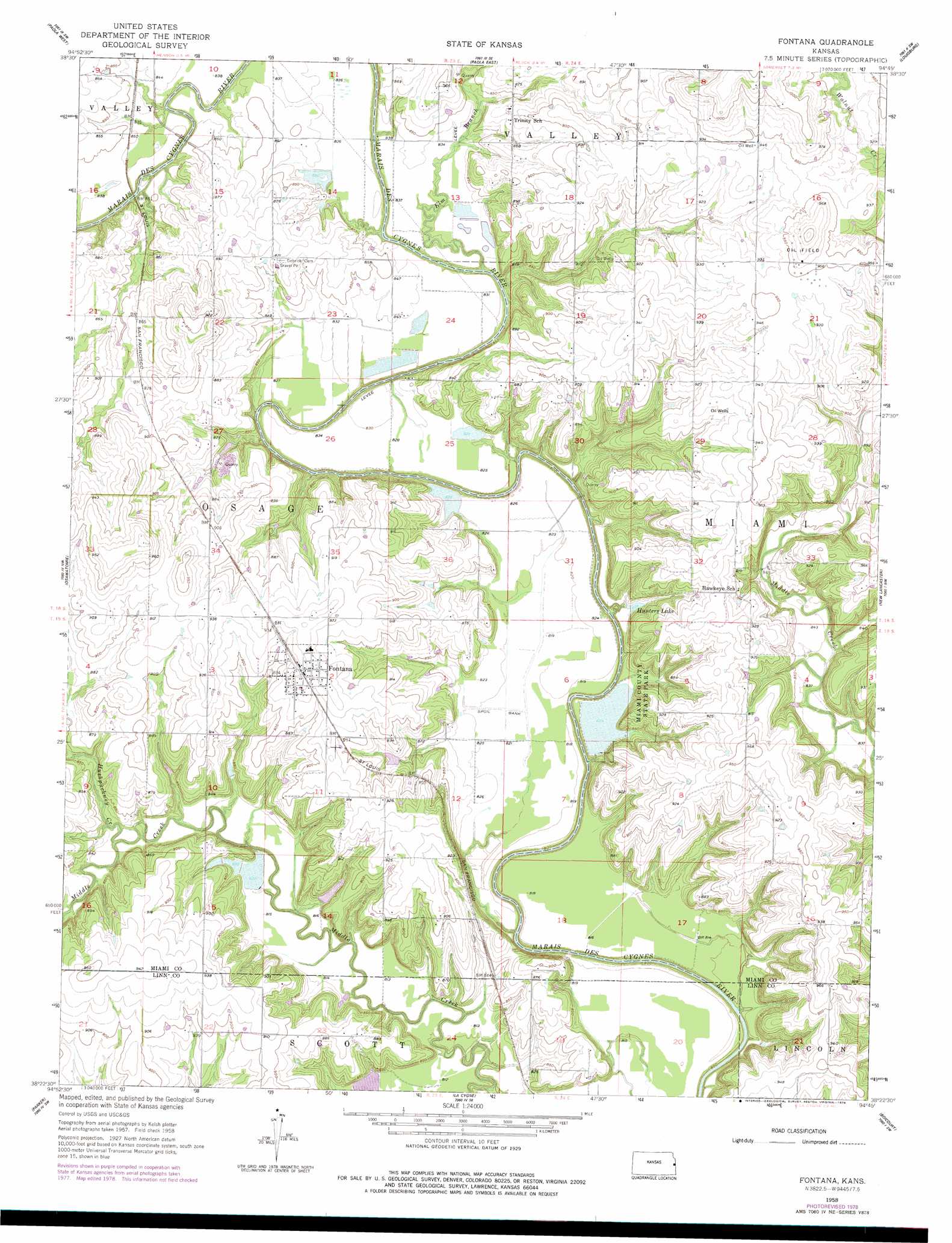
USGS Topo Quad 38094d7 - 1:24,000 scale
| Topo Map Name: | Fontana |
| USGS Topo Quad ID: | 38094d7 |
| Print Size: | ca. 21 1/4" wide x 27" high |
| Southeast Coordinates: | 38.375° N latitude / 94.75° W longitude |
| Map Center Coordinates: | 38.4375° N latitude / 94.8125° W longitude |
| U.S. State: | KS |
| Filename: | o38094d7.jpg |
| Download Map JPG Image: | Fontana topo map 1:24,000 scale |
| Map Type: | Topographic |
| Topo Series: | 7.5´ |
| Map Scale: | 1:24,000 |
| Source of Map Images: | United States Geological Survey (USGS) |
| Alternate Map Versions: |
Fontana KS 1958, updated 1959 Download PDF Buy paper map Fontana KS 1958, updated 1978 Download PDF Buy paper map Fontana KS 2009 Download PDF Buy paper map Fontana KS 2012 Download PDF Buy paper map Fontana KS 2015 Download PDF Buy paper map |
1:24,000 Topo Quads surrounding Fontana
Wellsville |
Antioch |
Spring Hill |
Bucyrus |
West Line |
Rantoul |
Paola West |
Paola East |
Louisburg |
Freeman |
Lane |
Osawatomie |
Fontana |
New Lancaster |
Drexel |
Garnett Se |
Parker |
La Cygne |
Boicourt |
Amoret |
Centerville |
Mound City Nw |
Mound City |
Pleasanton |
Worland |
> Back to 38094a1 at 1:100,000 scale
> Back to 38094a1 at 1:250,000 scale
> Back to U.S. Topo Maps home
Fontana topo map: Gazetteer
Fontana: Dams
Miami County State Lake Dam elevation 250m 820′Fontana: Parks
Miami County State Park elevation 250m 820′Miami State Fishing Lake and Wildlife Area elevation 250m 820′
Fontana: Populated Places
Fontana elevation 284m 931′Fontana: Reservoirs
Hunters Lake elevation 252m 826′Miami County State Lake elevation 250m 820′
Fontana: Streams
Elm Branch elevation 246m 807′Hushpuckney Creek elevation 246m 807′
Fontana digital topo map on disk
Buy this Fontana topo map showing relief, roads, GPS coordinates and other geographical features, as a high-resolution digital map file on DVD: