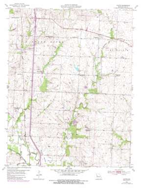
Austin Topo Map Missouri
To zoom in, hover over the map of Austin
USGS Topo Quad 38094e3 - 1:24,000 scale
| Topo Map Name: | Austin |
| USGS Topo Quad ID: | 38094e3 |
| Print Size: | ca. 21 1/4" wide x 27" high |
| Southeast Coordinates: | 38.5° N latitude / 94.25° W longitude |
| Map Center Coordinates: | 38.5625° N latitude / 94.3125° W longitude |
| U.S. State: | MO |
| Filename: | o38094e3.jpg |
| Download Map JPG Image: | Austin topo map 1:24,000 scale |
| Map Type: | Topographic |
| Topo Series: | 7.5´ |
| Map Scale: | 1:24,000 |
| Source of Map Images: | United States Geological Survey (USGS) |
| Alternate Map Versions: |
Austin MO 1954, updated 1955 Download PDF Buy paper map Austin MO 1954, updated 1982 Download PDF Buy paper map Austin MO 2012 Download PDF Buy paper map Austin MO 2014 Download PDF Buy paper map |
1:24,000 Topo Quads surrounding Austin
> Back to 38094e1 at 1:100,000 scale
> Back to 38094a1 at 1:250,000 scale
> Back to U.S. Topo Maps home
Austin topo map: Gazetteer
Austin: Airports
Harrisonville Landing Strip elevation 271m 889′Lawrence Smith Memorial Airport elevation 269m 882′
Austin: Dams
Cook Lake Dam elevation 274m 898′Hartzler Lake Dam elevation 260m 853′
J A Tobin Construction Company Dam elevation 250m 820′
Kurzweil Lake Dam elevation 261m 856′
Austin: Populated Places
Austin elevation 274m 898′Daugherty elevation 272m 892′
Lone Tree elevation 268m 879′
Rural Home (historical) elevation 262m 859′
Austin: Reservoirs
Hartzler Lake elevation 260m 853′J A Tobin Construction Company Lake elevation 250m 820′
Kurzweil Lake elevation 261m 856′
Austin: Streams
Black Creek elevation 238m 780′Elm Branch elevation 244m 800′
Tennessee Creek elevation 243m 797′
Austin: Summits
Bodenhammer Hill elevation 296m 971′Emrick Hill elevation 278m 912′
Snowball Hill elevation 295m 967′
Austin: Valleys
Mound Valley elevation 240m 787′Austin digital topo map on disk
Buy this Austin topo map showing relief, roads, GPS coordinates and other geographical features, as a high-resolution digital map file on DVD:


