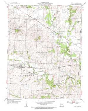
East Lynne Topo Map Missouri
To zoom in, hover over the map of East Lynne
USGS Topo Quad 38094f2 - 1:24,000 scale
| Topo Map Name: | East Lynne |
| USGS Topo Quad ID: | 38094f2 |
| Print Size: | ca. 21 1/4" wide x 27" high |
| Southeast Coordinates: | 38.625° N latitude / 94.125° W longitude |
| Map Center Coordinates: | 38.6875° N latitude / 94.1875° W longitude |
| U.S. State: | MO |
| Filename: | o38094f2.jpg |
| Download Map JPG Image: | East Lynne topo map 1:24,000 scale |
| Map Type: | Topographic |
| Topo Series: | 7.5´ |
| Map Scale: | 1:24,000 |
| Source of Map Images: | United States Geological Survey (USGS) |
| Alternate Map Versions: |
East Lynne MO 1954, updated 1955 Download PDF Buy paper map East Lynne MO 2011 Download PDF Buy paper map East Lynne MO 2014 Download PDF Buy paper map |
1:24,000 Topo Quads surrounding East Lynne
> Back to 38094e1 at 1:100,000 scale
> Back to 38094a1 at 1:250,000 scale
> Back to U.S. Topo Maps home
East Lynne topo map: Gazetteer
East Lynne: Airports
Roth Farms Airport elevation 270m 885′East Lynne: Dams
Hapke Lake Dam elevation 253m 830′Hereford Lake Dam elevation 261m 856′
Jim Kircher Dam elevation 268m 879′
Kircher P D Dam elevation 264m 866′
Mehrer Lake Dam elevation 267m 875′
Roth Farms Lake Dam elevation 267m 875′
Roth Lake Dam elevation 264m 866′
Schrock Lake Dam elevation 254m 833′
Shingleton Lake Dam elevation 263m 862′
Young Lake Dam elevation 260m 853′
East Lynne: Populated Places
Cause Prairie (historical) elevation 255m 836′East Lynne elevation 261m 856′
Gunn City elevation 261m 856′
Hadsell elevation 249m 816′
Oviet (historical) elevation 264m 866′
Wingate elevation 256m 839′
East Lynne: Reservoirs
Hapke Lake elevation 253m 830′Hereford Lake elevation 261m 856′
Kircher Lake elevation 264m 866′
Kirchers Upper Lake elevation 268m 879′
Meher Lake elevation 267m 875′
Roth Lake elevation 267m 875′
Shingleton Lake elevation 263m 862′
Young Lake elevation 260m 853′
East Lynne: Streams
Clear Creek elevation 244m 800′Crawford Creek elevation 242m 793′
Louse Run elevation 246m 807′
Willow Branch elevation 251m 823′
East Lynne: Summits
Schindorff Hill elevation 299m 980′Staley Mound elevation 298m 977′
East Lynne digital topo map on disk
Buy this East Lynne topo map showing relief, roads, GPS coordinates and other geographical features, as a high-resolution digital map file on DVD:


